Today, NOAA announced the 2016 Atlantic hurricane season is more likely to be near normal than above normal or below normal. This outlook suggests we may see more Atlantic hurricanes this year than in the past three, which averaged only four hurricanes per season.
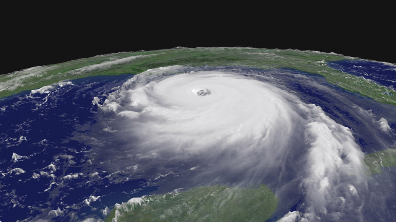
Hurricane Katrina as seen from space on August 28, 2005. (Image credit: NASA)
What this outlook does not reveal is how many storms might strike land. It only takes one storm of any category to deliver a powerful blow to lives and property along the coast and hundreds of miles inland. It is essential for coastal residents everywhere to prepare now by assembling emergency supplies, reviewing insurance policies, and developing evacuation plans. Explore, in pictures, what to expect in 2016 and what you can do to keep you and your loved ones safe.
A “near normal” hurricane season means you are still at risk
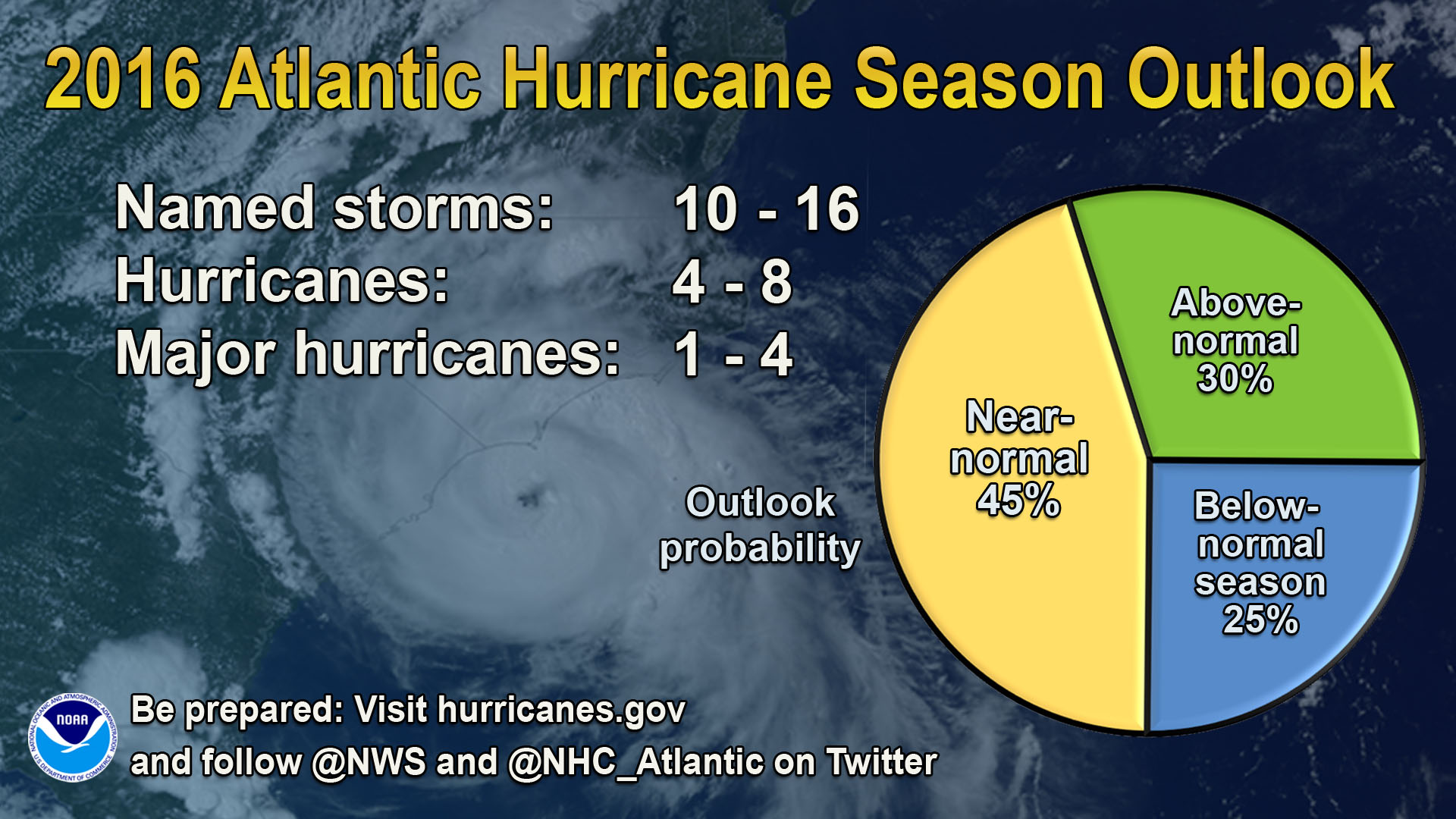
Each year, NOAA scientists issue hurricane outlooks for the Atlantic, eastern Pacific and central Pacific ocean basins. The outlooks are based on monitoring, analysis and prediction of key climate patterns that influence the hurricane season, such as La Niña and El Niño, and ocean temperature patterns that last for decades at a time. Sophisticated global climate and weather models also provide forecasters with critical information to help produce these outlooks. The models help determine how quickly different ocean and atmospheric conditions might develop and interact to influence the hurricane season.
Inland flooding: a leading cause of death during a hurricane

Hurricanes can cause death and destruction in numerous ways, including strong winds, storm surge, flooding and tornadoes. Nine out of 10 fatalities associated with hurricanes are related to water. At NOAA, our ability to forecast inland floods from tropical systems is improving this year. NOAA has developed a new National Water Model — set to launch this summer — which produce a 7-day water forecast and a 30-day water outlook for the nation. Using data from every stream reach in the United States, this National Water Model will provide hourly water forecasts for 700 times more locations than our current forecast system, greatly enhancing our ability to forecast inland flooding from tropical storms and hurricanes.
New forecast tools warn for dangerous waters

Storm surge, which is water from the ocean that is pushed toward shore by the force of the winds swirling around a hurricane, is also a major threat. Continued use of the prototype storm surge watch and warning graphic and the potential storm surge flooding map by NOAA’s National Hurricane Center will improve how storm surge threats are communicated — which is especially valuable in an era of increased coastal vulnerability due to sea level rise and a tremendous increase in coastal population density over the past several decades. This clear visual of a specific and dangerous threat depicted at height above ground is an intuitive new product NOAA developed to help people recognize and understand their personal risk so they can make informed decisions.
Satellites scanning the Earth faster and in greater detail than ever before

NOAA’s hurricane monitoring also stretches tens of thousands of miles above the Earth. Earlier this year, NOAA launched Jason-3 — a new environmental satellite that, along with its twin Jason-2, carries specialized radar which watches for pools of warm water that can fuel the explosive growth of tropical storms. Jason-3 is expected to become fully operational this season, with another powerful satellite — GOES-R — expected to launch later this year. GOES-R will scan the Earth five times faster and produce vivid images of severe weather at a resolution four times greater than ever before. Recent upgrades in supercomputing and in our weather models also provide more data to our forecasters so they can issue lifesaving and ever-improving watches and warnings.
Preparedness is key: Don’t wait until it’s too late
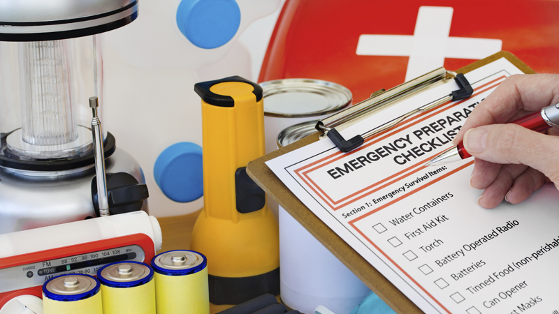
Take time now to update your family’s emergency plan and make sure your kit is stocked with essentials. Ready.gov has the information and resources you need should a hurricane threaten your community this season. Working together, we can build a Weather Ready Nation that ensures everyone is empowered in the face of extreme weather.


