At NOAA, we rely on citizen scientists to help us monitor the ocean and atmosphere. From now until Citizen Science Day on April 14, 2018, we’re celebrating these dedicated volunteer researchers and the programs they support. We will be highlighting one program each day from April 2 through April 14.
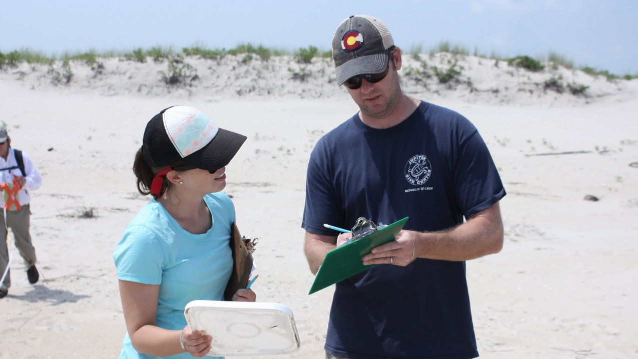
Volunteers conduct a marine debris survey using the Marine Debris Monitoring and Assessment Project protocol. (Image credit: NOAA)
Citizen science engages people in important research that contributes to a greater understanding of Earth system science. With so many projects to choose from, there's something for everyone — whether it's an online crowdsourcing program you can do anytime, an app that helps you report real-time observations of weather or wildlife on your smartphone, or a research project that lets you contribute detailed observations from your home or community.
Citizen Science Day offsite link is our opportunity to thank our intrepid volunteers and invite others to get involved. As we count down through these examples, we hope that you are inspired to find a project that's right for you.
1. CrowdMag app
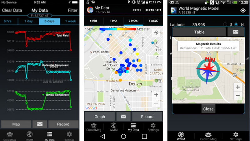
Citizen scientists can use their smartphones to measure Earth’s magnetic fields with NOAA’s CrowdMag app, available for Apple and Android. This information helps improve airplane and ship navigation around the world. Your smartphone can see the Earth’s main magnetic field and many local magnetic field sources such as bridges, iron pipes, and other metal objects. Through crowdsourcing, citizen scientists map the magnetic field across the globe by simply moving around with their smartphone, and CrowdMag automatically and anonymously sends the data back to NOAA. Become a citizen scientist and join NOAA’s research team studying the Earth’s geomagnetic field.
2. Ocean Video Lab
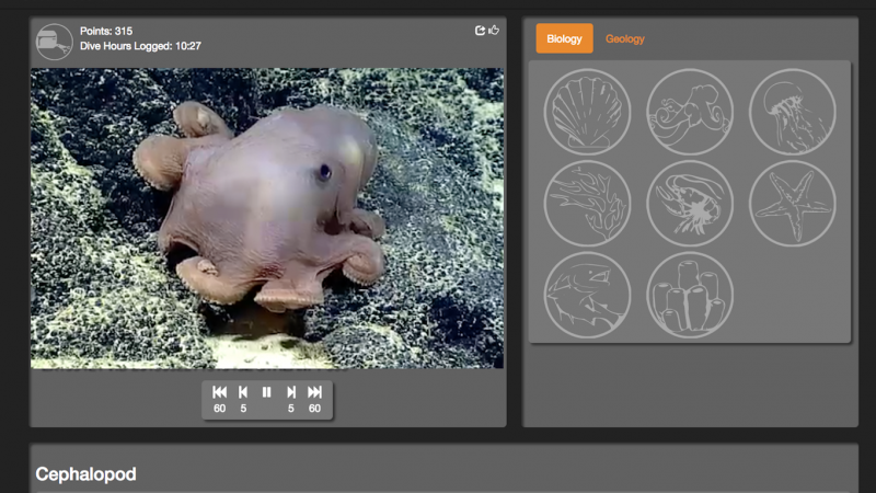
Interested in exploring the unknown ocean? Anyone, anywhere can use the Ocean Video Lab offsite link portal to help scientists review underwater video from research cruises. Citizen scientists identify interesting observations in the videos. Researchers can then analyze those sightings in detail without having to view hours of footage. Citizen scientists can also review archived video, potentially unearthing new discoveries. Ocean Video Lab’s citizen science interface is developed in partnership with Lamont-Doherty Earth Observatory offsite link of Columbia University, NOAA’s Office of Exploration and Research, and the University of Rhode Island Inner Space Center offsite link with grant funding from a NOAA Big Earth Data Initiative grant.
3. Cyclone Center
Citizen scientists are helping climatologists decipher and understand tropical cyclones, also known as hurricanes or typhoons. Cyclone Center offsite link analyzes hundreds of thousands of hurricane satellite images using input from citizen scientists worldwide. Tropical cyclones produce devastating impacts in coastal regions around the globe. By answering questions about a past storm's intensity, you can add new information about these powerful storms. You can complete your first image in just five minutes, helping scientists get the data they need to make better predictions. The Cyclone Center is the result of a partnership between NOAA's National Centers for Environmental Information, the Cooperative Institute for Climate and Satellites offsite link, the University of North Carolina at Asheville offsite link, the Risk Prediction Initiative offsite link, and Zooniverse offsite link.
4. mPING app
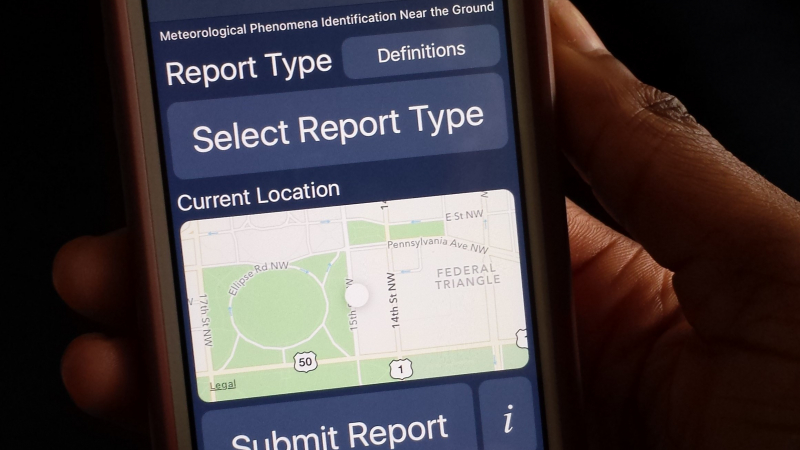
Is it raining? Hailing? Snowing? Drizzling? Believe it or not, your observations can help improve weather forecasts. Using the mPING (Meteorological Phenomena Identification Near the Ground), app available for Apple and Android, citizen scientists can report the type of precipitation they are experiencing. Weather radar don't "see" close to the ground, so these anonymous reports can improve weather computer models. The information can also be used by road maintenance crews and the aviation industry to warn about icy or hazardous conditions. mPING was developed by NOAA's National Severe Storms Laboratory, the University of Oklahoma offsite link, and the Cooperative Institute for Mesoscale Meteorological Studies offsite link.
5. National Weather Service SKYWARN Program
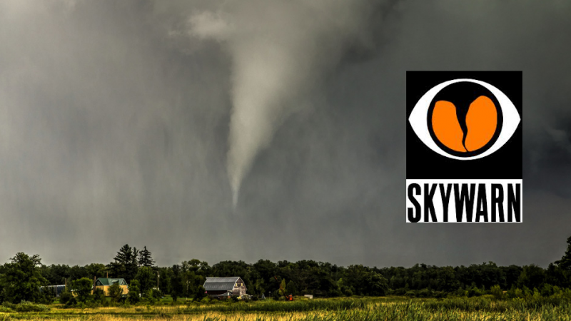
Do you know what to watch for when severe weather threatens? Help keep your community safe by volunteering to become a trained severe storm spotter for NOAA’s National Weather Service (NWS). Storm spotters report hazardous weather, helping the NWS issue accurate and timely warnings. Spotters are trained by NWS meteorologists to identify and describe severe local storms, including thunderstorms, tornadoes, and floods. Interested? Visit the NWS SKYWARN website and contact your local NWS office to find out about free local and online training.
6. Whale Alert
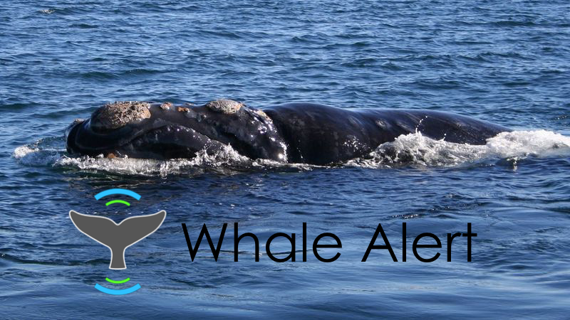
Endangered whales are killed by ship strikes each year. The most dangerous areas are busy shipping lanes. The Whale Alert offsite link program invites nature lovers, fishers, and mariners to help reduce ship strikes to whales. The success of Whale Alert depends on citizen scientists who report observations while whale watching from land and at sea. When a whale sighting is tagged in the app, the information is uploaded to a database used by biologists and resource managers. Whale Alert is supported by NOAA, the Office of National Marine Sanctuaries, and many other partners offsite link.
7. Community Collaborative Rain, Hail, and Snow (CoCoRaHS) Network
The Community Collaborative Rain, Hail, and Snow (CoCoRaHS) Network offsite link is a group of volunteer observers who measure precipitation from their backyards in all 50 states. Citizen scientists and weather lovers of any age can participate by installing low cost equipment and recording their measurements online. The data is used by a wide variety of experts, ranging from meteorologists and hydrologists to insurance adjusters and engineers. The data you collect can contribute to severe storm warnings, water resource analysis, and regional drought monitoring. Want to get involved? Sign up offsite link to become an observer.
8. Marine Debris Monitoring and Assessment Project
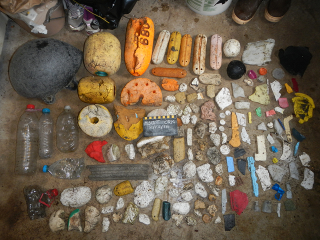
The Marine Debris Monitoring and Assessment Project (MDMAP) is a citizen science project from the NOAA Marine Debris Program that engages NOAA partners and volunteers to survey and record the amount and types of marine debris on shorelines across the nation. Each partner in the MDMAP network selects a nearby shoreline monitoring site that they return to monthly to conduct surveys and submit data to the MDMAP database. The program provides meaningful data to help researchers identify the most common debris types and sources and develop effective prevention strategies. Over 340 monitoring sites have been registered with MDMAP.
9. Signs of the Seasons
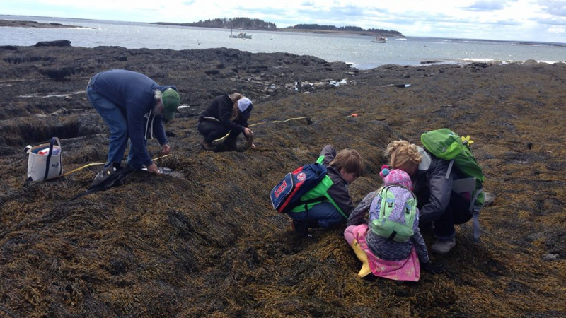
Signs of the Seasons offsite link is a New England citizen science program that trains volunteer observers to collect data on phenology, the study of seasonal change and timing. In addition to gathering valuable data for research projects, Signs of the Seasons increases connection to place among New Englanders. Signs of the Seasons has trained nearly 600 volunteers, from retirees to students, and provides ongoing support with access to new observation and data exploration tools. Signs of the Seasons is a partnership between Maine Sea Grant offsite link, the University of Maine Cooperative Extension offsite link, and the USA National Phenology Network offsite link.
10. Snapshot CalCoast Bioblitz
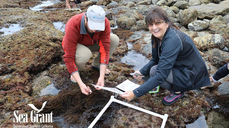
During the Snapshot CalCoast Bioblitz offsite link, volunteers help capture the biodiversity along the California coast by taking photos of plants and animals. BioBlitzes are citizen scientist-driven surveys to record all living things in a particular area. Snapshot CalCoast is a California statewide effort to document coastal biodiversity, focusing on intertidal zones in marine protected areas. University of Southern California Sea Grant offsite link and partners are leading a bioblitz at Pelican Cove in Palos Verdes on June 18, 2018.
11. New Hampshire Coastal Research Volunteers
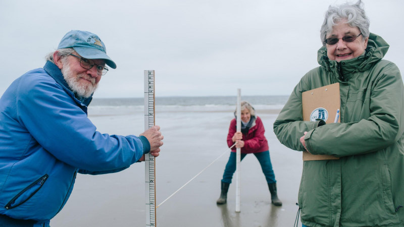
New Hampshire Sea Grant’s Coastal Research Volunteers offsite link program connects citizen scientists with researchers and natural resource managers in the New Hampshire Seacoast region. Coastal Research Volunteers participate in a wide range of research activities, including beach profile monitoring, dune restoration and research, American eel migration monitoring, oyster reef restoration, horseshoe crab spawning surveys, and more. This program enhances the capacity for local coastal research and builds connections between researchers, community decision makers, and residents.
12. Washington Sea Grant Crab Team
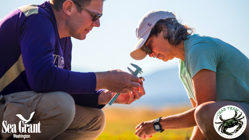
Volunteers help the Washington Sea Grant Crab Team offsite link protect Salish Sea shorelines in Washington by monitoring for invasive European green crabs. The recent arrival of the green crab on the U.S. West Coast is cause for concern. The green crab has already invaded coastal communities outside its native range, including South Africa, Brazil, Australia, and both coasts of North America. An able colonizer and efficient predator, this small shore crab has the potential to alter any ecosystem it invades. Since 2015, this citizen science program has established a network of 52 sites monitored by more than 225 volunteers, and partner tribes and agencies, capturing the earliest stages of invasion by this globally damaging crab.
13. LiMPETS (Long-term Monitoring Program and Experiential Training for Students)
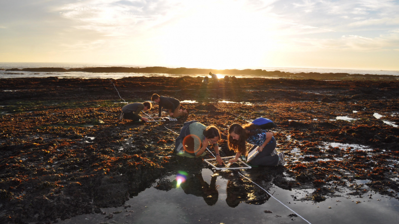
LiMPETS (Long-term Monitoring Program and Experiential Training for Students) offsite link is a citizen science program for students, educators, and volunteer groups. Citizen scientists monitor the coastal ecosystems of California’s national marine sanctuaries, increasing awareness and stewardship of these important areas. The statewide program connects over 6,000 citizens annually to the ocean, covering more than 60 sites and over 600 miles of California coastline. LiMPETS participants contribute real data for real scientists, experience hands-on scientific endeavors that take place in the field, and become a part of a new generation of informed ocean stewards. The LiMPETS network is a collaborative effort among California’s national marine sanctuaries, Greater Farallones Association offsite link, and Pacific Grove Museum of Natural History offsite link.
It's Citizen Science Day!
That's a wrap! It's April 14 and Citizen Science Day offsite link has arrived. We began our countdown by sharing projects you can do anywhere, anytime. As Citizen Science Day got closer, we zoomed in to highlight local and regional examples. Thanks for joining us and hats off to the dedicated volunteers who make these programs possible.
To find projects near you, check out the Federal Citizen Science Catalog offsite link. Whether it’s joining a crowdsourcing project or reporting on weather right outside your window, we’ve got a volunteer opportunity for you.


