The hurricane season had yet to see its first named storm in August 1992, but that changed dramatically with the arrival of Hurricane Andrew and its direct hit on NOAA’s National Hurricane Center in Coral Gables, Florida. We're going to take you behind the scenes for a glimpse of what it was like to be on duty that week 25 years ago.
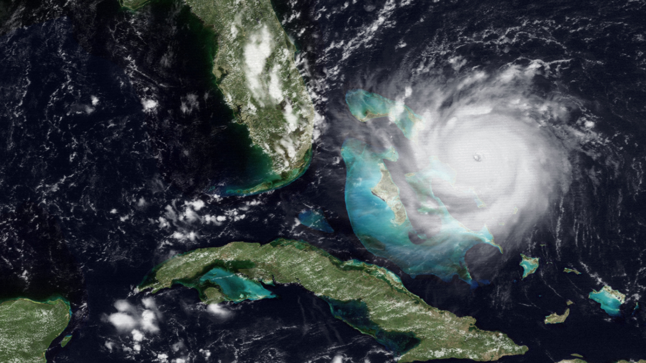
NOAA's GOES-7 satellite captured this image of Hurricane Andrew on August 23, 1992. (Image credit: NOAA)
A disturbance rolled off the coast of Africa and became Tropical Storm Andrew on August 17, but three days later it didn’t look like a threat. In fact, according to forecaster Dr. Richard Pasch, “It looked like the storm had dissipated. The hurricane hunter aircraft couldn’t locate the center of circulation but I told NHC Director Bob Sheets, I don’t think it’s going away.” Dr. Pasch was spot on.
NOAA continued to track Andrew and on August 21, reconnaissance aircraft found the system was much better organized. Shortly afterwards on Saturday morning, August 22, they found hurricane-force winds and Andrew officially became a hurricane. As it rumbled across the Atlantic the storm intensified. In the pre-dawn hours of August 24 with winds screaming at more than 155 mph, it neared Miami-Dade County and the National Hurricane Center.
That’s when the whole building shuddered. No one knew what it was, but NHC radar meteorologist Martin Nelson noticed the Miami radar had quit working. “We believe another antenna broke loose and hit the fiberglass dome, exposing the radar”. With the Miami radar out of commission, Andrew’s trek over Florida was captured by the National Weather Service Doppler radar in Melbourne, Florida, about 180 miles north of Miami.
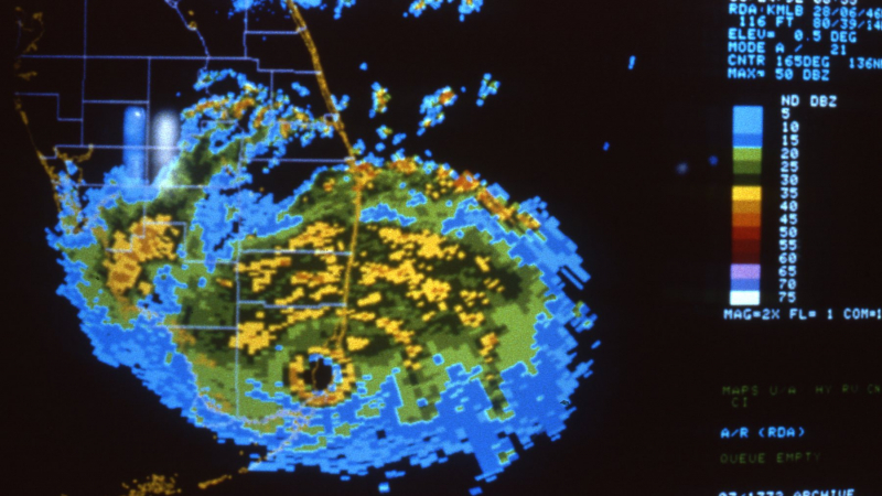
Lead forecaster Dr. Ed Rappaport, now the acting Hurricane Center director, recalls how tense that night was. “Thanks to the frenetic pace, very few of us were aware of the chaos taking place right outside our building. We were all focused on our jobs. But after the 5:00 a.m. advisory was issued I realized the building was actually swaying! A few minutes later, the rooftop anemometer measured a 164-mph wind gust.”
164 mph
Hurricane Andrew's wind speed at the National Hurricane Center
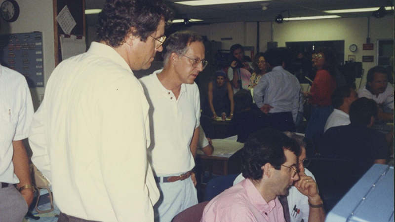
Anticipating Andrew’s arrival, several NHC forecasters were sent to NOAA’s National Meteorological Center in Maryland to back up the hurricane center, just in case. One of those forecasters, Hugh Cobb, was taking a break a few hours after Andrew made landfall: “I was watching CNN and the newscaster was talking about damage to the National Hurricane Center. I happened to glance up and I saw a photo of my car. The wind was strong enough that a blue Chevy landed right on top of it."
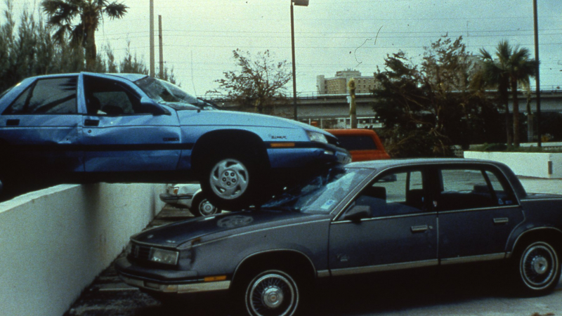
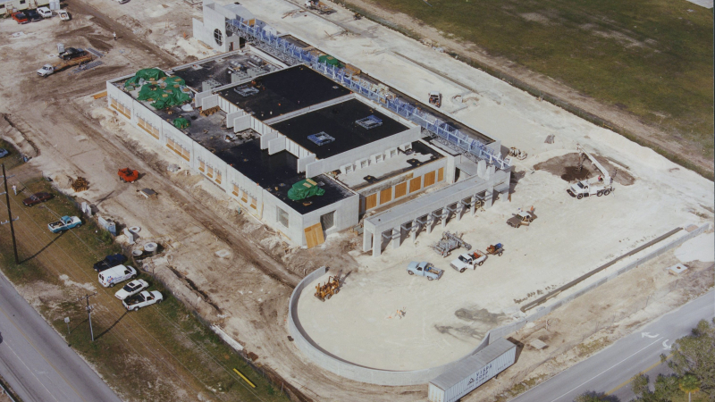
The National Hurricane Center was heavily damaged by Andrew and an improved, stronger facility needed to be built. The NHC moved to its new home, about 15 miles inland on the campus of Florida International University in 1995. The new building is a veritable fortress compared to its predecessor and has survived close encounters with Hurricane Katrina and Wilma in 2005.
“We’ve got multiple back-up systems, generators, shutters, everything we need to hunker down and still issue our forecasts,” said Rappaport. “We’ve got our hurricane plan in place so we're good to go.”
Hurricane Andrew was one of seven storms during the 1992 hurricane season, a relatively inactive year, but it’s a stark reminder that it only takes one storm to make a very bad season. Having a plan in place is vital for everyone that lives or visits hurricane prone locations. More preparedness information is available from FEMA and NOAA’s National Hurricane Center.


