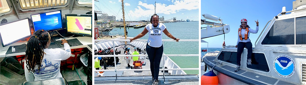
The Empowering Women in Hydrography project is a global effort led by the International Hydrographic Organization and Canada that seeks to initiate, organize and track a series of activities and initiatives which will enable more women to participate equitably in the field of hydrography and to assume leadership roles within the hydrographic community. NOAA is contributing to the project via an ‘at-sea experience’ on NOAA hydrographic ships for three women each year over the lifespan of the project. After a global call for nominations, three women were selected to join NOAA ships for the 2023 survey season. Victoria Obura, a Hydrographer from Survey of Kenya Hydrographic Office, joined NOAA Ship Thomas Jefferson from 12 June to 23 June 2023, while surveying offshore Galveston, Texas.
Introduction
I was elated by the fact that I traveled to join NOAA Ship Thomas Jefferson, leg 7, on World Ocean Day and celebrated World Hydrography Day aboard Thomas Jefferson mapping offshore Galveston, Texas. My gratitude goes out to the joint IHO-Canada Empowering Women in Hydrography project and to NOAA, specifically the Thomas Jefferson crew for their hospitality and technical support while aboard and the office team that worked out the logistics to make this trip a success.
I work for Survey of Kenya Hydrographic Office but am also involved in the Nippon Foundation/GEBCO mapping projects. I am a course instructor on fundamentals of ocean mapping under the Ocean Teacher Global Academy of the Intergovernmental Oceanographic Commission UNESCO and a one-time course teacher for IHO-NF Geospatial Marine Analysis and Cartography. I give career talks to sensitize students on hydrography in various colleges around Western Indian Ocean and I’m a board member of the Organization for Women in Science for the Developing World Kenya Chapter. The organization’s mandate is to unite women scientists from the developing and developed worlds with the objective of strengthening their role in the development process and promoting their representation in scientific and technological leadership, focusing on mentorship and encouragement of women in science, technology, engineering, and math.
This opportunity aboard the Thomas Jefferson, therefore, is a support towards sustaining the skills I gained, developing professional competency to make significant impact as I go back to the hydrographic office in my home country, and purposefully, for passing down knowledge to the next generation of hydrographers.
At Sea Experience
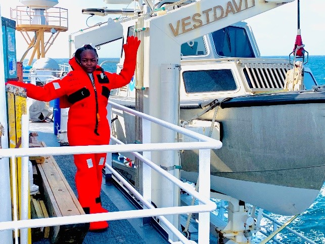
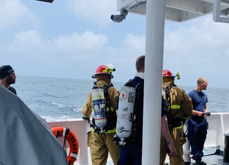
I boarded Thomas Jefferson on 12 June 2023 and spent the morning orientating to my new surroundings around the ship before leaving the Port of Galveston later that afternoon. On the second day, safety drills were conducted on fire, emergency and abandon ship—safety drills are performed weekly. Survey launches scheduled for the first week were canceled due to the rough sea state since launch operations are weather dependent. I also had a meeting with the commanding officer to discuss my expectations as a physical scientist aboard and the areas I required more emphasis on. With a plan of the day posted every evening, it was easy keeping track of day-to-day activities, especially tasks around the ship that were not survey and mapping related but required my input.
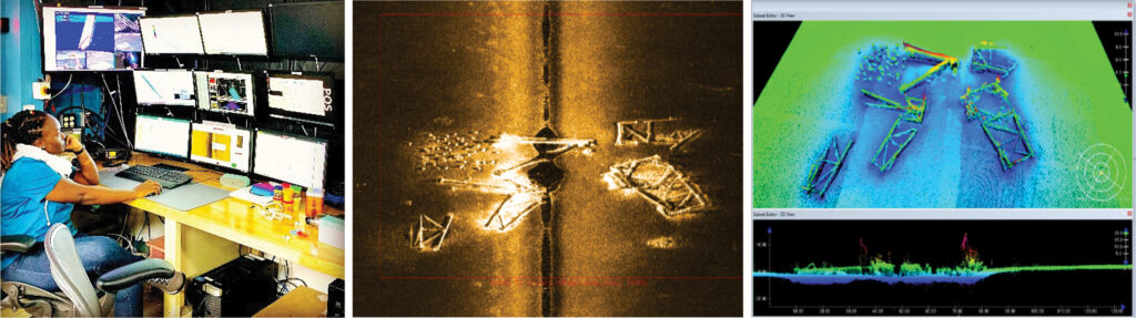
Data Acquisition and Processing
Three sets of data were acquired: multibeam data (Kongsberg EM2040 and EM710), side scan sonar data (Klein System) and sound speed data (conductivity, temperature, and depth cast or CTD). All these data streams were displayed on different screens through their respective acquisition software alongside the vessel position and motion measuring system, with line plans displayed on Hypack and Rose Point’s Coastal Explorer. The multibeam coverage was 60 degrees on each side therefore lines were planned 100 meters apart, while the side scan sonar coverage was between 75- and 100-meter range scale. Various junctions were covered in this survey area with previous surveys by Thomas Jefferson. All acquired raw data is sent to a specific directory and shared to a network that is accessible on all computers in the survey room, therefore pre-processing such as gross data cleaning holidays, noise, and sound-velocity errors can be done. The team was able to map approximately 1,810 linear nautical miles on this leg.
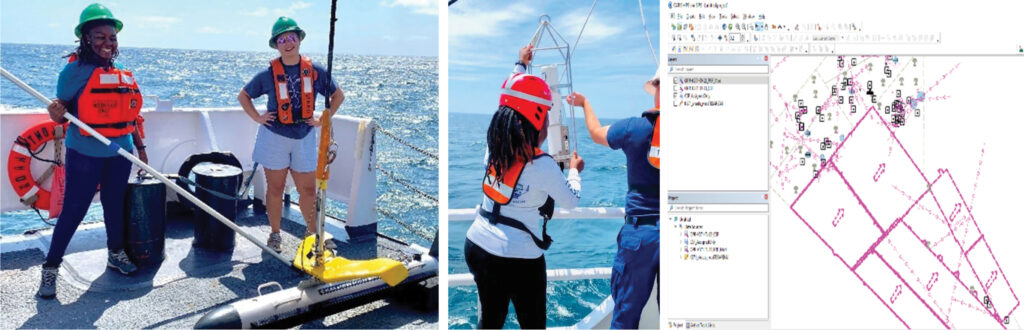
The data is then uploaded on Pydro Explorer-Charlene, an automated data processing and transfer tool which was developed by NOAA’s Office of Coast Survey. It does verification of raw data, processing of multibeam and sides can sonar data with Caris Batch and also creates a smoothed best estimate of trajectory with POSPac Batch, a vessel position and motion data processing software.
The conductivity, temperature, and depth (CTD) data acquired is uploaded via the sound speed manager after field survey and quality control. The salinity, temperature and conductivity information are made available through the National Centers for Environmental Information in World Ocean Atlas for public use at a later date—an amazing discovery since I have used sound speed data from World Ocean Atlas on various remote mapping projects.
My ship escort Miss. Angelina Ponella took the survey team through NOAA’s Hydrographic Survey Specifications and Deliverables, survey execution, quality control and assurance procedures and data management processes. For every survey area, there are features to investigate, whether they exist and if they do whether their position and definition are as indicated. For offshore Galveston, some of the features investigated are offshore platforms, pipelines and obstructions. This information is very useful as it is used to update the Coast Survey catalogue. It is worth noting that offshore platforms support a thriving reef ecosystem below the water surface, since they provide habitat needed by marine flora and fauna. It is in this light that The Artificial Reef Act was put in place so that decommissioned platforms (rigs) are not completely destroyed but turned into reefs.
Personal Log
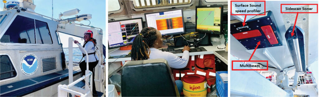
My day started at 0600 hours, joining the morning shift at 0800 to 1200 hours. This entailed data acquisition, deploying and recovering the side scan sonar and the CTD cast to collect sound speed data. My afternoon was engaged in multibeam and side scan sonar data processing and daily report update.
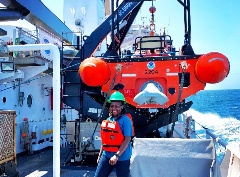
I had an opportunity to go out on the survey launch during the last week since the weather was not conducive for most of this leg. The survey launch is a mini replica of the main ship as it has almost all similar mapping equipment and software as the main vessel.
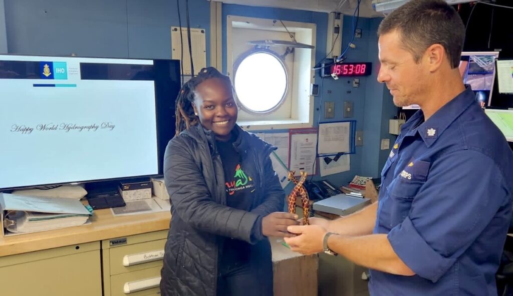
To celebrate World Hydrography Day, I had the opportunity to do a presentation on the structure and mandate of the Hydrography Office in Kenya, the resources available, and various hydrographic activities and projects the office carries out.
The Empowering Women in Hydrography at sea experience was not just a mapping expedition but a holistic approach towards human resource cooperation, resource use and handling towards a successful survey operation from data collection to final output. I appreciate the potential of continuous innovation capabilities—tailor-made data acquisition and processing software and automated data processing tools such as Pydro-Charlene. Some of NOAA’s Hydrographic Survey quality control and assurance procedures, survey execution and data management processes are items I would like to borrow from and apply to my home office since it makes it easier to identify sources of bottleneck in procedures and to act on them.
The teamwork, coordination and communication on various tasks like safety drills and handling lines brought almost all the teams together, and the concern over the wellbeing of everyone on board was so heartwarming that it made my stay worthwhile.
Bonjour je m’appelle Tatiana BIANDA , je suis une jeune camerounaise passionnée de levé balthimetrique. actuellement en service dans l’entreprise Studi International pour les travaux de construction du Port en eaux profondes de Kribi. j’aimerais participer au programme d’ autonomisation des femmes en hydrographie grâce à une expérience en mer. avec vos équipes. j’ai visualisé le passage de plusieurs consoeurs dans le domaine notamment celle de Victoria Obura.
je suis intéressée
j’aimerais savoir les critères de sélection pour participer à l’aventure ?
(Translated from French)
Hello my name is Tatiana BIANDA, I am a young Cameroonian passionate about bathymetric surveying, currently in service in the company Studi International for the construction works of the Kribi Deepwater Port. I would like to participate in the Women Empowerment in Hydrography through an experience at sea, with your teams. I visualized the passage of several sisters in the field including that of Victoria Obura. I’m interested and would like to know the selection criteria to participate in the adventure?
(Response in French)
Nous publierons l’opportunité 2024 et lancerons un appel à candidatures vers la période de janvier/février 2024. L’annonce sera publiée sur la page Web de l’OHI sur l’autonomisation des femmes en hydrographie. https://iho.int/en/basic-cbsc-ewh
(Response in English)
We will post the 2024 opportunity and call for applicants around the January/February 2024 timeframe. The announcement will be posted to the IHO’s Empowering Women in Hydrography webpage. https://iho.int/en/basic-cbsc-ewh
Hello Tatiana. You can reach me on ob.victoria@gmail.com for further discussion on prospects.