Know the risks before hitting the water.
This story map depicts six dangers at the beach and shows how NOAA helps mitigate risks for the nearly 190 million people who visit America’s beaches, Great Lakes and other waterways every year.

Play it safe story map opening. Two boys playing at the beach. (Image credit: NOAA)
Rip Currents
Beware the grip of the rip
Rip currents can occur wherever there are breaking waves. They don’t pull people under water, but can pull even the strongest swimmer far out to sea. They can also race up to eight feet per second, even faster than an Olympic swimmer.
The U.S. Lifesaving Association, a NOAA partner, estimates that rip currents cause more than 100 fatalities annually. Lifeguards rescue tens of thousands of people from rip currents each year.
Check NOAA Surf Zone Forecasts and local conditions before heading out to the beach. NOAA’s Rip Current Survival Guidealso provides life-saving information.
To stay safe, don't swim alone and try to swim near a lifeguard. If caught in a rip, never swim against the current. Swim out of the current parallel to the shore, and then to shore. If unable to escape, float or tread water. Call or wave for assistance.
Dangerous Waves
Never underestimate the power of dangerous waves. In the U.S., about 10 people drown each day. Here are three waves that can kill:
- Sneaker Waves: Sneaker Waves are deadly, larger-than-average swells that suddenly surge far up the beach following long periods of quiet surf and smaller waves. Along much of the West Coast, these waves can pull beachgoers into frigid, rushing currents, killing more people than all weather hazards combined. Before getting too close to the ocean, check for at least 15 minutes to see how far the waves reach.
-
High Surf Waves: High Surf Waves rush up quickly, well above the typical high tide waterline. Much larger than normal waves, high surf waves break in the surf zone with enough force to sweep people already in the water or along the shoreline into the churning current. They can erode beaches, wash away roads, and damage buildings. Learn how your area defines high surf waves because there are regional differences.
-
Shorebreak Waves: Shorebreak Waves break directly on shore. They can be powerful enough to crash down on swimmers in the surf zone, causing severe injury or death. These waves are deceptive. With no large waves in sight, danger is not apparent until the waves crash on shore, often propelling a swimmer head first into the bottom. In breaking waves, it’s critical to protect the head and neck by keeping hands out front.
New WaveSafe Series
Avas, the Samoan word for passages, are unique to islands with coral reefs and rock coasts. As tidal currents returning to sea rush over coral reefs, narrow gaps in the sharp reefs create a dangerous, churning pathway, severely injuring swimmers and sweeping them out to sea.
Avas will be featured in the first of a newOcean Today video series. The series also will highlight waves that can kill on the East Coast and in Hawaii, Southern California and the Pacific Northwest.
Eye on the waves
The ocean is never still. Staying vigilant about ocean conditions is vital to safety, for those nearshore and for commercial interests and mariners on the high seas.
NOAA’s WAVEWATCH III plays a leading role in keeping a world of users updated about ocean conditions by providing vital forecast information about wave height, direction and the distance between waves. WAVEWATCH III produces seven-day forecasts four times each day.
In addition, NOAA’s Nearshore Wave Prediction System provides model forecasts at hourly intervals for out to 144 hours for coastal waters within National Weather Service forecast areas.
Lightning
25 million strikes each year
The next time you hear that the chances of something happening are even less than being struck by lightning ... please set the record straight!
In the U.S., about 300 people are hit by lightning each year, and about 30 die. Many of those hit are severely injured. Insured economic losses are about $1 billion every year.
As animated here, the Geostationary Lightning Mapper on NOAA's GOES-16 satellite tracked lightning moving across the U.S. on July 15.
Rapid increases in lightning indicate a storm may be strengthening. In many instances, the mapper detects lightning before ground-based systems do, helping forecasters provide more accurate, earlier warnings of developing severe storms.
Bolt from the blue
- Even distant thunder means lightning is too close for safety.
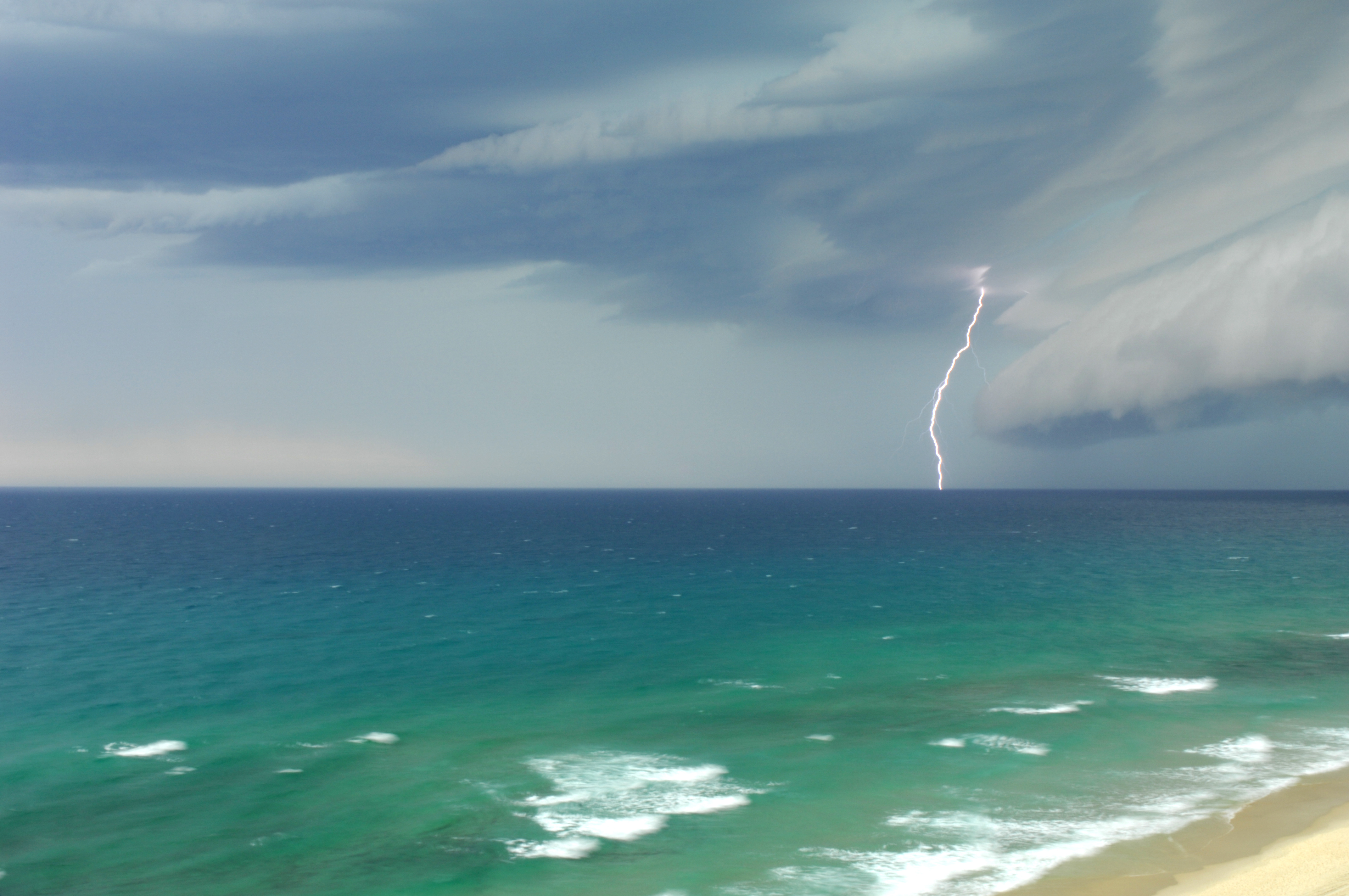
- Lightning can strike 10 miles from rain. Many deaths occur before rain falls.
- If outside, seek safety in a substantial building or hard-topped vehicle.
- Standing under a tree increases risk.
- Groups should spread out to minimize risk of multiple casualties.
- If inside, avoid faucets, showers, corded phones and anything plugged into an electrical outlet.
- It’s safe to touch victims. They don’t carry electrical charges. Administer CPR or other first aid as needed.
Harmful Algal Blooms
Tiny plants... toxic punch
Algae are simple plants that, under the right conditions, can grow out of control, producing toxins that can contaminate drinking water, devastate marine life and, in rare cases, harm humans.
Known as harmful algal blooms, or HABs, the toxic blooms can severely hurt local economies, especially in the many coastal communities that rely on tourist dollars.
With many partners, NOAA has developed the HAB Operational Forecasting System, which provides region-specific early warnings to detect HABs and forecast outbreaks. These warnings include the Gulf of Mexico and Lake Erie.
The regional focus is critical because HABs affect different regions in different ways and for a variety of reasons. Even over short distances, impacts can vary significantly. One beach, for example, can be affected, while a nearby one is not.
Similar to weather forecasts, NOAA’s regional forecasts deliver a timely, reliable heads-up about bloom health, helping health and water officials and the public mitigate human and economic risks.
Stay safe using NOAA HAB forecasts to find unaffected beaches. They identify where potentially harmful blooms are, their size, and where they're likely headed. Heed local advisories, shellfish harvesting alerts, and warning signs.
Heat

How hot is it?
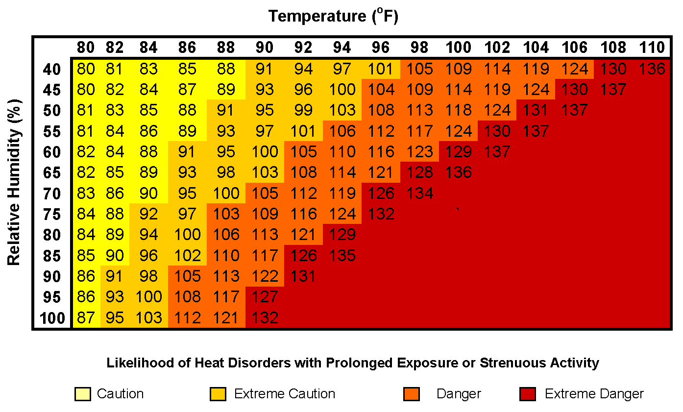
NOAA Heat Index
The Heat Index reflects how hot it actually feels when humidity is factored into the air temperature. If the air temperature is 96 °F and relative humidity 50%, it will feel like 108 °F. Red areas indicate extreme danger.
Heat Advisory means caution!
Typically issued 1 day ahead of high heat and humidity
Excessive Heat Warning means take action!
Issued within 1-3 days of the start of especially dangerous heat conditions
Excessive Heat Watch means be prepared!
Typically issued 2-5 days ahead of potentially hazardous heat
Practice safety wherever you are!
Heat-related deaths are preventable — indoors, outdoors, at work and in vehicles.
Check out NOAA’s safety tips: weather.gov/heat
Cold
The cold facts
Even when it’s stifling hot, water can be deadly cold. Air temperatures along the West Coast can top 100 degrees when water temperature barely reaches 60 degrees. The East Coast and Great Lakes face significant cold water threats as well.
The facts are daunting. Cold water drains body heat up to 25 times faster than cold air. About 20 percent of those who fall into cold water suffer shock and die within 60 seconds. Even strong swimmers lose muscle control in about 10 minutes.
Anyone immersed in water below 70 degrees is at risk, and the risk rises sharply when water is below 60 degrees.
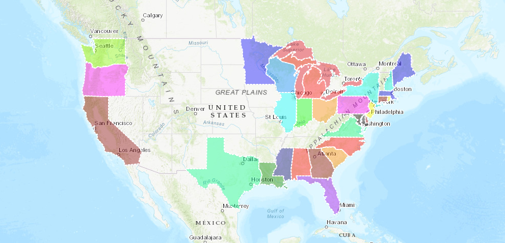
Know the water temperature before going to the beach. Check NOAA tools, such as this map, which includes current local temperatures. To use it: Zoom to Region. Click Meteorological. Hover over Locale.
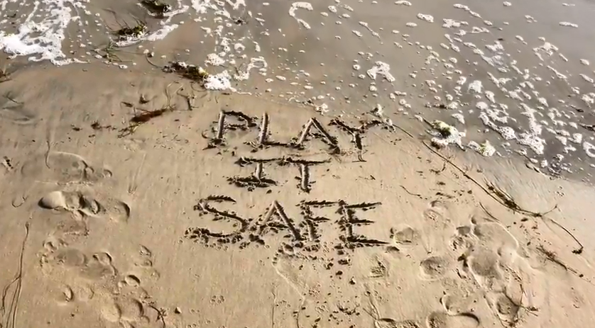
Stay safe at the beach!

Staying safe at the beach means knowing the dangers before you head out.
NOAA’s leading-edge science, technology, and beach safety campaigns provide a heads-up about hazards and mitigating risks. These safeguards are essential to protecting America’s beachgoers, communities and more than $300 billion ocean and Great Lakes’ economies, and they are vitally important to building a Weather-Ready Nation.
To view the original Our Ocean story map, please see this version on the ESRI websiteoffsite link offsite link.


