Wireless Emergency Alerts for flash flooding reserved for most life-threatening events

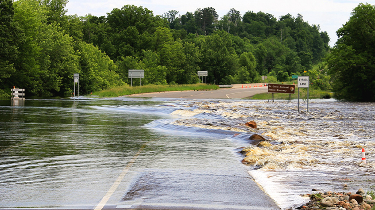
Highway 77 flooding in the Saint Croix National Scenic Riverway, 2018. (Image credit: National Park Service)
To better communicate the threat of a flash flood, NOAA’s National Weather Service is moving to a bulleted format for the warnings, with easily readable information, including a description of the flash flood hazard, the source of the information and the hazard impact.
The new impact-based format will allow for more targeted Wireless Emergency Alerts directed at those who need to take immediate action to preserve life during a flash flood event.
“We’re always looking for ways to improve how we communicate a flash flood threat,” said Mary Mullusky, branch chief, National Weather Service Water Resources Services. “The changes to our flash flood warnings simplify the text to more clearly tell people what the hazard is and what impacts are expected so they can take appropriate action. This is another step in our effort to build a Weather-Ready Nation.”
Software installation for the reformatted flash flood warning is underway in nine local National Weather Service (NWS) forecast offices. The remaining offices will implement the new format by late November. The new look builds on the successful reformatting of warnings for tornadoes, severe thunderstorms, and special marine warnings, and is part of the broader Hazard Simplification Project to improve communication of watches and warnings to the public.

A flash flood warning is issued when flash flooding is imminent or occurring. The agency issues more than 4,000 flash flood warnings each year and they all trigger a Wireless Emergency Alert on enabled cell phones, regardless of the severity of the event. The format changes being made to flash flood warnings will reduce the number of wireless alerts sent to customers.
Alert for Considerable, Catastrophic Flood Warnings
In December, after all NWS forecast offices are issuing flash flood warnings in the new format, wireless alerts will only be sent for flash flood warnings where a life-threatening flood event is occurring and urgent action is needed. Warnings with a damage threat tag of either “considerable” or “catastrophic” will trigger a wireless alert. Considerable flood events are significantly life-threatening and may cause substantial damage to property. Catastrophic events are violent flash floods that extraordinarily threaten lives and cause disastrous damage. The new tags will help reduce the number of flash flood warning Wireless Emergency Alerts currently distributed.
All National Weather Service flash flood warnings will still be issued and distributed via weather.gov, NOAA Weather Radio, Emergency Alert System and through dissemination systems to our emergency managers and partners.
“We listened to the public who voiced concern that there were too many flash flood Wireless Emergency Alerts,” Mullusky said. “In the future, if you receive a flash flood warning wireless alert, you need to take immediate life-saving action. We are reserving flash flood wireless alerts for the most life-threatening events.”
Flash floods are among nature’s most common and destructive natural hazards. Flash floods generally develop within minutes to hours of the immediate cause and bring a damaging and life-threatening rapid rise of water into a normally dry area. Causes of flash flooding include heavy rain, river ice or debris jams, and levee or dam failure.
The majority of flash flood deaths in the U.S. occur inside vehicles swept away by high water. Never drive into a flooded roadway, or around a barricade; Turn Around Don’t Drown. Always check weather.gov for official National Weather Service forecasts, watches and warnings.
Media contact
Maureen O'Leary, 301-427-9000


