New NOAA Lake Pontchartrain sensors to provide better evacuation planning, storm surge data

Sensors fill critical data gap in weather forecast accuracy

New water level and weather sensors on Lake Pontchartrain will provide additional data to improve storm surge warnings for the western portion of the lake. The new real-time data will allow local officials to improve emergency response and evacuation planning in an area that is extremely vulnerable to surge and had significant storm surge during Hurricane Isaac in 2012.
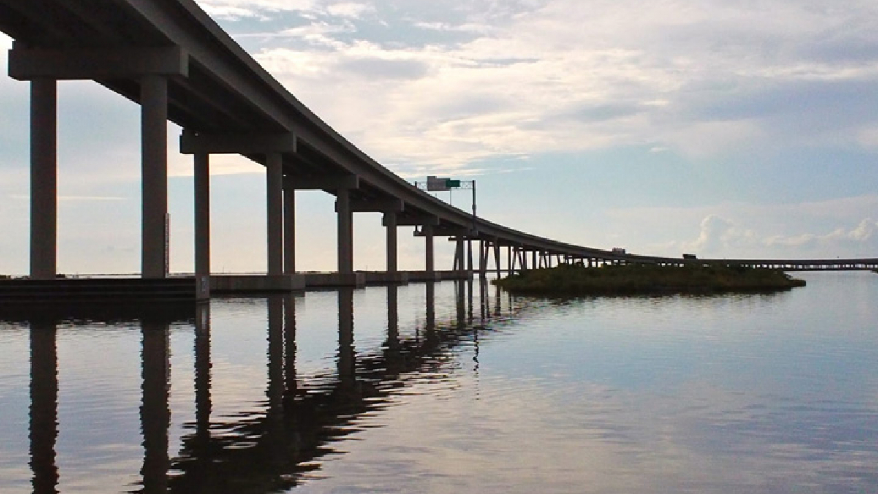
Nine miles of LA-1, from Leeville to Port Fourchon, are elevated to withstand flooding. The remaining section of the roadway, from Golden Meadow to Leeville, is level with Bayou LaFourche and vulnerable to frequent flooding.

Nine miles of LA-1, from Leeville to Port Fourchon, are elevated to withstand flooding. The remaining section of the roadway, from Golden Meadow to Leeville, is level with Bayou LaFourche and vulnerable to frequent flooding. (Image credit: Caitlyn Kennedy Esposito)

NOAA's new water level station uses microwave sensor technology to provide real-time water level data for improved storm surge forecasting. (Credit: NOAA)

The installations, a joint effort from NOAA’s Center for Operational Oceanographic Products and Services (CO-OPS) and NOAA’s National Weather Service, will also add to the these coastal communities’ resilience in the face of severe weather.

Officials from NOAA, Louisiana Governor’s Office of Homeland Security and  St.John’s Parish formally dedicated the new public safety installation today at Frenier Landing in LaPlace, Louisiana.

“Communities at risk of storm surge from hurricanes need to have immediate, accurate information on water levels in order to make the best decisions,” said Ellen Clark, deputy director for NOAA’s Center for Operational Oceanographic Products and Services. “These sensors fill a critical gap in observations for this area and can help communities become more resilient to flooding, as well as long-term sea level rise.”

The stations are built to survive multiple storm events, including 110 mile per hour winds with the goal of operating continuously and providing real time measurements before, during, and after any likely storm event.

CO-OPS installed two real-time microwave water level sensors on the Interstate 10 causeway across the lake to provide continuous monitoring of water levels, including those produced by storm surges. The new sensors were placed with new benchmarks and leveling surveys to ensure accuracy.

The new NOAA water and meteorological station on the western side of Lake Pontchartrain is built to withstand winds of up to 110 miles per hour (Credit: NOAA)

The National Weather Service, with assistance from CO-OPS, completely renovated and returned to service an existing station that now has a modern meteorological sensor system to measure air temperature, humidity, wind, rain, and barometric pressure at Frenier Landing in La Place, Louisiana. The water level sensors will now use more efficient and accurate radar, while the meteorological station has a unique system to keep its equipment above the storm surge. allowing it to function in harsh conditions.

“The new sensors won’t stop the next storm surge, but they play a huge role in helping us see the weather and water moving into and out of Lake Pontchartrain,” said Michael Coyne, acting National Weather Service southern region director. “The data will help build a long-term record and improve the accuracy of storm surge modeling for decision makers for generations to come.”

NOAA’s Center for Operational Oceanographic Products and Services has measured sea levels in the United States for more than 150 years and is the nation’s authoritative source for sea level through its National Water Level Observation Network.

NOAA’s National Weather Service Weather Forecast Office New Orleans/Baton Rouge is responsible for providing forecasts, warnings, and decision support services for 22 parishes in Louisiana and eight counties in Mississippi.

NOAA’s mission is to understand and predict changes in the Earth's environment, from the depths of the ocean to the surface of the sun, and to conserve and manage our coastal and marine resources. Join us on FacebookTwitter, Instagram and our other social media channels.

Contact:
Ben Sherman
301-713-3066

Ken Graham, NWS
985-649-0429 ext. 222