U.S. had 2nd wettest, 11th warmest April on record

National drought recedes to record-low level
A powerful storm system brought torrential rainfall and historic flooding to the Missouri Ozarks and southeastern Kansas from Friday night, April 28 through Sunday, April 30. Storm total rainfall amounts generally ranged from 4 to 8 inches with some areas of far southern and south central Missouri receiving from 10 to around 12 inches. This incredible rainfall resulted in widespread and historic flooding. Numerous roads, bridges and buildings were destroyed. Many roads were flooded through the event

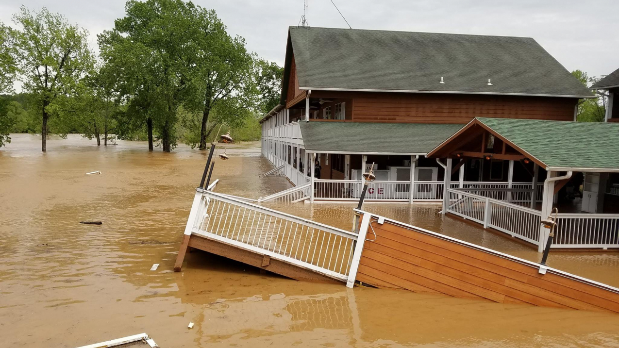
A powerful storm system brought torrential rainfall and historic flooding to the Missouri Ozarks and southeastern Kansas from Friday night, April 28 through Sunday, April 30. Storm total rainfall amounts generally ranged from 4 to 8 inches with some areas of far southern and south central Missouri receiving from 10 to around 12 inches. This incredible rainfall resulted in widespread and historic flooding. Numerous roads, bridges and buildings were destroyed. Many roads were flooded through the event including state highways and Interstate 44. Several rivers reached major and historic levels, notably the Current River in the city of Van Buren (pictured). Photo posted online May 1 by @MOConservation. (Image credit: Missouri Department of Conservation)

“April showers bring May flowers,” or so the saying goes.   

Perhaps a more appropriate description this year might be, “Heavy April showers bring record flooding.”

All that rain helped shrink the drought footprint for the contiguous U.S. to the lowest level since the nationwide Drought Monitor program began in 2000. It also caused loss of life and extensive property destruction in many communities.  

Climate by the numbers

April

Last month, the average contiguous U.S. temperature was 53.8 degrees F, 2.7 degrees above the 20th-century average. The month ranked as the 11th warmest April in the 123-year period of record, according to scientists from NOAA’s National Centers for Environmental Information. Much-above-average temperatures spanned the East, with record warmth in the Mid-Atlantic and Ohio Valley.

The average precipitation total for April was 3.43 inches, 0.91 inch above the 20th-century average, making it the second wettest April on record. Much-above-average precipitation fell across the Northwest, Central Plains, Mid-Mississippi Valley, Great Lakes and Mid-Atlantic.

Year to date

The year to date (January through April 2017) average temperature was 43.7 degrees F, 4.5 degrees above the 20th-century average. This was the second warmest January–April, behind 2012. The total year-to-date precipitation for the Lower 48 states was 11.46 inches, 1.99 inches above average, making it the fifth wettest YTD period on record.

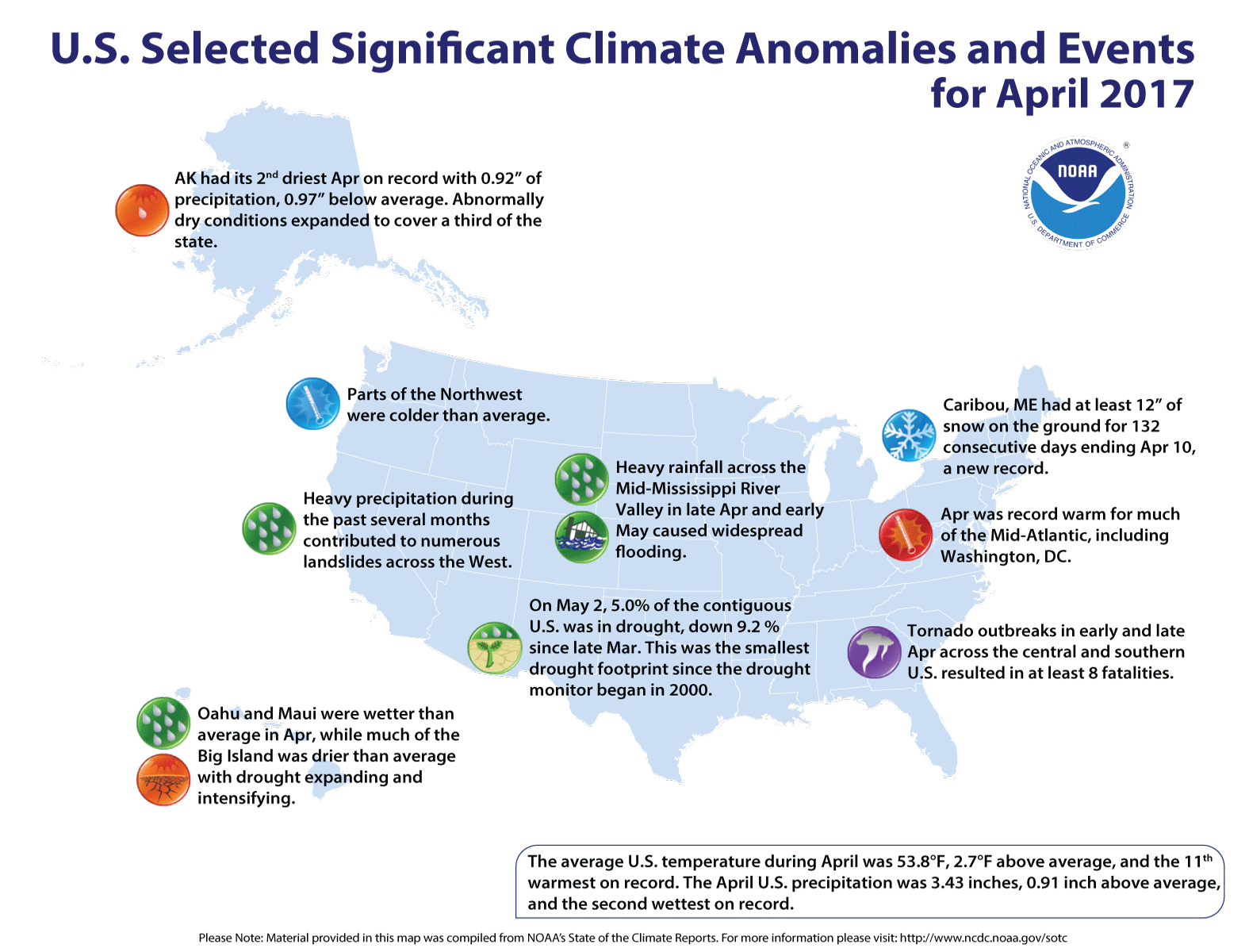
Here are some of the significant climate events that occurred across the country in April 2017.
Here are some of the significant climate events that occurred across the country in April 2017. (NOAA NCEI)

More notable climate events

  • Record warmth across the Mid-Atlantic and Ohio Valley: Delaware, Maryland, New Jersey, North Carolina, Ohio, Pennsylvania, West Virginia, Virginia and Washington, DC each had their warmest April on record.

  • Heavy rainfall caused widespread flooding: Record precipitation was observed in parts of the Northwest, Southern Plains and Mid-Atlantic. North Carolina had its wettest April on record. Rains caused widespread flooding in the Mid-Mississippi River Valley and contributed to numerous landslides in the West.

  • Drought shrunk to lowest extent since 2000: On May 2, 5 percent of the contiguous U.S. was in drought. This was the smallest drought footprint since the Drought Monitor began in 2000.  Despite improvement in many areas, drought worsened in the Southwest and across parts of the Southeast where several large wildfires burned in Florida and southern Georgia.

  • April saw substantial tornado activity: During April there were more than 200 preliminary tornado reports across the U.S. Large tornado outbreaks occurred in the Central and Southern U.S. in early and late April; these were responsible for eight deaths in Louisiana, South Carolina and Texas.

  • Winter reluctantly left Maine: Caribou, Maine, had at least 12 inches of snow on the ground for 132 consecutive days through April 10, a new record.

  • Alaska dried out: Alaska saw its eighth warmest and second driest April on record with 0.92 inch of precipitation. Abnormally dry conditions covered one-third of the state.   

Find NOAA’s report and download images by visiting the NCEI website.