Snowpack + snowmelt = water

Snow in the Sierra Nevada Mountains at its heaviest in more than two decades

Recent storms in California have provided widespread drought relief, but also caused deadly and destructive flooding and mudslides. Last week residents were evacuated from their homes as water poured over the damaged spillway at the Oroville Dam. Many rivers and creeks in the Central Valley and around Northern California are at or above flood stage.
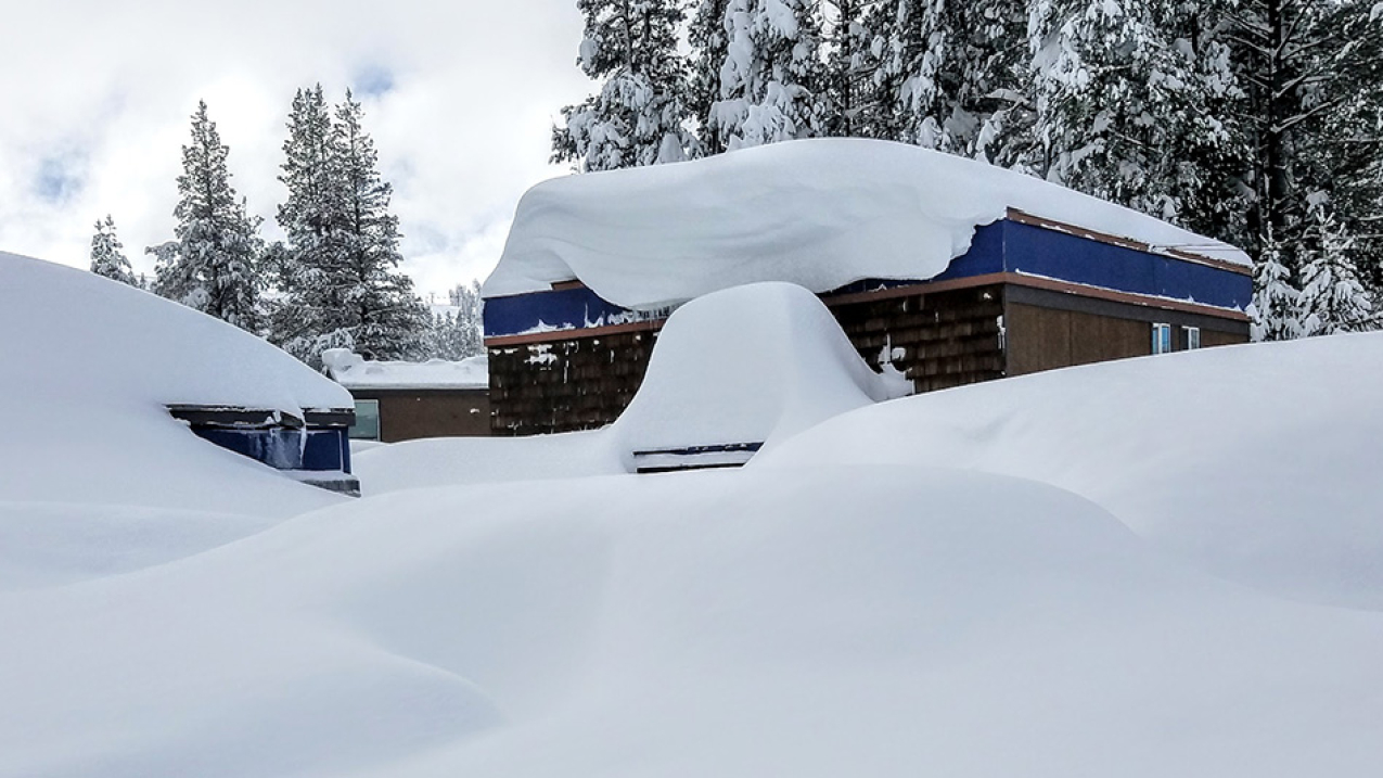
In early February 2017, snowpack in the Sierra Nevada mountains — the combined layers of snow and ice on the ground at any one time — was at its highest since 1995 for this point in the year. Pictured: Near Boreal Mountain Resort in Soda Springs, Calif.

In early February 2017, snowpack in the Sierra Nevada mountains — the combined layers of snow and ice on the ground at any one time — was at its highest since 1995 for this point in the year. Pictured: Near Boreal Mountain Resort in Soda Springs, Calif. (Image credit: Courtesy of Eric Kurth)

After years of too little rain, back-to-back storms in January and February brought record-breaking rain and snow to the entire state of California, which has left the northern half drought-free. The deluge of precipitation has significantly improved drought conditions in much of the Golden State, and it’s expected to continue.

17

— the percent of drought in California as of this week. It was 95 percent this time last year.

But, one wet season won’t end the drought in all areas, especially in Southern California.

Snowmelt is the key to recharging streams, lakes, rivers and reservoirs
In early February, snowpack in the Sierra Nevada Mountains — the combined layers of snow and ice on the ground at any one time — was at its highest since 1995 for this point in the year. When it melts, the snowpack provides one-third of the California’s freshwater supply.

Snow-water equivalent comparison: On February 21, 2017, the snowpack in the Sierra Nevada mountains held an average of 42 inches of water equivalent, compared to 21 inches one year ago.
Snow-water equivalent comparison: On February 21, 2017 (right map), the snowpack in the Sierra Nevada mountains held an average of 42 inches of water equivalent, compared to 21 inches one year ago (left map). Note: Lighter colors mean greater snow-water equivalence. (NOAA/NWS)

The amount of water contained within the snow is called the snow-water equivalent. In just six weeks, California’s snow-water equivalent totals have gone from below average to well above average — 186 percent of the February 21 average, in fact.

Unfortunately, it will take more than one above-average wet season for the state’s groundwater storage to fully replenish. Most major reservoirs are near capacity; some received more rainfall than can be stored. To avoid overflows, water managers have released some reservoir water to reserve space for spring snowmelt and rainwater from storms to come.

This aerial view looks east toward Oroville Dam and Lake Oroville, showing the damaged spillway with its outflow of 100,000 cubic feet per second (cfs) at the Butte County site. The California Department of Water Resources has a goal to lower the lake level by 50 feet to handle the next round of winter storms. Photo taken February 15, 2017.
This aerial view looks east toward Oroville Dam and Lake Oroville, showing the damaged spillway with its outflow of 100,000 cubic feet per second at the Butte County, California, site. Photo taken February 15, 2017. (Dale Kolke/California Department of Water Resources)

The latest Drought Monitor offsite link shows California’s drought shrank from 95 percent a year ago to 17 percent this week. California no longer has exceptional drought, the most severe category, compared to 38 percent of the state being in that category a year ago. And more good news, NOAA forecasters predict drought improvement will continue in central and Southern California through April.

What will spring bring?
This spring, and possibly before the end of winter, we should see some warming up, which could cause snow to melt faster and flood some areas. Snow in the high Sierras tends to produce a gradual runoff that should keep rivers and reservoirs at healthy levels through the dry season, though the sheer volume of expected runoff could cause flooding in the southern half of California’s Central Valley.

The latest spring runoff projections for the major rivers flowing from the Sierra Nevadas into the Sacramento Valley are 130 percent of average and 190 percent of average for those flowing into the San Joaquin Valley. 

What to expect in the near-term
Californians are getting a break from the wet weather, but it won’t last long: More storms are expected to impact Northern California February 26 and 27. And, nearly two months of California’s wet season remain.