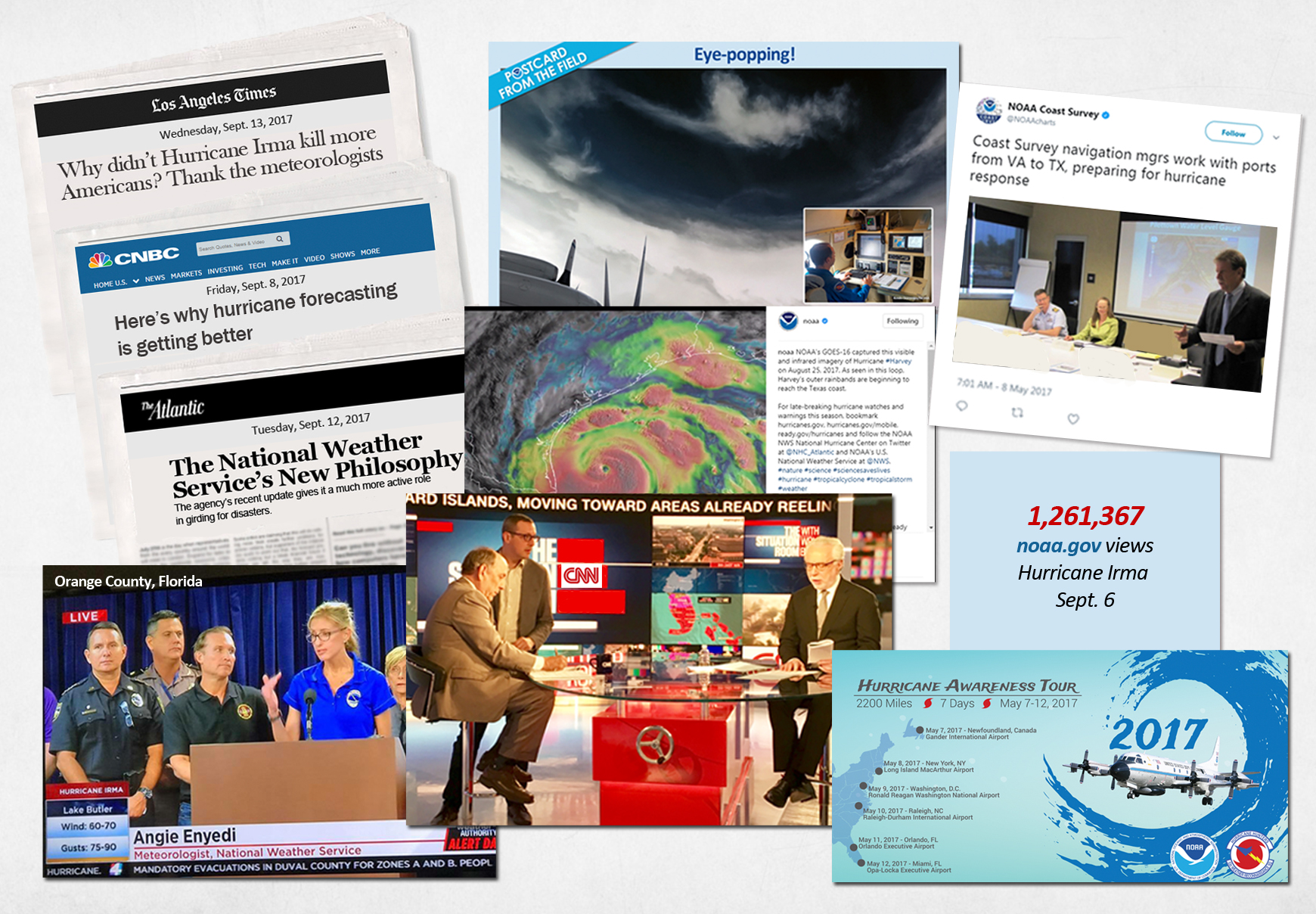
NOAA's work during the 2017 Hurricane season was monumental. New satellites, modeling tools and other new technology, and a revamped institutional philosophy designed to build a Weather-Ready Nation, amount to a complete change in how NOAA prepares our country and our communities for hurricanes.

Hurricane Harvey reaches peak intensity on August 25, 2017. (Image credit: NOAA)
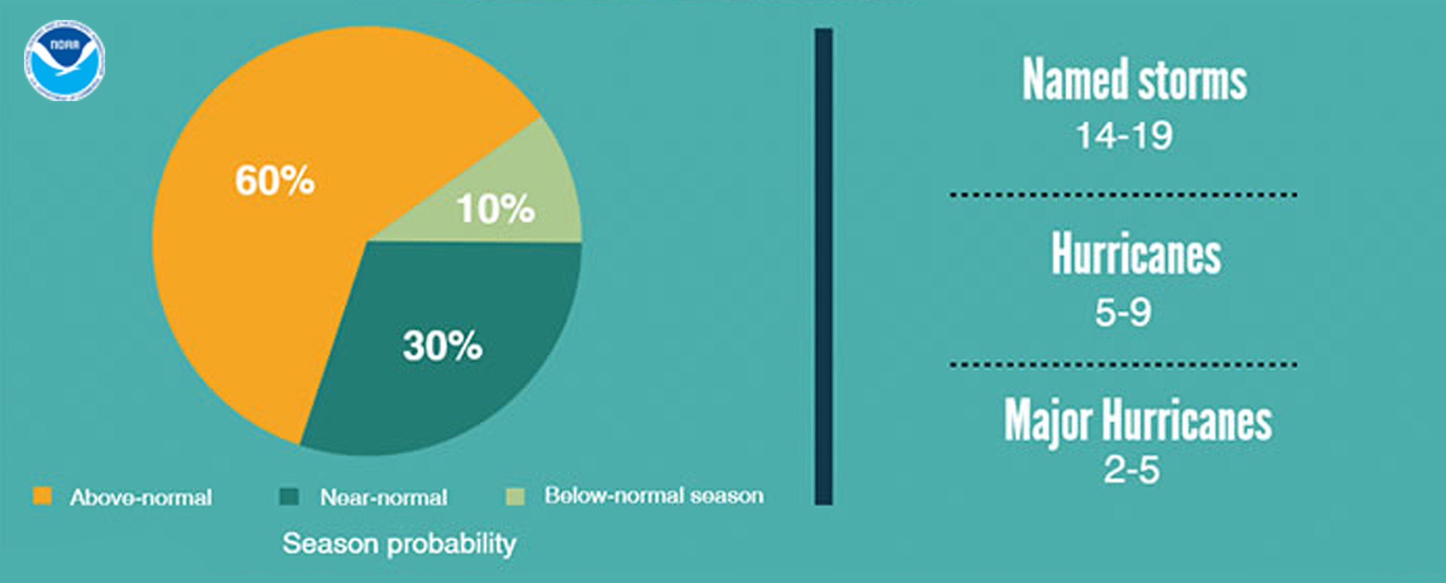
NOAA’s Atlantic outlook was on target for an active and above-normal season.
As 2017’s first major hurricane, Harvey hit Texas on August 25. With rainfall totals over 50 inches in spots, Harvey is the wettest tropical system on record for the continental U.S.
Catastrophic flooding left sections of Texas and western Louisiana underwater.
Two weeks later, Hurricane Irma, a rare Category 5, became the strongest Atlantic Ocean hurricane on record. Winds peaked at 185 mph winds, and stayed that intense for 37 hours.
Before landfall, Irma was 500 miles wide, 139 miles wider than Florida.
Irma’s Eye
Here’s a close look at Irma’s eye as it produced 185 mph winds.
This “1-minute” visible imagery was created with data from the still-experimental NOAA GOES-16’s Advanced Baseline Imager.
Along with more frequent scans, the near-real-time imagery provides the most detailed look yet at the structure and characteristics of storms. The result: faster, more reliable watches and warnings.
GOES-16 Sees Lightning in Hurricane Irma
The Geostationary Lightning Mapper(GLM) onboard NOAA's GOES-16 provides a constant vigil over lightning flashes across the Western Hemisphere. This animation shows storms associated with Irma on September 8.
As the first instrument of its kind in geostationary orbit, GLM, along with other tools, helps provide more accurate, earlier warnings of developing severe storms.
Rapid increases in lightning signal that a storm is strengthening, giving a vital clue that it may become more dangerous.
On September 9, Hurricane Jose brushed areas ravaged by Irma three days earlier. Hurricane Maria soon followed, striking Puerto Rico with Irma-level winds and Harvey-level flooding.
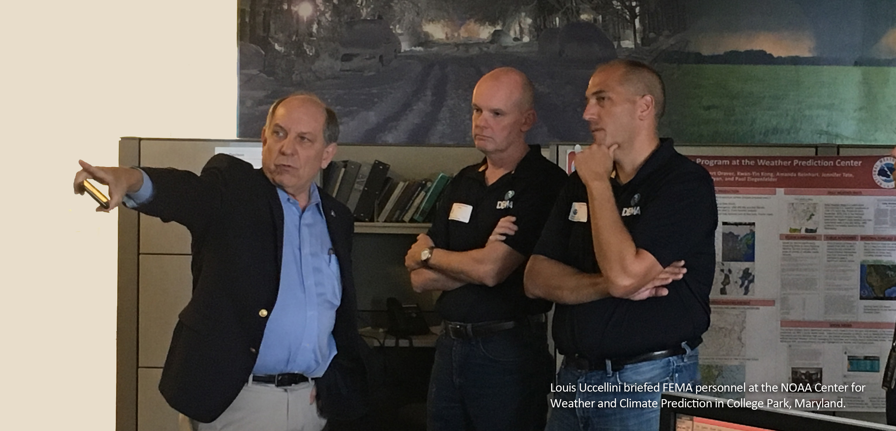
"History is being made this season. New satellites, modeling tools and other new technology, and a revamped institutional philosophy designed to build a Weather-Ready Nation, amount to a complete change in how NOAA prepares our country and our communities for hurricanes."
Louis W. Uccellini, Ph.D.
Director, NOAA National Weather Service
from an interview in The Atlantic
September 12, 2017

Pushing Science and Computing Power to the Edge
The above animation makes a compelling point about the high-impact value of NOAA Research’s Global Systems Division weather models.
Shown (right) are radar observations of Hurricane Maria striking Puerto Rico. Later, the radar was severely damaged, cutting off observations.
Shown (left) is NOAA’s experimental HRRRX, a real-time, hourly updated severe weather model that provides significantly greater coverage than the radar and continues vital coverage even after radar is lost.
HRRRX accurately forecast Maria's and Irma's tracks more than 24 hours in advance, and accurately predicted Harvey’s path and record rainfall up to 48 hours in advance.
New NOAA Products are Now Operational
A new National Hurricane Center product shows that hazardous conditions can occur well outside of the forecast cone. Another shows a smaller cone of uncertainty.
Here are three more new products:
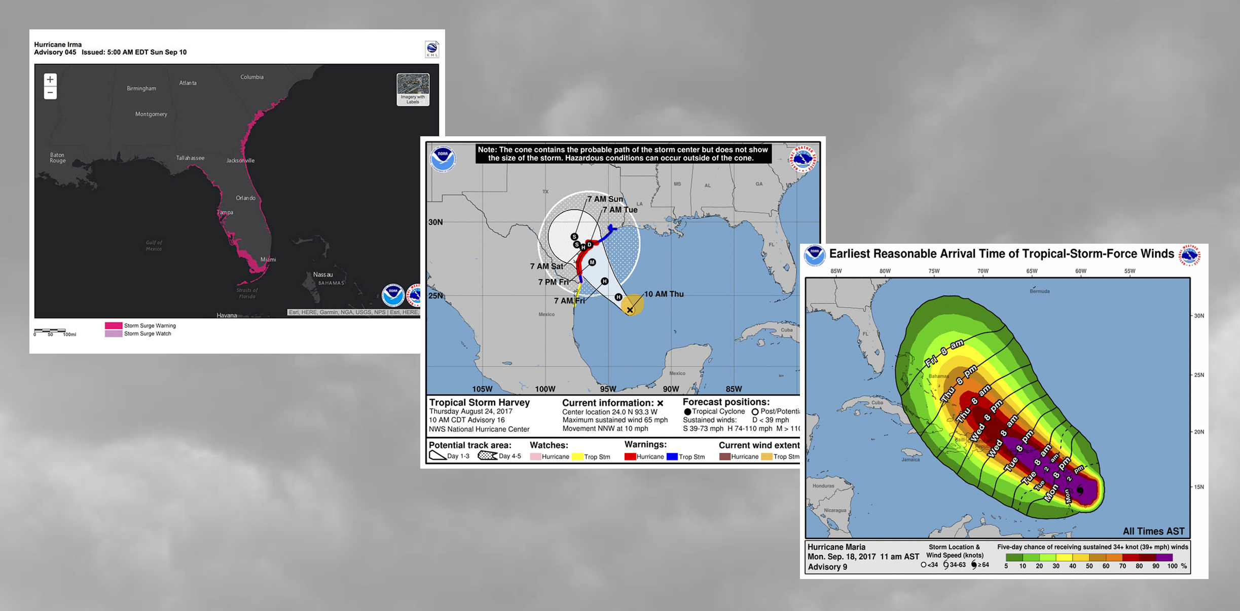
- Storm Surge Watches & Warnings highlight areas along the Gulf and Atlantic coasts at-risk for life-threatening inundation. Often the greatest threat to life and property, storm surge can occur at different times and locations than hazardous winds. Separate warnings for each hazard will save lives.
- Watches, Warnings & Advisories for potential tropical cyclones provide a vital heads-up for disturbances threatening danger to land areas within 48 hours. Forecast advances now allow the confident prediction of threatening events even as they are developing, rather than waiting until they actually occur.
- “Time of Arrival” graphics help coastal communities determine how much time they have to prepare safely for tropical-storm-force winds. Still experimental, graphics showing “earliest reasonable” and “likely” arrival times provide critical planning thresholds. Communities have the flexibility to plan, yet avoid being caught off-guard.
Citizen Scientists Track & Map Hurricane Harvey
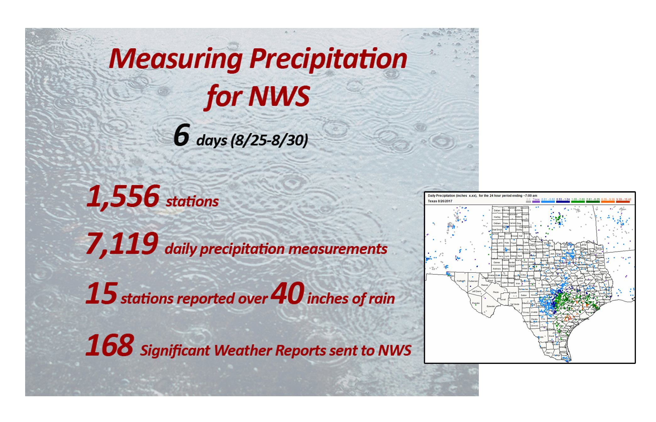
NOAA’s Office of Education helped spur development of CoCoRaHS, the acronym for the Community Collaborative Rain, Hail & Snow Network.
CoCoRaHS now has more than 20,000 volunteer observers. Of the network’s 333 coordinators, 254 work closely with NOAA.
When Hurricane Harvey hit, the Texas network played a vital role, tracking and mapping extreme rain throughout the storm, giving NWS forecasters a better real-time picture of what was happening on the ground.
NOAA Captures Emergency Images…and Brings Relief to Homeowners
"So many are passing your website along. Whether good or bad, knowing is such a relief."
"Wow! Thank you all at NOAA! We were able to see our house."
"You really made a difference in our lives today."
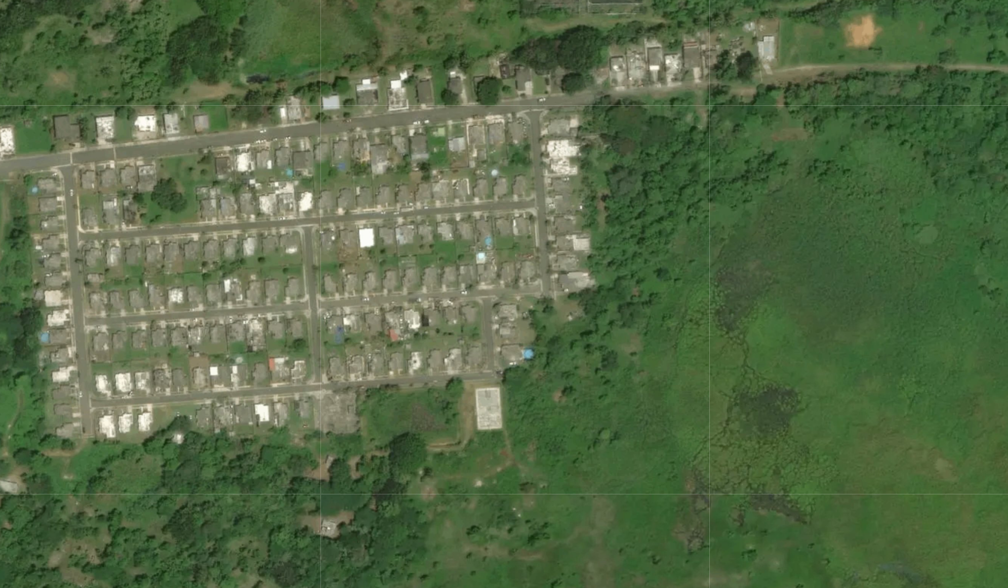
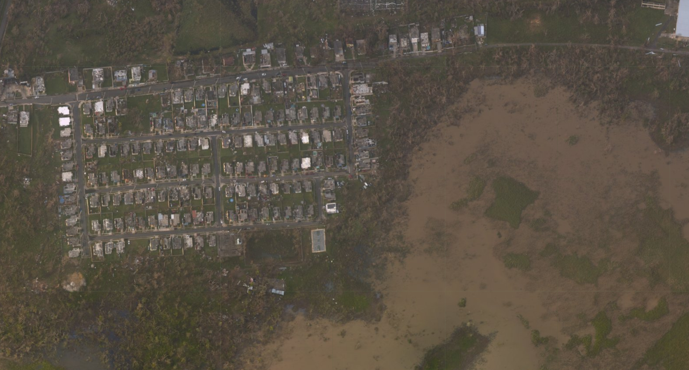
After each of this season’s hurricanes, NOAA’s National Geodetic Survey collected aerial images to help assess damage in areas targeted by the National Weather Service and FEMA.
Collected with specialized remote-sensing cameras aboard NOAA aircraft, the imagery is a crucial and cost-effective way of determining the extent of damage to homes, communities, infrastructure, major ports, waterways, and coastlines.
Since late August, about 65,000 images have been collected. For Hurricanes Harvey and Irma alone, there have been 1.7 billion requests for these images.
NOAA Coast Survey Supports Critical Need to Reopen Ports
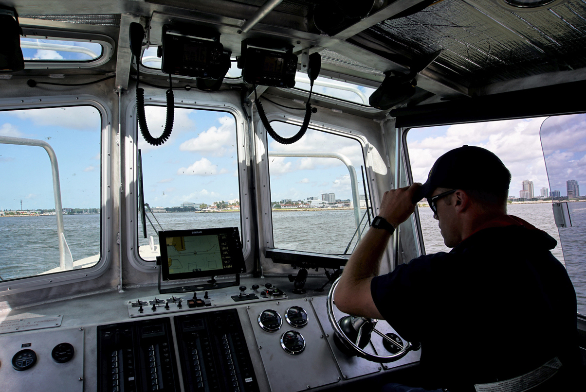
Following Hurricane Irma, NOAA Ensign Dylan Kosten led a NOAA Coast Survey Navigation Response Team surveying Tampa Bay.
Homeported in Connecticut, the team traveled to Florida to coordinate the survey with the U.S. Army Corps of Engineers.
The Ports of Tampa and Manatee handle about 41 percent of Florida’s motor fuel and, supported by the survey, the Coast Guard allowed three vessels to enter the port, bringing much-needed fuel to Florida residents.
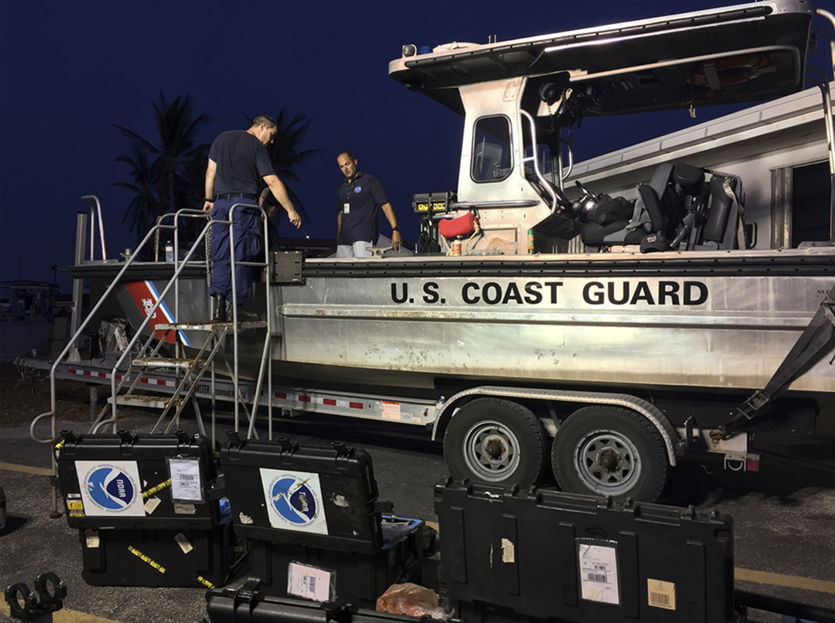
Mike Annis (right), NOAA scientist and lead of NOAA's Mobile Integrated Survey Team offsite link (MIST), and LCDR Jonathan French, NOAA Corps officer in charge of a NOAA Coast Survey Navigation Response Team, mount side scan sonar on a Coast Guard vessel in Key West.
After locating navigational hazards, clearance was given for cruise ships, Navy vessels and Coast Guard cutters to enter the Port of Key West. Cruise ships needed safe access to provide temporary housing for responders and residents.
In Texas, Coast Survey supported port reopening in Corpus Christi and Seadrift/Matagorda and provided survey support to help reopen ports in Houston and Galveston.
ERMA® Provides Fast, Regionally-tailored Data
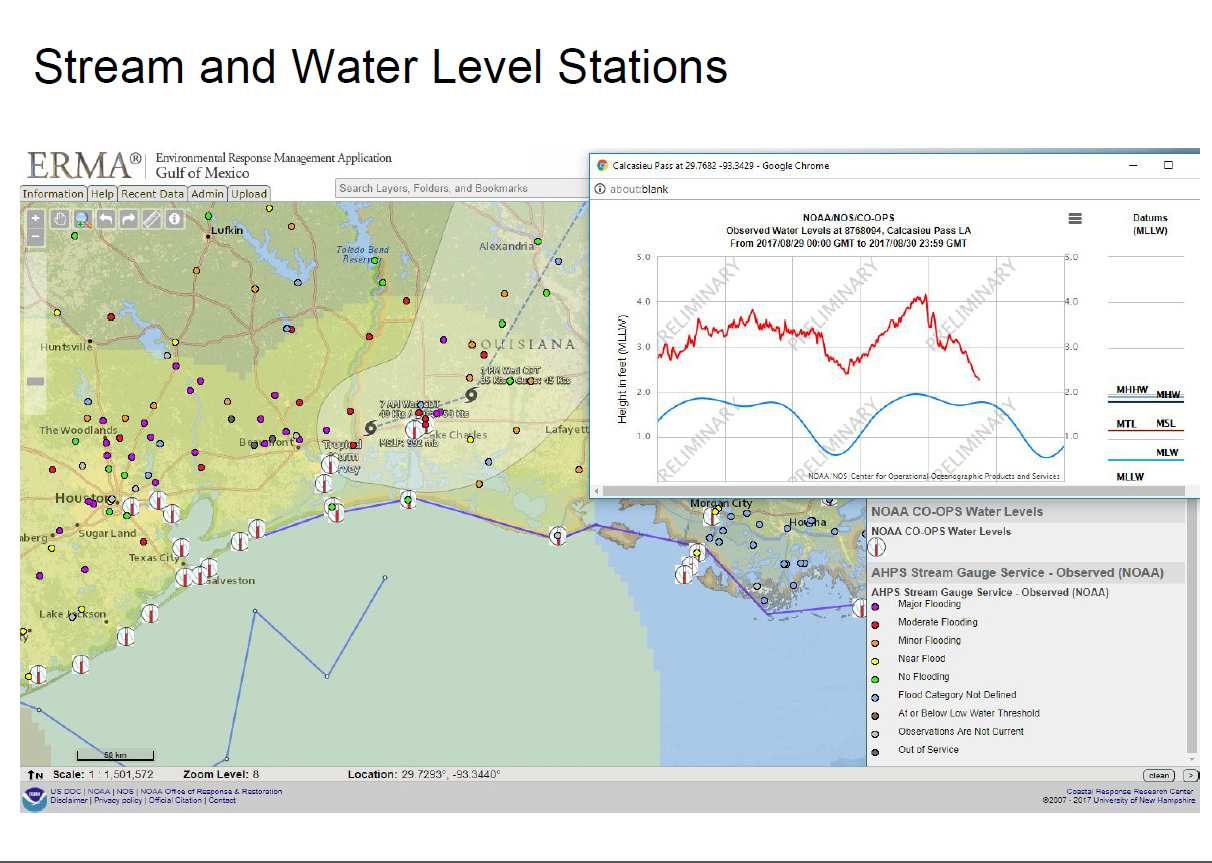
ERMA® (Environmental Response Management Application) is an online, regionally-tailored mapping tool that integrates static and real-time data.
Throughout this hurricane season, ERMA contributed to the significant work of the National Ocean Service’s Office of Response and Restoration by providing fast, reliable access to key data.
Gulf of Mexico ERMA’s continuing data about massive inundation and flooding were especially critical because that region is home to the nation’s largest oil refinery and serious spills in local waterways can follow devastating floods.
Galveston Staff Join Search & Rescue
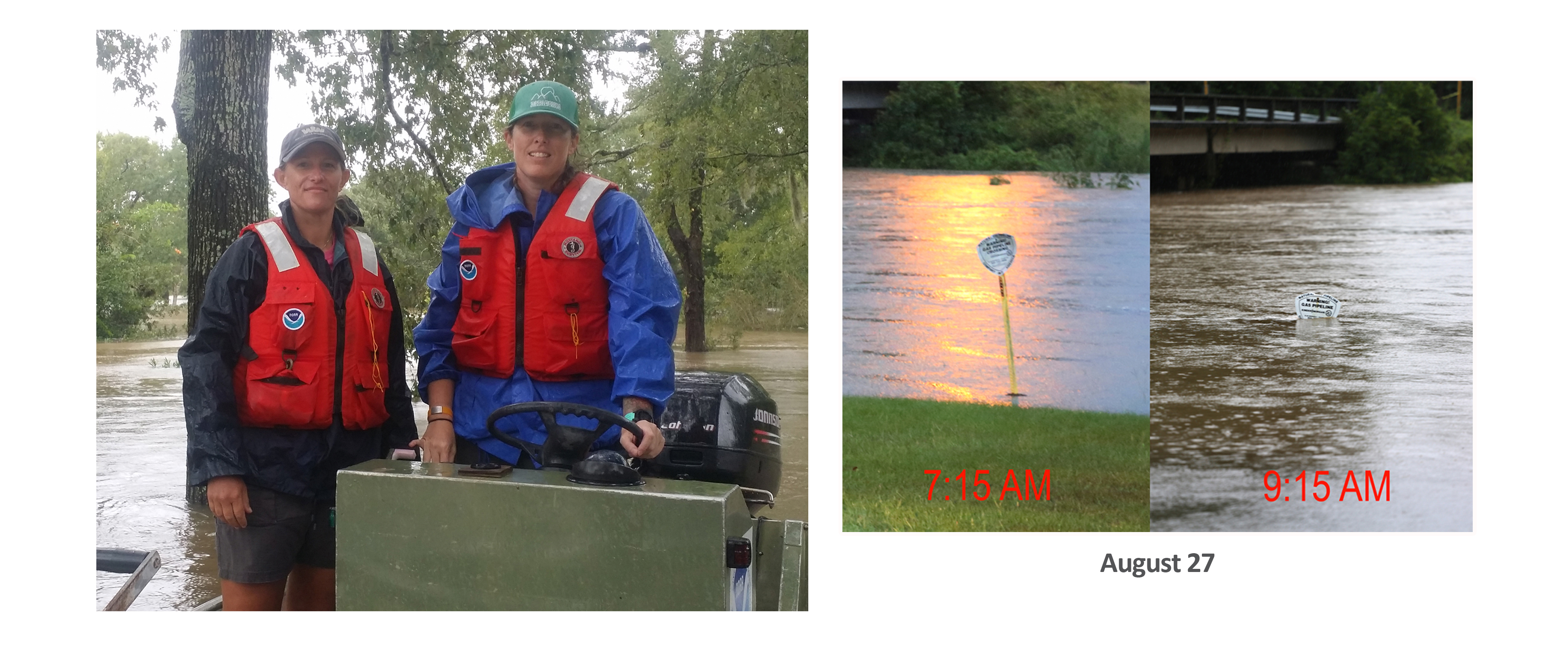
Jen Leo (right) and Jennifer Doer, research biologists at NOAA Fisheres' Galveston Lab, used a NOAA field study boat to rescue flood-stranded Texans. Joined by Kris Benson, of NOAA Fisheries' Office of Habitat Conservation, they helped process welfare checks in addition to evacuating adults, children and many pets over several days.
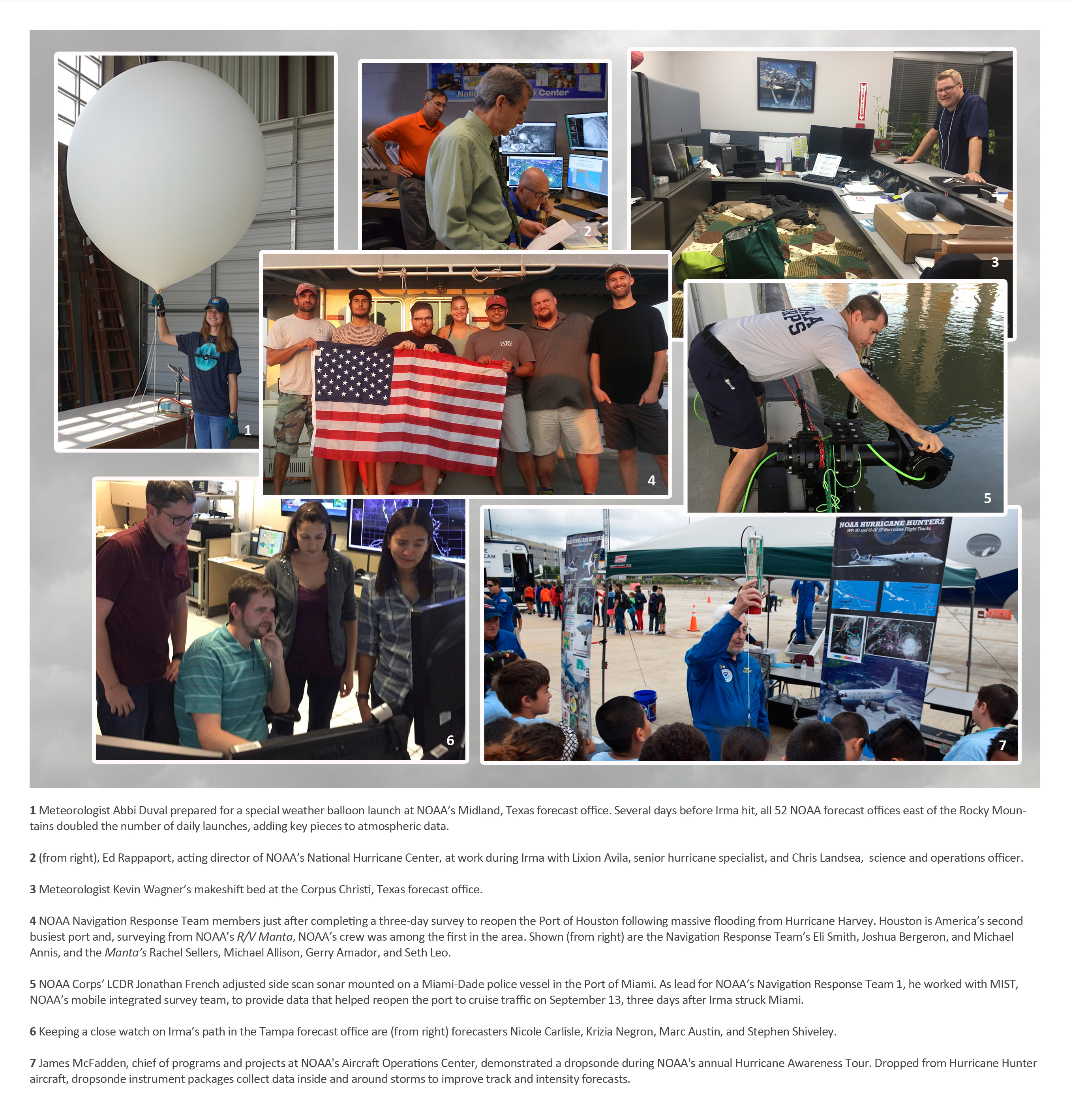
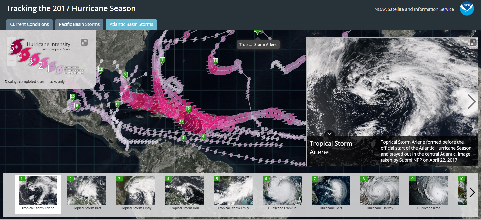
Keep 2017 Storms Straight with NOAA's New App
Storm Tracker App shows development, intensity,
track, and true-color imagery of every named storm.
To view the original NOAA 2017 hurricane season story map, please see this version on the ESRI website offsite link.


