We want everyone to be able to understand and work with the data our agency collects on the ocean, atmosphere, and beyond. But we know that, when it comes to using a new online data portal, sometimes the first few clicks are the hardest.

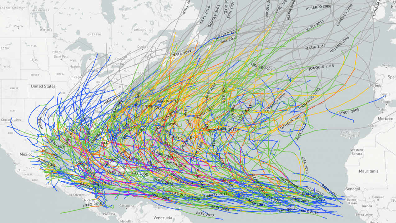
A screenshot from the historical hurricane tracks website (https://coast.noaa.gov/hurricanes/) showing hurricanes from the North Atlantic basin from 2000-2019. (Image credit: NOAA Digital Coast)
These "tiny tutorials" are designed to break the ice and get you started. These simple animations walk you through our data visualizations step by step.
From there, each data portal offers many variables and dimensions to explore. So roll up your sleeves, fire up your browser or phone, and start exploring the ocean and atmosphere.
Explore tiny tutorials on the following data tools:
Aurora forecast
Did you know that outer space has weather too? Not rain or snow but winds and magnetic waves that move through space! NOAA’s Space Weather Prediction Center has the latest forecasts and outlooks. Learn how to view the forecast for the aurora in the Northern and Southern Hemisphere.
CrowdMag: Magnetic field citizen science
CrowdMag is a citizen science project that uses your mobile phone. Created by the National Centers for Environmental Information, the CrowdMag app uses your phone's internal magnetometer to record magnetic fields as you move around outside. Explore the data you collect and see if you can match up magnetic anomalies with objects in your environment.
CrowdMag: Flight mode
The CrowdMag app now has a flight mode where you can collect magnetic data while you fly. Airplane observations fill in a large gap in magnetic data. Satellites can capture the biggest shapes of the magnetic field, and ground based observations can capture the smallest, but scientists aren’t able to capture observations between those extremes without airplanes. Help contribute to this project the next time you fly!
Environmental Response Management Application (ERMA®): Online mapping for environmental responders
The Environmental Response Management Application (ERMA®) is an online mapping tool from the Office of Response and Restoration, which integrates data, like habitats, weather, and currents, into one location for experts responding to environmental disasters like hurricanes or oil spills.
Fire weather graphical forecast
Did you know that the National Weather Service tracks fire weather around the country? With this interactive graphical forecast, monitor fire weather outlooks and click on individual locations to learn more.
Historical hurricane tracks
With historical hurricane tracks from NOAA Digital Coast, you can look for trends in where hurricanes occur or pull up the facts on a single storm.
If you want even more data resources from NOAA, check out the rest of our data resources for educators, which highlight ocean and atmospheric data sources that are easy to use and appropriate for classrooms, informal learning environments, and anyone who is interested in learning more.
Did you try our tiny tutorials? Let us know what you thought and if they worked for you. Do you have a request for the next tiny tutorial? Email us at education@noaa.gov or contact us on Twitter, Facebook, Instagram, or LinkedIn offsite link.

