Editor’s Note: This oral history was conducted by Molly Graham in 2019 as a part of the NOAA 50th Anniversary Oral History Project.
Bob Hansen wore many hats at NOAA, but this stalwart started at the agency working on maps - a fascination that began as a kid and followed him through his career. His first job at NOAA in the early 1970s was drawing maps for NOAA’s former aeronautical charting division (a function now led by the Federal Aviation Administration) which he said was like, “going back in time, in terms of how they were made [then] – stooping, being bent over light tables.”
He later managed NOAA’s map collection - the oldest in the federal government at the time. Through his tenure, Mr. Hansen also served as a NOAA historian, a writer, a sign language interpreter, a constituent affairs specialist, and finally, a national outreach coordinator for the Office of Education. He is credited - among his many achievements - for bringing Science on a Sphere® to NOAA’s headquarters, starting NOAA’s education website in the 90s, establishing a NOAA heritage week, and leading efforts to name at least five NOAA ships. He retired in 2019 after 43 years of service.
Hear a snippet of the interview recorded December 4, 2019:
Transcript:
On becoming interested in maps:
RH: From an early age, I used to draw maps freehand. So I would draw both imaginary places and recreate actual maps to see how accurate I could be. I actually still have a few atlases I had made when I was in elementary school. For whatever reason, I’m not quite sure – I think it was probably my grandfather’s travels that attracted me to that because he had traveled as a merchant marine in the German merchant marine, traveled all over the world. I think I was fascinated with travel. I think that’s why maps were so important to me at the time. I would collect all the highway road atlases, and I would have all these things and study them and look at them. I remember my grandparents had actually given me two things. Two gifts they had given me was a subscription to National Geographic when I was quite young, maybe ten years old, which I had for many years. Then they had given me my first book on maps, which I still have. It’s a classic book on antique maps. I think that was some of the basis of that. And my father being a boat builder, so I was familiar with nautical charts. I think that’s how it came to me. That’s why I wound up in that area. As far as Africa, I was always fascinated with Africa. Actually, I collect maps. My earliest map collections were maps of Africa.
[...]
RH: I would draw these imaginary places and see how they could be juxtapositioned with each other. Then I would actually draw population centers for them, and decide where the farms were going to be or what bridges were going to be built. It was a fun little pastime exercise. I don’t know why I was doing these things, but that’s what I did.
On overseeing NOAA’s map collection:
RH: I was a technical information specialist from about 1975 to about 1984, I would say. It was mostly in the same office, but I did make a switch. I was still classified as a technical information specialist.
MG: How did your job change over the years?
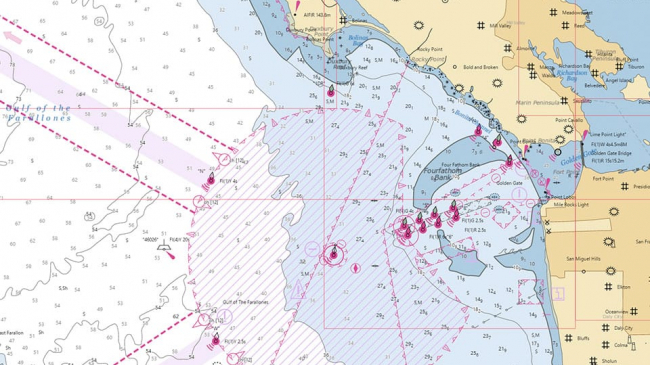
RH: How did my job change over the years? I wound up ghostwriting some articles for the director of NOS [National Ocean Survey]. I always felt so uncomfortable with that because I would be writing about things I knew nothing about, and I didn’t have any subject matter expert to help guide me in that process, so I would just have to create something. It would just go through the review process. They would say, “Okay, this is fine,” and it would go to print. So I would see these articles with someone else’s name, but I knew I wrote them. It was an interesting thing. We also ran a chart sales office, which they can’t do now legally. So I did some of that as well. The changes? Some of the offices were disbanded and moved. I wound up being in Riverdale, Maryland, which is where the chart distribution office was, still doing the technical information specialist position. It was a much more isolated existence over there. Then I wound up overseeing the map collection. The oldest map collection in the federal government was at NOAA at the time. Then I was also responsible for all the copper plates that were still leftover from the early charting days. They were actually physically stored in a vault in Riverdale.
[...]
MG: Can you describe the shift from the technical information specialist position to chief of the NOAA Map Library?
RH: You’re making it much more fancy than it really was. [laughter] It was a matter of the map collection was there. You’re making it much more elevated. Wow, that sounds like a really important position. I want that position. It was really not – it was a relegated piece of antiquity that most people didn’t even know was around, and we had a few visitors, but very few people knew of its existence. At that time, the map library also contained multiple copies of U.S. Geological Survey topographic maps, one to 24,000 scale maps. There were thousands upon thousands upon thousands of these things. Our job was to pull a lot of these topographic maps.
Cartographers would request them for a particular geographic area. We would have to pull these and then send them to the cartographer. The cartographer would then study these topographic maps to then do whatever they were doing for the NOAA chart. But the antique maps were also part of his collection of geological survey topographic maps. Obviously, very differently done today because it’s all done digitally. So these hard copies are not done.
Listen to the full interview with Bob Hansen.


