Warmer-than-average temperatures favored in much of U.S. this spring

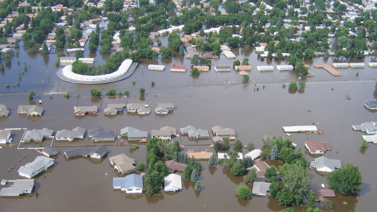
NOAA's National Weather Service urges communities in northern North Dakota to prepare for moderate to major flooding on the Souris River this spring. Last time the river flooded was in 2011 (as pictured here, near Minot.) (Image credit: Courtesy of the North Dakota State Water Commission)
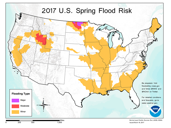
Northern North Dakota – the Souris River, Devils Lake and the northernmost reaches of the Red River – has the greatest risk of major flooding this spring, while moderate flooding is possible over southern Idaho in the Snake River basin, according to NOAA’s Spring Outlook released today.
California, which saw extensive flooding in February, is susceptible to additional flooding from possible storms through the remainder of the wet season and later, from snowmelt.
“If you’re in northern North Dakota, or in the Snake River basin in Idaho, prepare for moderate to major flooding this spring,” said Tom Graziano, Ph.D., director of NOAA’s Office of Water Prediction. “Snowpack is heavy in the West and northern plains, and if our long term warm-up coincides with spring rains, already saturated soils will not be able to absorb the increased water, which would lead to increased runoff and potential flooding.”
But while the extreme north could see flooding, the rest of the country could be warmer than average, forecasters said. “Above average temperatures are favored for much of the U.S. this spring with the south-central Plains and eastern U.S. having the highest chance for warmer than average conditions,” said Jon Gottschalck, chief, Operational Prediction Branch, NOAA’s Climate Prediction Center.
There was a remarkable turnaround in California’s five-year drought over the winter. According to the U.S. Drought Monitor offsite link, issued today, the geographic extent of drought in the state dropped from 73 percent three months ago to eight percent this week, due to near-record precipitation from a series of powerful winter storms. Also, in February, only three percent of the contiguous U.S. saw severe to exceptional drought, the lowest level in seven years. [See our video summary of the Spring Outlook]

Spring Flood Risk
Driving the forecast for major flooding in northern North Dakota is an extensive snowpack, containing up to four inches of liquid water that could increase with additional storms through April. When this snowpack melts, the already saturated and frozen soil won’t be able to absorb it, creating runoff and potential flooding. The location of greatest concern is Devils Lake, where forecasters are projecting a near record runoff that could cause the lake to rise three to four feet, possibly exceeding its record high flood level set in June 2011.
Central and southeastern Idaho in the Snake River basin, which received its second highest snowfall on record this winter, has a moderate flood risk. Rapid snowmelt from rain storms on top of snowpack has already caused flooding at lower elevations of this region. How long the flooding could last and how intense it will be depends on future precipitation and temperatures.
California and Nevada may experience snowmelt flooding in the spring. Numerous storms this winter brought record-breaking rain and snow to the western United States. Snowpack is above normal in most of this region, with the Sierra Nevada Mountains having the heaviest snowpack in more than 20 years. Rivers in the area have already experienced elevated stream flows and flooding, while most reservoirs are at or above capacity. Snowpack is expected to continue to build over the next month, making it currently too early for forecasters to determine final spring snowmelt flooding severity.
Minor flooding is possible in parts of Minnesota and Wisconsin southward to eastern Texas, and in a narrow band across the Southeast up the coast to southern Virginia. Minor flooding is also possible across Maine and parts of New Hampshire. The flood threat is low in southern New England and the Mid-Atlantic, due to below-normal precipitation this winter, even with this week’s late-season nor’easter that brought the region significant snow.
Drought Outlook
Drought conditions have been slowly expanding over the past three weeks in the southern Plains and Southeast due to continued dry conditions, warm temperatures, and seasonal increased water demand from early springtime vegetation. This trend is favored to continue in parts of the southern Plains as drought development is forecast for northwest Texas and far eastern New Mexico this spring.
Current drought conditions, however, in some areas of the northern High Plains, south-central Plains, Tennessee Valley, mid-Atlantic and Northeast are favored to improve. The beginning of the rainy season also favors improving conditions for Florida during April through June. Remaining drought areas in California and Arizona are expected to persist with the onset of the dry season in April.
Temperature and Precipitation Outlook
For April through June, above-average temperatures are favored for a large area stretching from the Southwest eastward to include the central and southern Plains, Great Lakes, Southeast and Northeast. Most of Alaska and Hawaii are also favored to see above-average temperatures. The greatest odds for above-normal temperatures include the south-central Plains and eastern U.S. No areas in the U.S. are favored to see below-average temperatures this spring.
For precipitation, odds favor wetter-than-average conditions for the northern Rockies, northern Plains and along the Gulf Coast from Texas to the western Florida Panhandle. Below-average precipitation is favored for the western half of Alaska and eastern Hawaii during April through June.
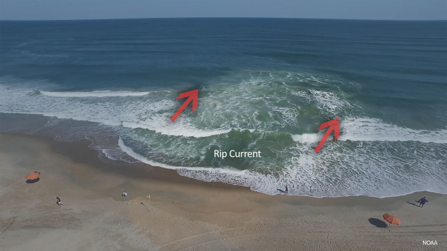
More: NOAA’s Spring Weather Safety Campaign has tips on how to stay safe during a tornado, flood, thunderstorm, hail, lightning, heat, wildfires, and rip currents.
Related Resources
Contact:
Maureen O’Leary, 301-427-9000


