Hello La Nina

Weather this winter to be influenced by climate phenomena

La Nina has arrived and is favored to stick around through winter. Forecasters say the climate phenomena will likely contribute to drier and warmer weather in the southern U.S. and wetter, cooler conditions in the Pacific Northwest and across to the northern tier of the nation this winter.
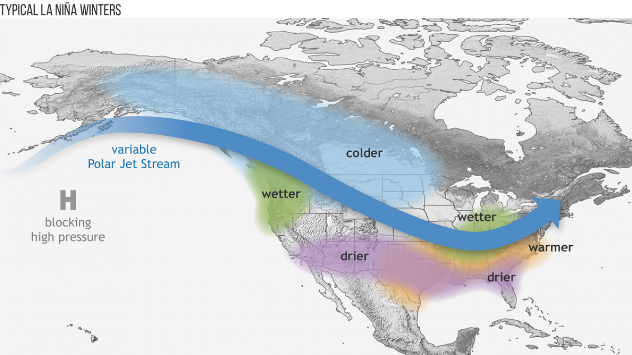
Graphic showing a typical La Nina Winter pattern

Wintertime La Nina patterns (Image credit: NOAA)

NOAA scientists declared the arrival of La Nina on Nov. 10, calling it present, but weak. It is predicted to be short-lived, possibly only lasting a few months. La Nina is associated with cooler-than-average sea surface temperatures in the Equatorial Pacific, which trigger changes in the atmosphere. This ocean-atmosphere coupling impacts the position of the Pacific jet stream influencing weather and climate patterns around the globe.

“A weak La Nina is in place and is likely to remain for the winter,” said Mike Halpert, deputy director, NOAA’s Climate Prediction Center. "The weak La Nina is likely to contribute to persisting or developing drought across much of the southern U.S. this winter."
 

This La Nina follows one of the strongest El Ninos on record, which ended in June. Recent La Nina years include 2011-2012; 2010-2011; 2007-2008; and 2000-2001. Find out more about La Nina on the ENSO Blog.

What to expect this winter: NOAA’s Winter Outlook.
 

Media contact:
Maureen O'Leary, ​301-427-9000 (office), 202-578-5257 (cell)