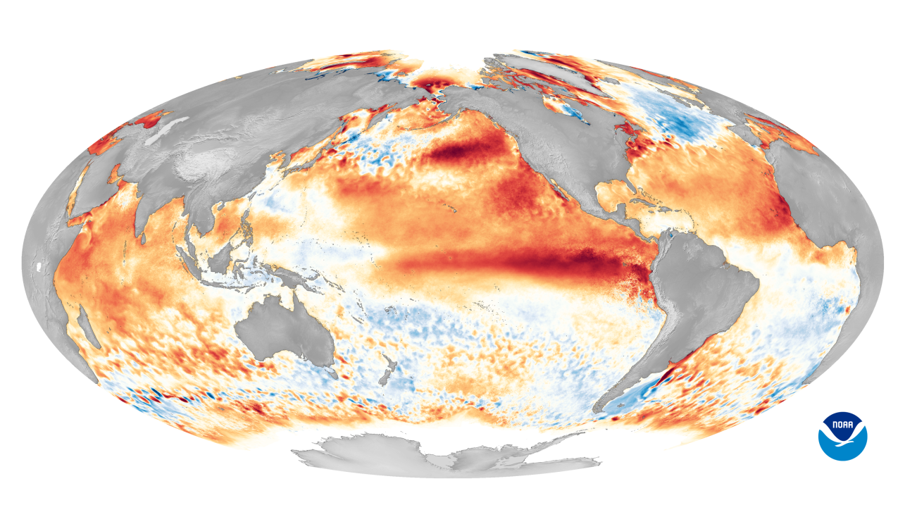
This world map shows sea surface temperature anomalies during one of the strongest El Nino events on record in 2016. The red areas indicate warmer-than-average ocean temperatures, while blue areas represent cooler-than-average temperatures. (Image credit: NOAA)
NOAA’s Climate Prediction Center has issued an El Nino Watch this morning as part of its April ENSO outlook.
A watch is issued when conditions are favorable for the development of El Nino within the next six months. While we are still in an ENSO-neutral phase – when no El Nino or La Nina is present – there is a 62% chance El Nino will develop sometime between May and July. This comes after nearly two continuous years of a La Nina.
El Nino: What it is and why it matters
The El Nino-Southern Oscillation (or ENSO) is a climate pattern defined by sea surface temperature and precipitation departures from normal across the equatorial Pacific Ocean that can influence weather and climate patterns across the U.S. and around the world.
El Nino is the warm phase of ENSO when ocean temperatures are warmer and precipitation is greater than normal in the area spanning the central to eastern Pacific Ocean.
NOAA scientists will continue to monitor the potential development of El Nino and will issue the next monthly update on May 11, 2023.
More ENSO resources
- Read the latest ENSO blog post from NOAA’s Climate.gov
- What is El Nino and La Nina?


