Photo story: Measuring Hurricane Matthew's storm surge impact

Storm surge causes nearly 50 percent of fatalities in tropical cyclones. So after Hurricane Matthew completed its trek along the southeast U.S. coastline, NOAA's National Hurricane Center Director Dr. Rick Knabb and storm surge specialists Jamie Rhome and William Booth traveled to areas in Florida, Georgia and South Carolina that were hardest hit by Matthew's storm surge. This was the first time hurricane center personnel were able to truth-test its operational potential storm surge flooding maps and see how the new experimental storm surge watch and warning graphics were received by emergency management officials and the public. The verdict was overwhelmingly positive on all counts.


NHC Storm Surge watch warning issued 
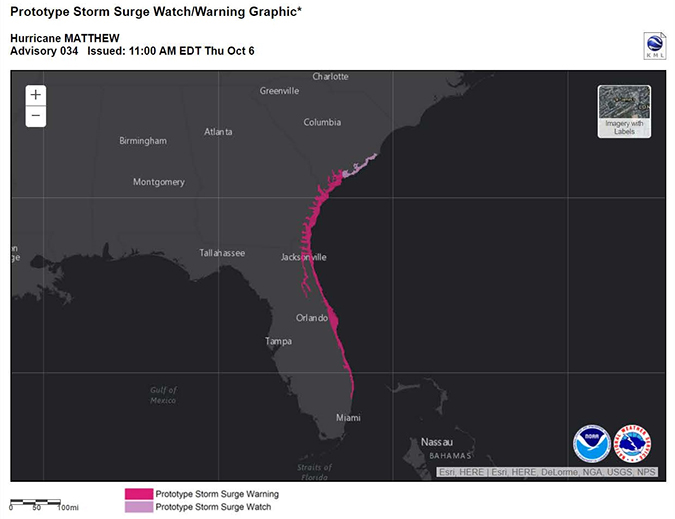
Oct. 6, 2016- The Prototype Storm Surge Warning extended along the coastlines of most of eastern Florida, all of Georgia and portions of South Carolina, highlighting the areas at risk of life-threatening storm surge.
Oct. 6, 2016- The National Hurricane Center issued a storm surge watch/warning for most of the eastern coastline of Florida, all of Georgia and portions of South Carolina. This prototype graphic was released to emergency managers, the media, and the public. It shows the locations at risk of life-threatening storm surge. (NOAA)Download Image


Beach erosion and dune loss along Jacksonville Beach
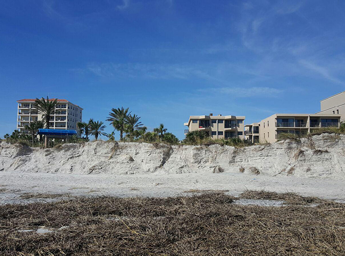
Oct. 14, 2016- The onshore pounding of waves and storm surge from Hurricane Matthew washed away parts of the protective dunes at Jacksonville Beach, Florida.
Oct. 14, 2016- The onshore pounding of waves and storm surge from Hurricane Matthew washed away parts of the protective dunes at Jacksonville Beach, Florida. (NOAA)


Severe storm surge and wave damage to home at Matanzas Inlet, Florida – resulting in a total loss
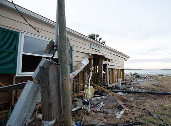
Oct. 14, 2016- The power of Matthew’s storm surge took its toll on this home near Matanzas Inlet in Florida’s St. John’s County.
Oct. 14, 2016- The power of Matthew’s storm surge took its toll on this home near Matanzas Inlet in Florida’s St. John’s County. (NOAA)


Jamie Rhome inspects debris line

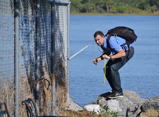
Oct. 15, 2016- NHC storm surge team leader Jamie Rhome assesses the debris line along a fence at Ft. Pulaski near Savannah, Georgia., to help determine the height of Matthew’s storm surge.
Oct. 15, 2016- NHC storm surge team leader Jamie Rhome assesses the debris line along a fence at Ft. Pulaski near Savannah, Georgia, to help determine the height of Matthew’s storm surge. (NOAA)


Damage to South Carolina home caused by storm surge and waves
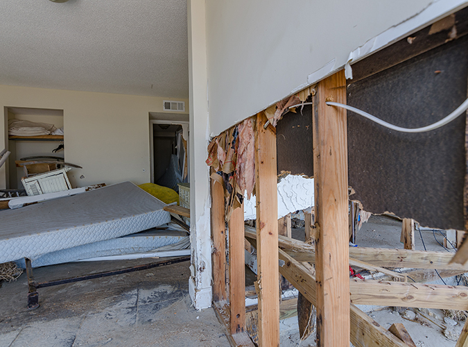
Oct. 15, 2016- Most of the lower level of this home along coastal South Carolina was gutted by the storm surge during Hurricane Matthew.
Oct. 15, 2016- Most of the lower level of this home along coastal South Carolina was gutted by the storm surge during Hurricane Matthew. (NOAA)


Jamie Rhome and William Booth measuring a high water mark inside Fort Pulaski
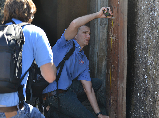
Oct. 15, 2016- NHC storm surge specialists Jamie Rhome and William Booth measure the high water mark from Hurricane Matthew’s storm surge inside Ft. Pulaski, Georgia, to help determine the height of the storm surge.
Oct. 15, 2016- NHC storm surge specialists Jamie Rhome and William Booth measure the high water mark from Hurricane Matthew’s storm surge inside Ft. Pulaski, Georgia, to help determine the height of the storm surge. (NOAA)

The team's assessment confirmed the storm surge watch/warning forecast accurately depicted Matthew's storm surge and the new graphic map played an important role communicating life saving information to those in harm’s way. This kind of data will help the National Hurricane Center fine tune their forecasts for future storms. For more information check out the hurricane center's storm surge resources