Wide-ranging mission will inform NOAA's marine, fisheries and habitat management
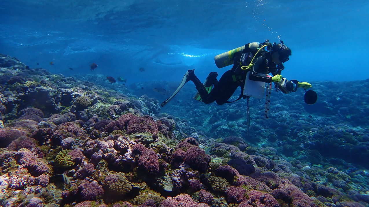
Dr. Courtney Couch prepares to take digital photographs of the reef surface in the shallows off of Swains Island in the South Pacific. (Image credit: NOAA Fisheries/Mia Lamarind)
Our scientists recently set sail aboard NOAA Ship Rainier to conduct coral reef surveys and high-resolution hydrographic surveys in American Samoa and the Pacific Remote Island Areas. This expansive mission includes multiple NOAA programs, including the Coral Reef Conservation Program, Office of Coast Survey, Ocean Acidification Program and National Marine Fisheries Service. Some scientists are mapping the seafloor, while others are taking water samples, counting fish and assessing coral reefs.
This work is part of NOAA’s Coral Reef Conservation Program’s National Coral Reef Monitoring Program (NCRMP) surveys. This long-term NOAA survey has over 20 years of paired biology and ocean chemistry data throughout the Pacific to monitor the status and trends of U.S. coral reefs and gain a better understanding of how climate drives coral health and sustainable fisheries.
Data collected during this research mission will improve tsunami modeling, support habitat management and restoration, fisheries management and marine resource management (including the management of coral reefs).
Here are 5 facts about the mission:
1. This mission is dedicated to and in honor of NOAA Corps Rear Adm. Richard T. “Rick” Brennan.
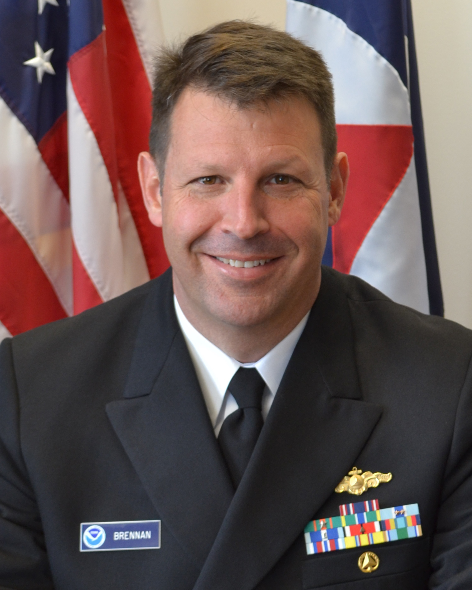
Rear Adm. Richard T. “Rick” Brennan was the director of NOAA’s Office of Coast Survey for just a few short weeks before his death in May 2021. He served in the NOAA Commissioned Officer Corps and nautical charting community for nearly three decades. Throughout his career he served on nearly every hydrographic ship in the NOAA fleet. This one-NOAA mission on NOAA Ship Rainier is a result of his vision and leadership, along with his firm belief in the importance of hydrography to the nation and the world.
To honor his life’s work and commitment to NOAA and the Office of Coast Survey, NOAA named its 2022 and 2023 research cruises RICHARD. The acronym stands for Rainier Integrates Charting, Hydrography, And Reef Demographics. Most of the data collected for this mission will be publicly accessible within one year.
2. NOAA is working closely with local partners in American Samoa, where family leaders are key.
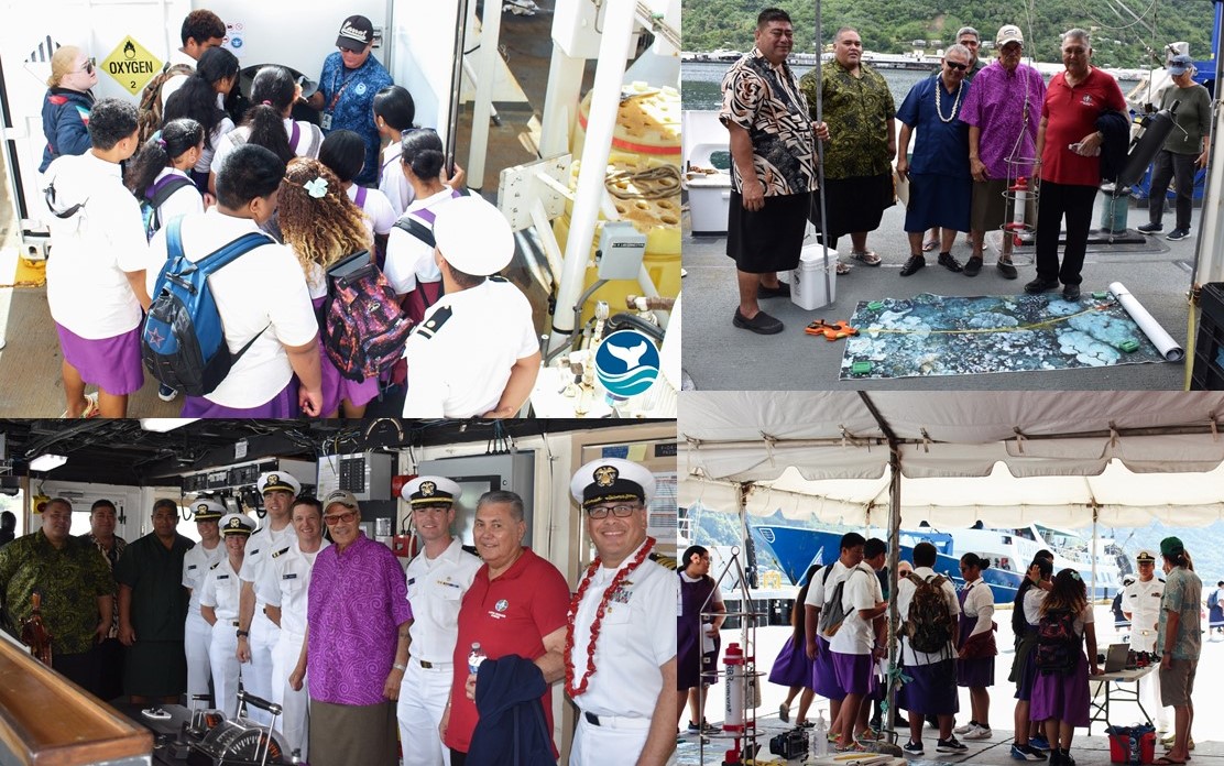
American Samoa is sometimes called the “cradle” of Polynesia’s oldest culture. Fa‘a Samoa refers to the traditional Samoan way of life. Fa‘a Samoa places great importance on the dignity and achievements of the group rather than on individual achievements. The traditional communal lifestyle revolves around the ‘aiga, or family. ‘Aiga are headed by a leading matai (titled person), either an Ali‘i (chief) or an orator (tulafale or failauga), who manages the communal economy, protects and distributes family lands, is responsible for the welfare of all in their ‘aiga and represents the family in councils. The matais work with the territorial legislature called the Fono and the Office of Samoan Affairs.
Upon arrival there in March of 2023, NOAA representatives provided a tour of NOAA Ship Rainier to and met with the Governor's Office, Office of Samoan Affairs and members of the Fono. Researchers have been providing updates to local agency directors and these important local partners with the goal of working together and communicating about plans for management of the natural resources.
3. Many areas in the region have not been mapped in decades, or have never been mapped to modern standards.
NOAA’s Office of Coast Survey will collect high resolution bathymetric (bottom depth) data to update nautical charting products. These data will increase maritime safety and provide new insights into seabed habitat.
Seafloor mapping will assist managers with characterization of the seafloor and inform future deep sea exploration efforts. The mission includes some new surveys in the National Marine Sanctuary of American Samoa. Researchers will work with the Deep Coral Reef Ecosystem Study to gather the first quantitative data deeper than 100 feet on coral reefs from from Ta'u, Rose Atoll and Swains Island.
This mission includes surveys in the Pacific Remote Island Areas Marine National Monument. These reefs are some of the most pristine in the Pacific, full of vibrant corals and teeming with fish. Conditions around these mostly uninhabited islands help scientists understand drivers of reef health conditions without the influence of people.
4. Part of this mission takes place in the National Marine Sanctuary of American Samoa, which also protects extensive coral reefs in the Valley of the Giants.
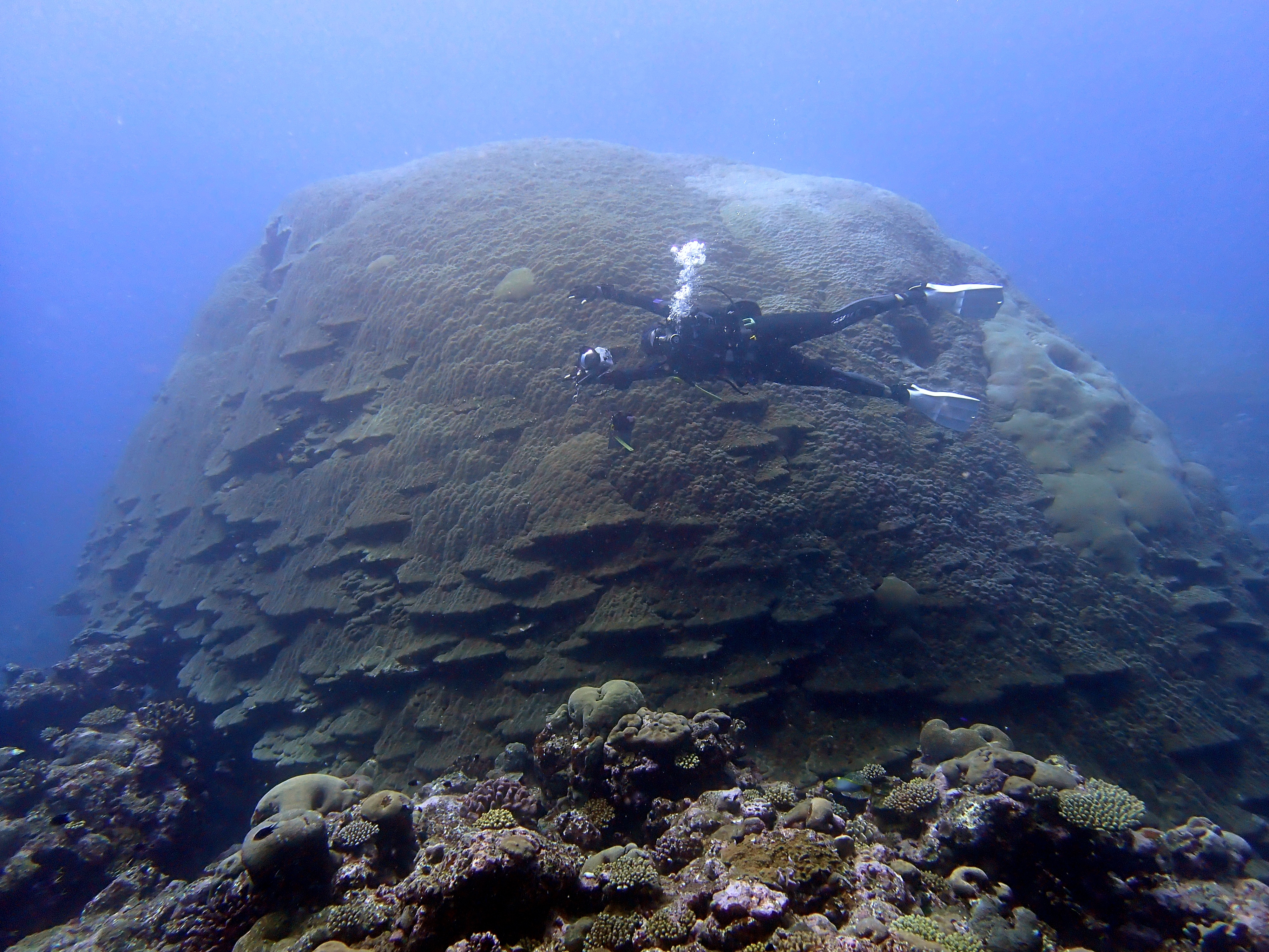
One of the largest and oldest coral heads in the world is more than 20 feet tall and 135 feet in circumference. Known as “Big Momma,” this coral head is located in the National Marine Sanctuary of American Samoa, along with many other large corals in an area known as the “Valley of the Giants.” There are also deep-water reefs, hydrothermal vent communities and marine archaeological resources.
Although surveying will not take place in the Valley of the Giants, surveys will extend beyond the sanctuary to neighboring islands and atolls in the region. The cruise may provide information to aid resource protection decisions. These decisions will support Fa’a Samoa (the traditional Samoan lifestyle), and will bring a large team of experts together to update seafloor maps and provide data about the health of their coral reefs under changing ocean conditions.
5. American Samoa has some of the least acidified waters in the world, leading to a robust coral community.
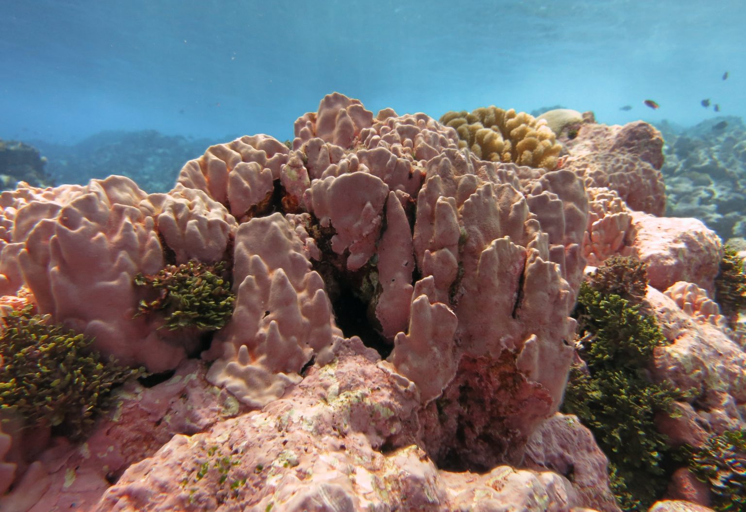
Neighboring atolls like Rose Atoll (pictured here) shimmer in pink offsite link from another calcifier — coralline algae — just below the surface. Scientists are especially interested in monitoring this area’s ocean chemistry to better determine the drivers of coral health, since many of the world’s coral reefs are imperiled by disease and bleaching.
Ocean chemistry data from the NCRMP surveys help scientists understand how and where ocean acidification may impact coral reefs.
With this mission, researchers will bring techniques that have been used in the Atlantic and Caribbean to the Pacific for the first time, which will help determine if the reef habitat is growing or shrinking in the region. They will evaluate how temperature and ocean chemistry impact the rates of reef growth.


