Meet NOAA's storm surge expert: Jamie Rhome

Storm surge, it sounds foreboding and it’s responsible for more deaths than any other danger associated with tropical cyclones. However, many people are not aware of the hazards. NOAA’s National Hurricane Center is leading the charge to change that.
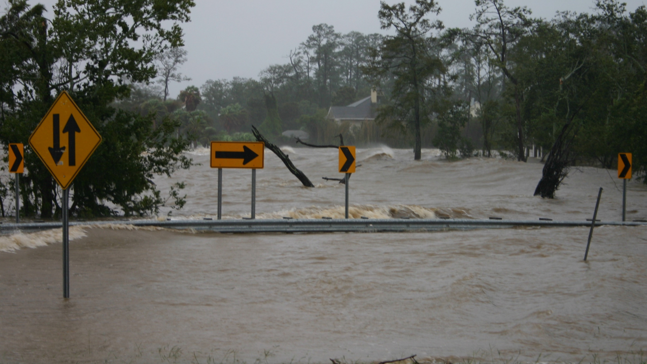
On August, 29, 2012, Hurricane Isaac brought torrential rain to the New Orleans area. This rainfall created a surge on Lake Pontchartrain that rivaled levels seen during Hurricane Katrina in 2005.

On August, 29, 2012, Hurricane Isaac brought torrential rain to the New Orleans area. This rainfall created a surge on Lake Pontchartrain that rivaled levels seen during Hurricane Katrina in 2005. (Image credit: Lt. Conrad H. Franz/Lake Pontchartrain Causeway Police)

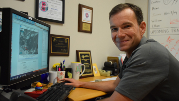
Meet Jamie Rhome, the leader of the Storm Surge Unit at the hurricane center. For him, the job is personal. He grew up in eastern North Carolina, where he endured hurricanes and winter storms. He saw how the water could change the coastline, destroying homes and businesses, making lasting impacts on lives and livelihoods. 

Jamie Rhome, the leader of the Storm Surge Unit at NOAA's National Hurricane Center
Jamie Rhome, NOAA's National Hurricane Center (NOAA)

Say the word hurricane and most think “wind” first. Why not “water”?

Most people experience wind on a daily basis – a windy day, a thunderstorm – and, for most people, the hazard they experience in a hurricane is only wind. They can’t draw upon personal experience to reconcile the water danger. 

Yet nearly 90 percent of the deaths are related to water.

Yes, people are drowning in hurricanes. Only 8 percent of the fatalities are caused by wind. That gap between what people think first (wind) and what they are dying from (water), is what we’re trying to address. The fact that people just don’t understand this phenomenon at all, and that we’re going to have a major event at some point, is what keeps me up at night. 

How are you changing this?

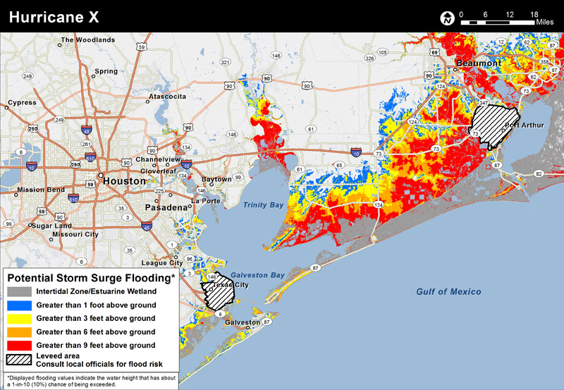
We knew we had to focus on the dangers of storm surge in our communication with the public, the media, and emergency managers. Starting two years ago, we rolled out our experimental storm surge models, and our messaging is now totally dominated by storm surge. It includes the new Potential Storm Surge Flooding Map and the Storm Surge Watch/Warning Graphic, which becomes operational next year and will push storm surge to the forefront. 

NOAA's National Hurricane Center will issue a potential storm surge flooding map to clearly depict locations that may be affected by storm surge (NOAA)

You did a lot of research with these new graphics.

We wanted an attractive and informative visual so that the media would talk about storm surge. We rely on our media partners to broadcast the dangers about storm surge. But if you don’t provide graphics or datasets that are easy to put on television, in print, and online, they aren’t going to talk about it. We did several rounds of focus groups and surveys of our constituents, including emergency managers, media, the general public and other NWS offices. All of the input went into the design of the new graphics. 

Any plans to expand the effort beyond the continental U.S.?

It’s currently applicable from Texas to Maine, so now we have to figure out how to move it to the U.S. Virgin Islands, Puerto Rico and Hawaii.  Some initial groundwork exists, but it’s going to take several years to implement a forecasting system for those areas.  

You’ve worked on this project for 8 years. Now that it’s coming to fruition, what is the key point you want people to know about storm surge?

Water matters. History has taught us that it’s the primary killer in a hurricane.