A whirlwind of an Atlantic hurricane season: What gives?

This year's busy Atlantic hurricane season with back-to-back strong storms and multiple landfalls has everyone asking: Why is this happening? Well, the season is playing out as NOAA predicted in May and August. Let's dive into the science behind this year’s hurricane season with NOAA's lead hurricane season forecaster, Dr. Gerry Bell.
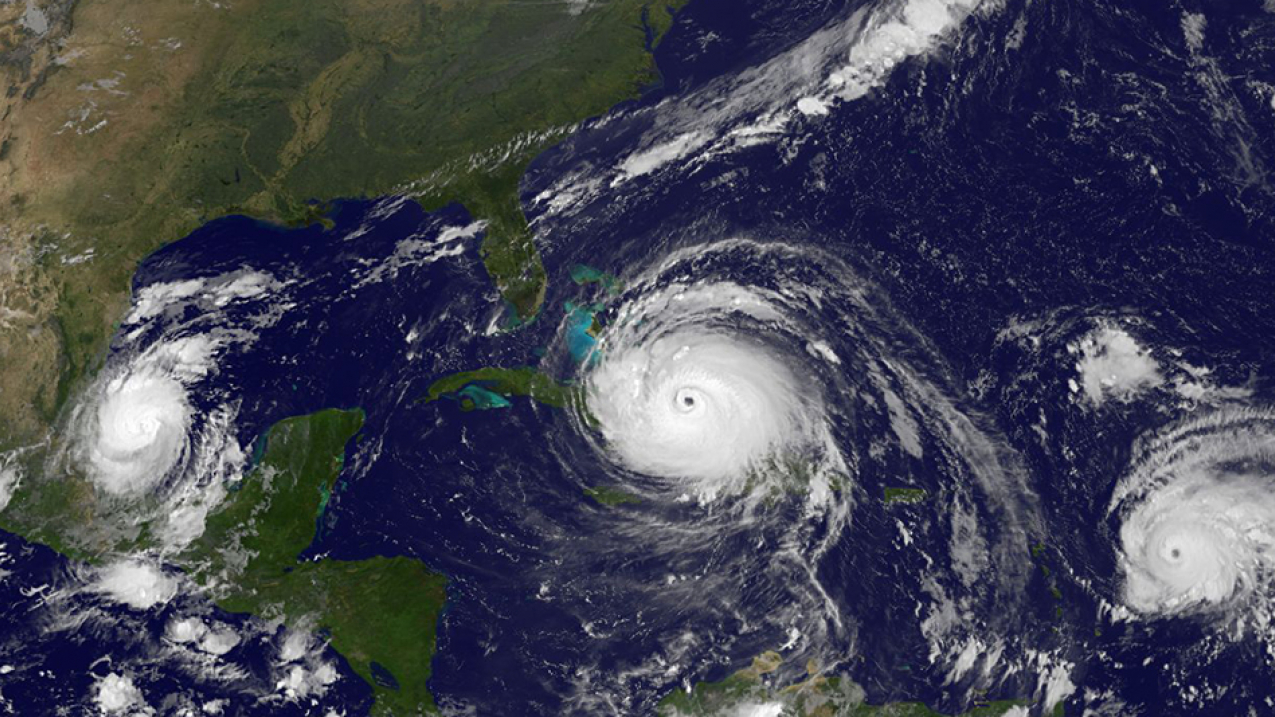
During one of the most active Atlantic hurricane seasons in recent years, three simultaneous hurricanes were captured by the Suomi-NPP satellite on September 8, 2017. The appearance of Katia (left), Irma (center), and Jose (right) was the first such occurrence since 2010. All three hurricanes were threatening land at the time.

During one of the most active Atlantic hurricane seasons in recent years, three simultaneous hurricanes were captured by the Suomi-NPP satellite on September 8, 2017. The appearance of Katia (left), Irma (center), and Jose (right) was the first such occurrence since 2010. All three hurricanes were threatening land at the time. (Image credit: NOAA/NASA)

Q: How does the season so far compare with your predictions?

A: We’ve had 15 named storms, of which 10 were hurricanes, including 5 major hurricanes. Our August prediction increased the initial May outlook to 14-19 named storms, 5-9 hurricanes, and 2-5 major hurricanes after it became clear that El Nino wouldn’t form and weaken the season.

Dr. Gerry Bell.
Dr. Gerry Bell. (NOAA)

Q: Is this a typical hurricane season?

A: We’ve had 14 extremely active seasons since 1950, and this is the first since 2010. An average season produces 12 named storms, of which six become hurricanes, including three major hurricanes.

Q: What climate patterns stoke and fuel hurricanes?

A: Three main climate patterns influence hurricane development:

  • The Atlantic Multi-Decadal Oscillation, or AMO, is a climate pattern over the Atlantic Ocean that lasts for decades at a time. When the AMO is in the warm phase, like it has been since 1995, we are predisposed for more active seasons.

  • El Nino and La Nina are season-to-season climate patterns marked by sea surface temperature fluctuations in the tropical Pacific Ocean. El Nino tends to suppress Atlantic hurricanes while La Nina fuels them.

  • And finally, the Madden-Julian Oscillation, or the MJO, is a rainfall pattern that propagates around the world. This pattern lasts 30-60 days and produces within-season variability in hurricane activity.

Q: What conditions are present this year to promote such a strong hurricane season?

A: The AMO is causing a set of interrelated conditions that work together to help hurricanes develop, grow and persist. These conditions are typical of other extremely active seasons that we have seen in the past.

  • The Atlantic Ocean is 1-2 degrees F above average;

  • The West African monsoon is stronger, which allows wind patterns coming off Africa to more easily spin up storms;

  • An extensive area of weak wind shear across the tropical Atlantic Ocean and Caribbean sea, and weaker than average trade winds across tropical Atlantic, are allowing storms to persist and gain strength; and

  • More moisture and atmospheric instability in the tropical region where storms form allow them to grow larger and stronger.

Q: How unusual is it to see such a fast succession of powerful storms in one season, like we saw with Harvey, Irma, Jose, Lee, and Maria?

A: It’s not unprecedented during an extremely active season to see a succession of major storms, with more storms tracking further westward and threatening land.

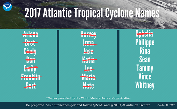
2017 Atlantic Tropical Cyclone Names as of October 12, 2017.
2017 Atlantic Tropical Cyclone Names as of October 12, 2017. (NOAA)

Q: What’s driving so many storms to make landfall this year?

A: The same wind patterns that produce strong storms also steer them farther westward. We’ve also had a strong and persistent ridge of high pressure in the upper atmosphere over the western Atlantic causing extremely weak wind shear, which is why so many major hurricanes lasted for so long.

Q: What’s the influence of climate change on hurricanes?

A: Scientists are still studying the effects of climate change on hurricanes. We know that a warmer climate is always running in the background, causing the atmosphere to hold more moisture and contributing to higher ocean temperatures. We also know that climate change contributes to more devastating impacts from hurricanes, such as higher storm surge due to sea level rise.

Q: Any parting words?

A:  We’re still in peak of a very active hurricane season. Everything is secondary to people making sure that their hurricane preparations and planning remain in place for the rest of season.