Keep exploring
Find even more resources on tornadoes in our searchable resource database.
Lesson plans & activities
Multimedia
Data resources
Background information
Career resources
Related stories
Each year more than 1,200 tornadoes take place in the United States. These destructive and awe-inspiring events are notoriously difficult to predict. Yet, NOAA and others are deepening our understanding of tornadoes and improving warning times to save lives. The resources in this collection cover the past, present, and future of tornado science and forecasting. Through research and technical advances, we can now better predict and prepare for these once unknowable phenomena.
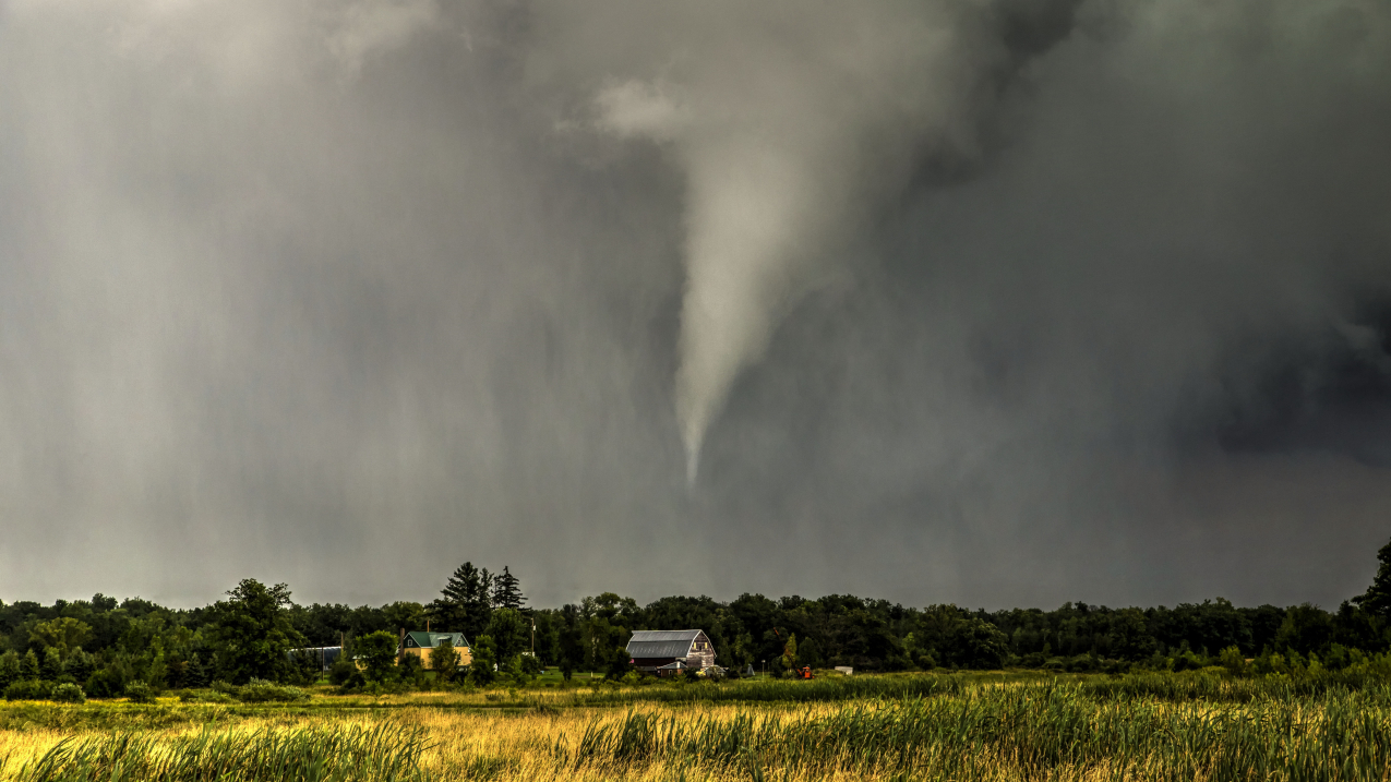
A ghostly tornado moves across a Benton County, Minnesota, landscape, narrowly missing this rural farmstead on August 24, 2014. (Image credit: Amanda Hill/NOAA Weather in Focus Photo Contest 2015)
Keep exploring
Find even more resources on tornadoes in our searchable resource database.
Lesson plans & activities
Multimedia
Data resources
Background information
Career resources
Related stories
Tornadoes usually only last a few minutes. However, some of these rapidly rotating columns of air can potentially last more than an hour and travel dozens of miles. Most of the world’s tornadoes occur in the United States, and they are most common between April and June.
Tornado formation
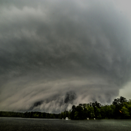
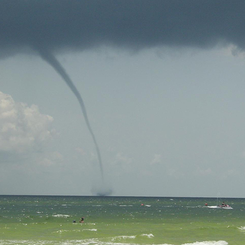
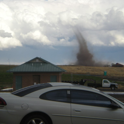
There are multiple types of tornadoes. Most tornadoes form as a result of supercell thunderstorms. Other tornadoes, which include landspouts and waterspouts, form in different conditions.
Supercell tornadoes
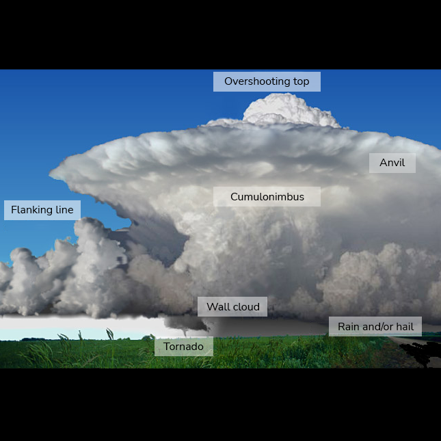
Most tornadoes result from supercell thunderstorms. You can often recognize supercell thunderstorms by their anvil-shaped cumulonimbus clouds. These thunderstorms have a strong, rotating, and persistent updraft that can reach speeds of 100 mph (approximately 161 km/hour). This means there is a strong column of rotating air within the storm.
The rotating updraft in these storms may begin because of wind shear. Wind shear is a change in wind direction or speed with height. So, the wind may be blowing a different direction and speed near the ground than the wind higher up.
Once the rotating updraft is established, rotation near the surface can start strengthening and organizing, which can lead to a tornado. Most people think of tornadoes as the funnel cloud, or condensation funnel, stretching from sky to land. But a tornado can form and be in touch with the ground even without a visible condensation funnel.
Non-supercell tornadoes
Though most tornadoes form from supercell thunderstorms, there are other tornado types as well. Strong lines of thunderstorms, referred to as “quasi-linear convective systems,” also called squall lines, can cause tornadoes to form.
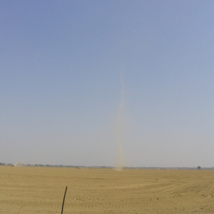
Landspouts and waterspouts are also types of tornadoes. They can form during thunderstorm formation, rather than from a supercell storm that is already rotating strongly. Note that dust devils are different from landspouts, and although dust devils can be damaging, they are not a type of tornado.
Non-supercell tornadoes are typically weaker than supercell tornadoes, but they can still be dangerous and destructive.
Scientists still have unanswered questions about tornadoes: Why do most supercell thunderstorms not result in a tornado? How exactly do tornadoes form? What are the causes of wind shear that lead to rotation? NOAA scientists are working to learn more about tornado formation and improve forecasting. Read more in the “Tornado research and advancements in forecasting” section.
Read more about tornado formation
- JetStream: Thunderstorm hazards — Tornadoes
- National Severe Storms Lab: Severe Weather 101: Tornadoes
- Storm Prediction Center: The Basics about tornadoes
Did you know that a wider tornado is not necessarily more damaging than a narrow one? Explore what makes tornadoes more or less damaging with the SciJinks tornado simulator.
Tornado prediction and detection
Even though meteorologists cannot predict exactly when and where a tornado will occur, they use what they know about tornado formation to make lifesaving predictions.
Forecasters and storm spotters are trained to recognize thunderstorm features that make tornado formation more likely. Storm spotters are community members that are formally trained to recognize certain conditions and report them to the National Weather Service. Forecasters are trained professionals with degrees focused on meteorology or atmospheric science. They look for conditions that could lead to tornadoes using weather observations and tools like computer models. These models analyze data from multiple sources, including Doppler radar, weather balloons, satellites, and more.
When forecasters detect conditions that have become favorable for severe weather, the National Weather Service’s Storm Prediction Center can put out a tornado watch. If a tornado is imminent or ongoing, they put out warnings based on the path of the storm. When a tornado warning is issued in your area, you may:
- Get an emergency alert to your phone.
- Hear tornado sirens blaring in your community.
- Hear an announcement on local television and radio stations, or if you have one, on your NOAA Weather Radio.
Read more about tornado prediction and detection:
- National Severe Storms Lab: Severe Weather 101: Tornado detection
- National Severe Storms Lab: Severe Weather 101: Tornado forecasting
- National Weather Service SKYWARN
- Storm Prediction Center: Forecasting tornadoes
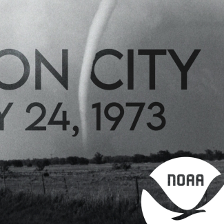
National Severe Storms Lab researchers made history in 1973 when they used radar to observe the entire lifecycle of a tornado. Their discovery of the “tornadic vortex signature” led to the beginning of a new era of tornado forecasting and warning.
Tornado research and advancements in forecasting
Did you know that before 1950, the U.S. government was banned from mentioning tornadoes in forecasts in the U.S. for fear that it would cause panic? Tornado research has come a long way since then. NOAA has made great strides and is always working to increase our understanding of tornadoes and improve forecasting and forecast delivery.
Research on tornado formation and dynamics
There is still a lot for scientists to learn about tornado formation, or tornadogenesis. As recently as 1973, the National Severe Storms Laboratory’s work led to the landmark discovery that tornadoes could be active in thunderstorms even before they show up on film.
Advancements are ongoing, and the National Severe Storms Lab has several projects aimed at better understanding both supercell and non-supercell tornadoes. They are researching what “ingredients” are needed to form a tornado, what causes a tornado to die, and why some storms produce tornadoes and others don’t.
Improving forecasting and forecast delivery
Research on forecasting makes our society more prepared for tornadoes — whether by increasing the amount of time that people have to prepare for a tornado or by improving their ability to respond to the threat. This includes everything from detection to communicating about watches and warnings.
NOAA’s Warn-on-Forecast research project aims to increase lead time for severe weather warnings, including for tornadoes. Right now, warnings are usually based on detection of a severe hazard that is in progress or quickly approaching. This project is working towards providing warnings before the hazard is imminent.
NOAA is also improving forecast delivery through social science. Social scientists assess how people receive, understand, and act on weather information, like tornado watches and warnings. Where do people hear about warnings when they happen? Do they trust the warning and how do they react? By answering questions like these and understanding societal needs, social scientists can help improve forecasting to save lives and reduce tornado impacts.
Read more about tornado research:
- National Weather Service Heritage: The first tornado forecast rules
- National Weather Service Heritage: The history of tornado forecasting
- National Severe Storms Lab: Research tools
- National Severe Storms Lab: Tornado research
- NOAA Hazardous Weather Testbed
- Story map: Inside tornado alley offsite link
- Storm Prediction Center: Tornado research
Tornado impacts and ratings
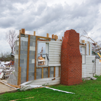
Tornadoes have significant impacts on human activities and communities. Impacts range from minor damage to the complete destruction of buildings as well as injury and even death. In fact, the damage they inflict is central to how we rate them and estimate their top wind speed.
Tornado damage
From 1993-2022, an average of 71 people were killed by tornadoes each year. Tornadoes associated with severe storms contribute to billion dollar disasters in the United States. On the National Centers for Environmental Information's website, you can view preliminary tornado occurrences for the current month or the number of tornadoes and associated fatalities by each year.
The spring of 2011 was one of the deadliest and most destructive tornado seasons on record. Between April and June 2011, tornadoes killed more than 580 people and caused more than $21 billion dollars in economic damages. The high death toll was partly a result of the tornadoes traveling rapidly through heavily populated areas and lack of adequate storm shelters.
If you have received a tornado alert or been impacted by a tornado, fill out the Tornado Tales online survey. The survey collects information about how people respond to watches and warnings.
Assigning tornadoes ‘ratings’: The Enhanced Fujita Scale
The National Weather Service (NWS) rates tornadoes using the Enhanced Fujita Scale (EF Scale) based on estimated wind speeds and associated damage. The EF scale is a set of wind estimates based on damage, not direct measurements of wind speed.
NWS assesses damage using a set of damage indicators and degrees of damage. They use this assessment to estimate the tornado’s highest wind speed and assign a rating.
The EF scale is an updated version of the original Fujita Scale, or “F scale.” NWS began using the EF Scale in 2007. The original F scale was developed by Dr. Tetsuya Theodore Fujita offsite link to estimate tornado wind speeds based on damage. A forum of nationally renowned meteorologists and wind engineers created the EF scale to reflect better damage assessment.
Read more about tornado impacts:
- National Weather Service: The EF scale
- National Centers for Environmental Information: Tornado data
- Storm Prediction Center: Tornado damage
- Storm Prediction Center: Historical tornadoes
Be weather-wise: Reducing the risks
Knowing what to do during severe weather is key to reducing your risk should a tornado form. Though we summarize safety advice below, if you live in an area where tornadoes form, we suggest visiting Ready.gov’s Tornado web page.
- Your first line of defense is to be aware of weather forecasts, warnings, and watches.
- It’s best to seek shelter during thunderstorms, whether or not it could produce tornadoes. Remember: When thunder roars, go indoors.
- Once you are aware of a watch or warning, make sure you know where to go, whether you’re at home, work, school, or out and about. Plan ahead, thinking of your “safe place” where you can seek shelter should a tornado approach.
- This may be a specially designed room like a storm shelter or “safe room.” Or, it may mean identifying the safest locations in a nearby building.
- The safest location in a building is the most interior room on the lowest floor. Ideally, it should be a sturdy interior room without windows that is below ground, if possible, or at ground level.
- If you live in a mobile home or home without a basement, identify a nearby safe building you can get to quickly.
- If you are stuck outside and cannot reach somewhere indoors, lie flat in a ditch, ravine, or low spot in the ground.
- No matter where you are, protect your head with your hands and any other protective objects you have handy, such as a coat, book or pillow.
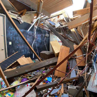
A daycare director in Selma, Alabama, acted quickly when her daycare was in the path of a tornado. She moved the staff and children to interior bathrooms — a decision that saved their lives.
More readiness resources:
- Ready.gov: Tornadoes
- National Weather Service: Prepare! Don’t let tornadoes take you by surprise
- Office of Response and Restoration: How to stay safe when tornadoes threaten
EDUCATION CONNECTION
Tornadoes can be an important topic with which to engage students in meteorological processes. Educators can use the resources in this collection to develop lessons and activities to help students investigate the impacts of natural hazards and other Earth processes on humans. These are some of the topics described in the Next Generation Science Standards offsite link and many state science standards.
Keep exploring
Find even more resources on tornadoes in our searchable resource database.


