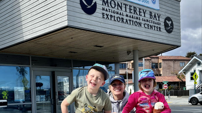
During her children’s spring break, Nicole Fernandes and her family spent time exploring NOAA’s mission along the north coast of California. Nicole, a policy analyst within the National Ocean Service’s Policy Office, is eager to share these unique places and how NOAA supports coastal and inland communities, including Tribes, through a variety of conservation, meteorological, and climate-related services and products. Read about their NOAA adventure below!
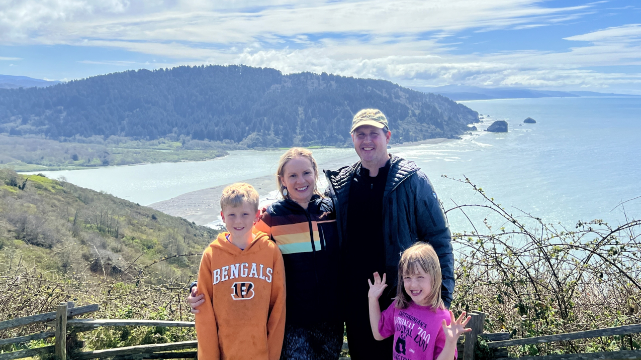
Nicole Fernandes, her husband Peter Arbuckle, and her two children pose in front of the mouth of the Klamath River where it meets the Pacific Ocean in Klamath, California. (Image credit: Nicole Fernandes/NOAA)
Inspired by our unintentional NOAA-themed spring break in central California in 2023, this year our family deliberately set out to explore NOAA’s mission in Northern California during our children’s spring break. Although our primary focus was visiting Redwood National and State Parks and family located upstate, we discovered plenty of opportunities to learn more about NOAA along the way.
First stop: Greater Farallones National Marine Sanctuary
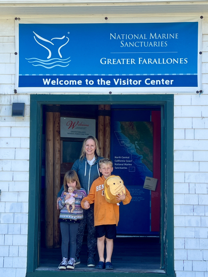
Heading north from Southern California, our first stop was the Greater Farallones National Marine Sanctuary’s Visitor Center in the shadow of the Golden Gate Bridge in San Francisco. With an area of 3,295 square miles off the northern and central California coast, the sanctuary protects wildlife, habitats, and cultural resources of one of the most diverse and bountiful marine environments in the world. The waters within Greater Farallones National Marine Sanctuary are a nationally significant marine ecosystem and support an abundance of life, including many threatened and endangered species.
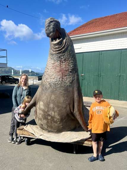
Just outside the Visitor Center, we were greeted by a massive Northern elephant seal statue. This species is one of 36 marine mammal species found in the sanctuary that are protected under the Marine Mammal Protection Act. Inside the visitor center, we learned about some of the other iconic species within the sanctuary, including white sharks, which are apex predators that rely on the sanctuary’s rich waters and play a key role in maintaining a balanced ecosystem. Our children were delighted to view live coastal fish in the visitor center aquarium and locally collected plankton under a microscope.
NOAA is supporting working waterfront communities in the face of climate change
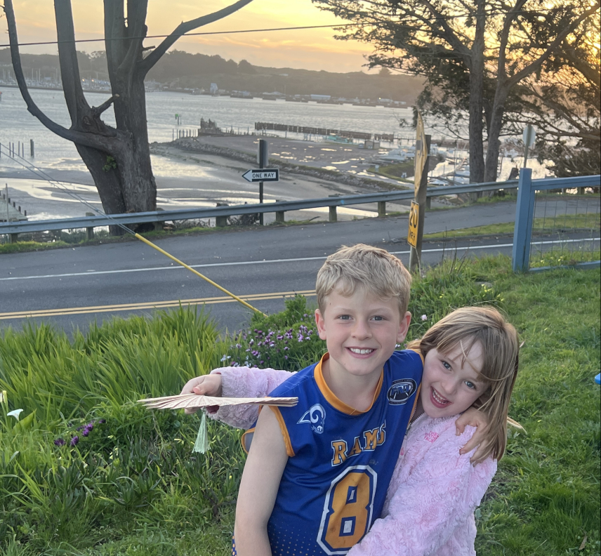
Traveling about an hour north that same day, we spent the night in Bodega Bay, located off the coast of the Greater Farallones National Marine Sanctuary. We enjoyed the bounty of local seafood, including Dungeness crab and rockfish, within this working waterfront community. With environmental stressors due to climate change affecting both species, NOAA continues to support research and work with local communities to mitigate these impacts.
NOAA’s National Centers for Coastal Ocean Science is currently studying how best to support the Dungeness crab fishery, the West Coast’s most valuable fishery. In partnership with coastal Tribes in California and the Pacific Northwest, the commercial Dungeness crab fishery industry, and relevant federal and state agencies, NOAA is working to better understand how multiple stressors like ocean acidification and increasing temperatures are likely to impact Dungeness crabs and the communities dependent on them.
As Pacific Ocean waters warm due to climate change, rockfish and other groundfish species are increasingly moving into cooler waters, forcing northern fishermen to fish much deeper or further offshore. Although some fishermen can adapt by catching different fish or moving to new areas, some may not be able to. NOAA is working closely with fishing communities to understand specific risks and vulnerabilities to develop effective climate adaptation strategies.
Redwoods, salmon, and the Yurok Nation
Traveling north, our next stop was Humboldt County where we stayed for several days exploring Redwood National and State Parks and NOAA’s mission in the region. The first stop was Yurok Country, where we were welcomed at the Yurok Tribe’s Visitor Center with a sign stating: “Cho’ Skuy’ Soo Hoo-Le’-Mow’” or “May You Folks Travel Safely.” The Yurok Tribe offsite link is California’s largest federally recognized Native American Tribe with nearly 5,000 enrolled members. The Tribe’s ancestral lands include much of the nearby coastline and extend through redwood habitat up the Klamath River for over 40 miles.
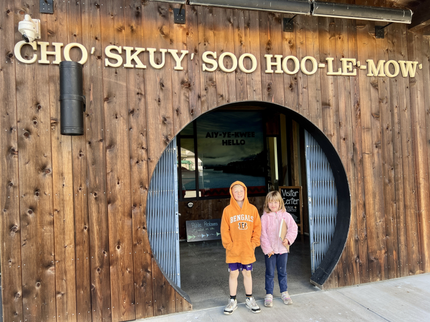
At the Visitor Center, we learned how central Chinook and coho salmon are to the Yurok Tribe’s culture, spirituality, and livelihood. With a Visitor Center staff member, we discussed how Tori McConnell, the first Yurok member to hold the title of Miss Indian World, has elevated the importance of salmon to the Tribe on a national scale. Her 2023-2024 reign coincides with the removal of four dams along the Klamath River. NOAA Fisheries is supporting the dam removals with science and funding for river restoration as the dams come down by end of this year. One of our major trip highlights was standing at an overlook where the river meets the Pacific Ocean and helping our children visualize that salmon hatched upstream in the Klamath River migrate to saltwater to live for much of their lives.
A test tsunami alert and a game of “radar ball!”
The next day, colleagues at NOAA’s National Weather Forecast Office (WFO) in nearby Eureka graciously hosted our family to learn about meteorology and to experience their annual Tsunami Warning Communications Emergency Alert System test. The test simulated the dissemination of a tsunami warning for nearby counties for a large tsunami wave originating from far away, such as in Alaska or Japan. We enjoyed hearing the countdown and the blare of the outdoor tsunami siren and seeing the local television station broadcast the alert.
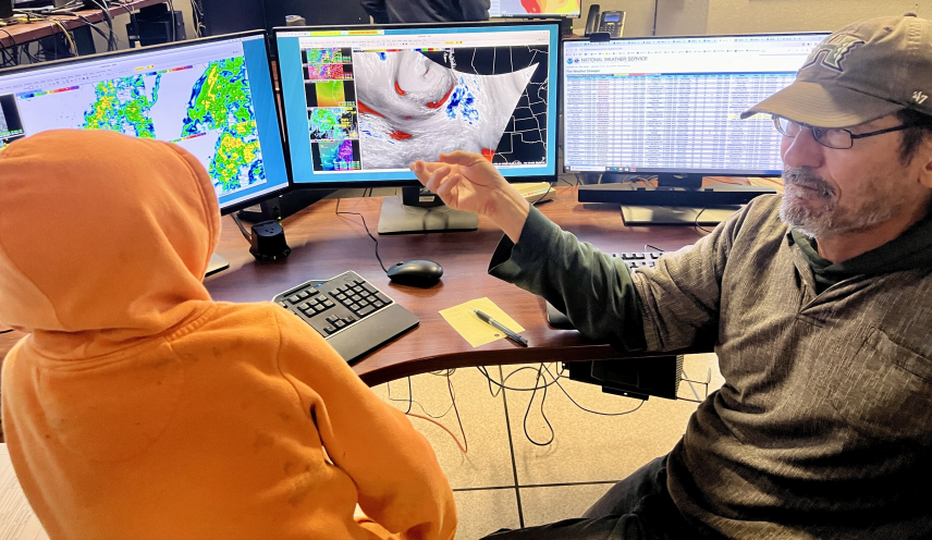
Additionally, we viewed live heavy local rain conditions and forecast models displayed on a computer through graphical representations generated from satellite and radar data on maps. Troy Nicolini, the WFO’s Meteorologist-in-Charge, showed us a variety of weather instruments that help meteorologists get a complete picture of current conditions and predict future conditions. These included an anemometer measuring wind speed, a water gauge and a WSR-88 radar measuring precipitation, and a buoy that measures ocean waves like those that NOAA’s National Buoy Data Center operates.
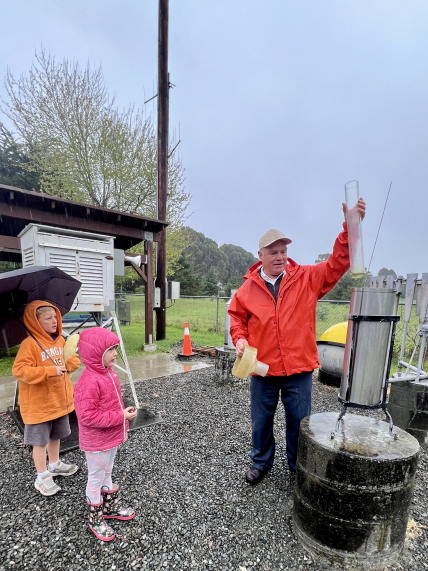
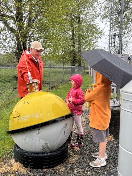
Troy Nicolini also played a game with our children demonstrating how radars function. He acted as a 360 degree rotating radar and our children acted as rain drops located at different distances from him. He tossed a ball that represented how radars scan the atmosphere with short bursts of electromagnetic waves. As the ball (radio waves) traveled from my children (water droplets), who passed it back to him, he explained that the length of time it takes for the wave to return to the radar can give meteorologists a sense of the amount of precipitation and its duration to help them develop weather forecasts. Playing “radar ball” was a fun and easy way for children to understand how meteorologists use technology to predict weather.
Fish hatchery, Trinity River, and wildfire
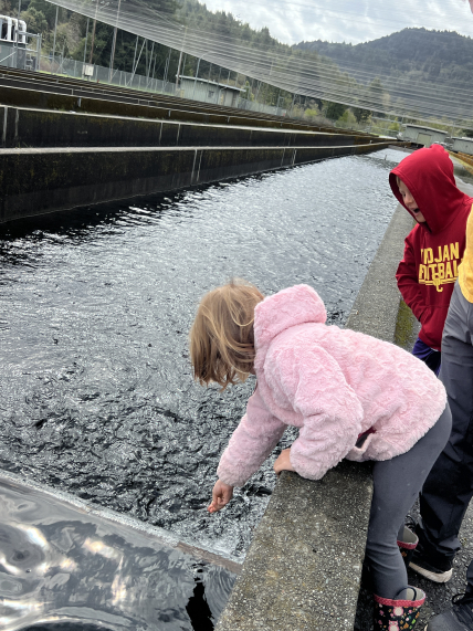
Following our WFO visit, we traveled south to visit family in Chico, a city in the northern Sacramento Valley. Along the way, we stopped at the Mad River Hatchery, a Northern California steelhead trout hatchery managed by the California Department of Fish and Wildlife in Humboldt County. As our children fed the juvenile steelhead along raceways, the fish grouped together in a frenzy, gobbling up pellets, resulting in a fit of laughter from our children. An onsite fisheries biologist explained that the fish would be released into the adjacent Mad River for sportfishing. By bolstering the populations via hatchery propagation, sportfishermen capture these individuals rather than depleting the native steelhead population, which is a protected species under the Endangered Species Act. Hatcheries like Mad River are an important tool to help support wild populations and provide fish for harvest. NOAA Fisheries supports the use of hatcheries, but carefully considers interactions between hatchery and natural-origin fish in the context of overall goals for threatened or endangered fish.
As we traveled south from the Mad River, we encountered the Trinity River, a tributary of the Klamath River, and observed the breathtaking beauty of bald eagles, a variety of duck species, and elk. Continuing south to Chico, we followed the Sacramento River, which like the Trinity and Klamath Rivers provide important habitat for steelhead trout and endangered Chinook Salmon.
Once in Chico, we enjoyed family time and visited the adjacent town of Paradise, which was heavily impacted by the devastating Camp Fire in November 2018. As one of the worst wildfires in American history and the deadliest in California, the town experienced 88 fatalities and the loss of 95% of its structures. During the initial Camp Fire response, the WFO in Sacramento provided weather forecast support while Incident Meteorologists (IMETS) provided on-site support. IMETs helped keep firefighters safe by interpreting weather information and providing continuous meteorological support for the duration of the Camp Fire. Additionally, NOAA’s Global Systems Laboratory’s smoke forecasting system offsite link accurately predicted the general movement and concentration of the Camp Fire’s smoke during the initial week of the lengthy blaze. As a result, NOAA improved decision-making during the fire and helped save lives.
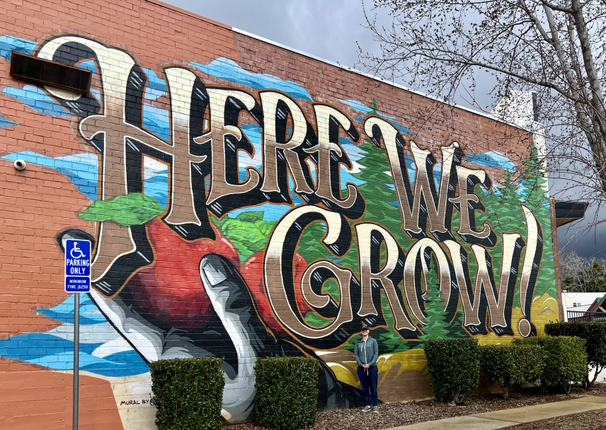
The town of Paradise is still struggling to recover from the Camp Fire. My cousin Rashell Meiko Brobst, the CEO of the local Boys and Girls Club offsite link, has helped lead the recovery effort for local youth. She took me on a “recovery tour” of the town, including the new Boys and Girls Club facility, which was gutted by the fire, and Paradise’s new “Building Resiliency Center.” The Center is a one-stop shop for residents who are rebuilding or considering rebuilding. Rashell was the impetus for and co-authored an evidence-based comprehensive manual that offers guidance to people working with children, youth, and families in the event of a fire or the threat of a fire in or near their community. As wildfire frequency and severity across the western United States continues to grow, the manual can be a resource for supporting youth and communities. Despite the tangible wildfire impacts still present in the town of Paradise, hope for recovery persists. A sign of this hope is a mural on the side of the Boys of the Girls Club facility, which reads, “Here We Grow.”
Our Northern California vacation was enriched by the many resources NOAA, Tribes, the State of California, and community organizations provide to enable communities to thrive culturally, economically, and environmentally. Our family loved learning all that NOAA does to serve communities and the natural and cultural resources in the northern reaches of our home state. Even while taking time away from work, I was once again grateful to be immersed in NOAA’s expansive and meaningful mission!


