-
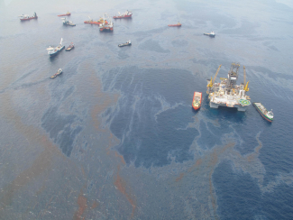
NOAA mobilizes ships, aircraft, and personnel in response to the Deepwater Horizon oil spill in the Gulf of Mexico.
-
2010
NOAA Ship Okeanos Explorer participates in the first join expedition by the U.S. and Indonesia to explore unknown deep-sea areas in Indonesian waters.
-
2010
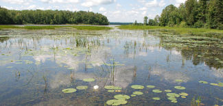
A nearly 17,000-acre area encompassing freshwater marshes, uplands, and river on the shores of Lake Superior in Wisconsin becomes the 28th member of NOAA's National Estuarine Research Reserve System.
-
2010
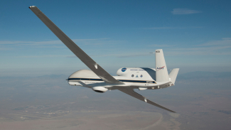
Hurricane Earl marked the first flight of an unmanned aircraft system, NASA’s Global Hawk, above a fully developed tropical cyclone. AOML and NASA researchers collected data and images of Earl at 60,000 feet.
-
2011
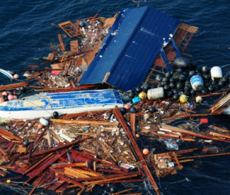
NOAA's Marine Debris Program launches a response to debris floating across the Pacific Ocean resulting from a devastating 9.0 earthquake and tsunami in Japan.
-
2011
The NWS begins to upgrade the NEXRAD radar network to add dual polarization capabilities. Dual polarization (using horizontal and vertical radar pulses) improves the identification of different precipitation types and amounts, as well as tornado debris and other non-weather targets, leading to more accurate forecasts and warnings.
-
2011
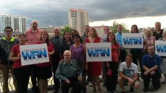
Following several weather disasters in 2011 that took hundreds of lives, NWS initiates the Weather Ready Nation campaign. WRN combines the resources of the NWS with communities, emergency managers, businesses, and the general public to encourage readiness, responsiveness, and resilience to extreme weather, water, and climate events.
-
2011
A 4-day tornado outbreak across 21 states and parts of Canada results in a total of 360 tornadoes, including a record 216 on April 27 alone. The outbreak kills 348 people, making it the deadliest day for tornados since 1925.
-
2011
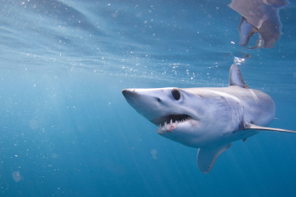
The Shark Conservation Act improves the conservation of sharks domestically and internationally.
-
2012
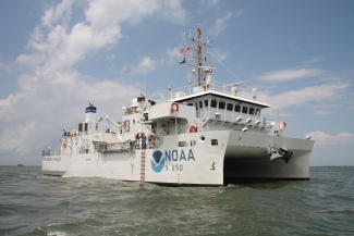
NOAA commissions state-of-the-art coastal mapping vessel, NOAA Ship Ferdinand R. Hassler, named for the founding superindendent of the Coast Survey (1770-1843), the precursor to today's NOAA. The ship operates mainly along the Atlantic and Gulf coasts, Caribbean Sea, and Great Lakes in support of NOAA's nautical charting mission.
-
2012
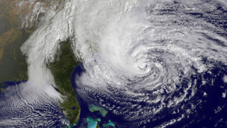
Superstorm Sandy makes landfall along the south shore of New Jersey. NOAA conducts navigation surveys to restore maritime commerce, aerial surveys to assist on-the-ground responders, and other storm damage assessments.
-
2013

The Alaska Tsunami Warning Center is renamed the National Tsunami Warning Center. Its responsibilities cover the areas of the U.S. Pacific, Atlantic, and Gulf Coasts, British Columbia, Puerto Rico, the Virgin Islands, and the Atlantic Coast of Canada.
-
2013
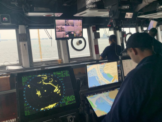
NOAA announces the end of traditional paper nautical charts, instead providing print-on-demand charts and electronic charts
-
2013
NOAA dedicates the Daniel K. Inouye Regional Center in Honolulu. The center integrated new facilities with historic preservation of four WWII-era structures, culminating in an environmentally-sustainable, state-of-the-art, LEED-certified campus.
-
2013
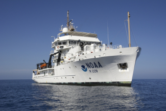
NOAA takes delivery of Reuben Lasker, the agency's newest high-tech fisheries survey vessel. The 208-ft ship supports surveys of fish, marine mammals, and turtles of the U.S. West Coast and in the eastern Pacific Ocean.
-
2013
The Eastern population segment of Steller sea lions is removed from the Endangered Species list.
-
2014

NOAA forecasts a bloom of cyanobacteria that contaminated drinking water in Lake Erie on August 2, 2014. This event left nearly 400,000 people in Ohio without drinking water for two days.
-
2014
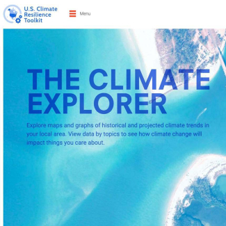
NOAA released version 1.0 of the web-based U.S. Climate Resilience Toolkit, which helps the Nation address challenges related to coastal flooding and other climate-related risks.
-
2014
NOAA collaborates on a tool called OceanAdapt to track shifting fish distribution in response to climate change. A Presidential Task Force is established to combat illegal, unreported and unregulated fishing and seafood fraud. Involving 12 federal agencies co-led by the State Department and NOAA, the Task Force identified 15 actions to strengthen enforcement. One of those actions resulted in establishing the Seafood Import Monitoring Program.
-
2015
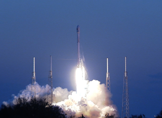
NOAA successfully launched DSCOVR from Cape Canaveral, Florida. DSCOVR, the United States’ first operational deep space satellite, is a vital piece of our international space weather observing system.
-
2015
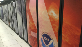
NOAA begins a major upgrade of its large scale operational supercomputers that will create more realistic conditions in NOAA models and enable more accurate weather forecasts and enhanced public safety.
-
2015

NOAA ships collect critical hydrographic, fisheries, and protected species data in the Arctic region, enabling improvements to nautical charts required for safe navigation and providing data on managed species.
-
2016
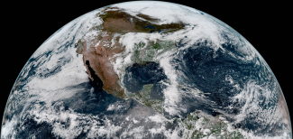
The next generation of geostationary satellites begins with the launch of GOES-16 on November 19, 2016, and GOES-17 on March 1, 2018. The GOES-R series provides advanced imagery and atmospheric measurements of Earth’s weather, oceans and environment, real-time mapping of total lightning activity, and improved monitoring of solar activity and space weather.
-
2016
The United States represents one of the largest single markets for fish and fish products, second only to the European Union in imports; in 2016, the EU, US, and Japanese markets together accounted for approximately 64 percent of the total value of world imports of fish and fish products.
-
2016
40th anniversary of the Magnuson-Stevens Act: overfishing and overfished numbers hit historic all-time lows, with just 8 percent of managed fish stocks on the overfishing list and 16 percent of stocks considered overfished—all of them under rebuilding plans.
-
2017
The Weather Research and Forecasting Innovation Act of 2017 is passed. The first major weather legislation since the early 1990s, the act directs NOAA to prioritize weather research and forecasting improvement, satellite and data innovation, and improve coordination among government agencies, research institutions, and industry.
-
2017
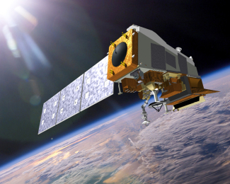
NOAA launches polar-orbiting satellite JPSS-1, officially known as NOAA-20. The satellite's advanced instruments provide global observations that serve as the backbone of both short- and long-term forecasts, including those that help us predict and prepare for severe weather events.
-
2017

Federal, state, and local officials cut the ribbon on the new facility for NOAA’s Aircraft Operations Center at Lakeland Linder International Airport in Lakeland, Florida.
-
2018
NOAA launches a massive supercomputer upgrade, putting it among the 30 fastest in the world with the ability to process 8 quadrillion calculations per second.
-
-
2018
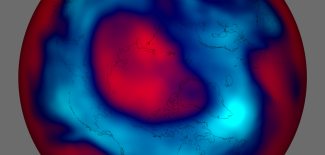
A NOAA scientist discovers rising emissions of a banned ozone-destroying chemical originating from eastern Asia, galvanizing the international community to strengthen the Montreal Protocol, an international treaty focused on repairing the ozone hole.
-
2019
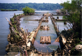
NOAA designates Mallows Bay National Marine Sanctuary in Maryland, protecting the remnants of more than 100 World War I-era wooden steamships and other maritime resources and cultural heritage dating back nearly 12,000 years.
-
2020
NOAA celebrates 50 years of science, service and stewardship.
An official website of the United States government
Official websites use .gov
A .gov
website belongs to an official government organization in the United States.
Secure .gov websites use HTTPS
A lock (
) or https:// means you’ve safely connected to the .gov website. Share sensitive information only on official, secure websites..
- NOAA Heritage home
- Exhibits
- Our history
- NOAA timeline
- NOAA Photo Library

