Hurricanes and Nor’easters are major hazards that face the coastal communities of Massachusetts. As pressure from coastal development increases, less-intense storms that occur more regularly and sea level rise will lead to costly flooding and erosion damage. Educating and preparing youth for these kinds of coastal hazards is important to help keep them safe in dangerous storm events. NOAA’s Waquoit Bay National Estuarine Research Reserve offsite link, located on Cape Cod, has developed a series of educational programs in an effort to tackle these issues and help coastal communities better prepare for coastal hazards.

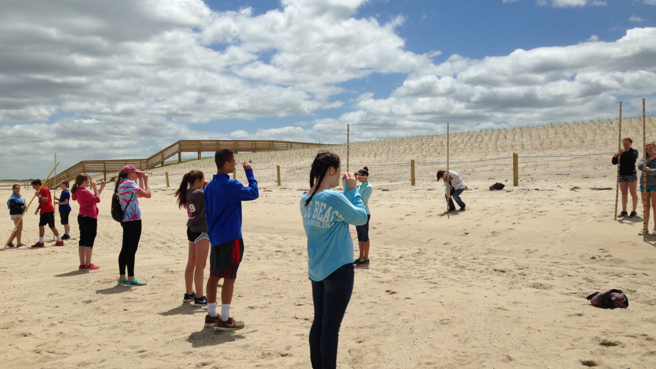
STEM Academy Middle School 8th grade students using measuring poles and levels to determine the location of the hypothetical high tide line given projected one and two meter increases in sea level to their local beach on Cape Cod. (Image credit: Amy Ferreira/STEM Academy Middle School)
In 2014, the Research Reserve partnered with a local middle school to develop and teach a curriculum unit that explores the science behind coastal hazards and increases geographic awareness and hazard preparedness. Students share their experiences with major storms and the damage they have witnessed in their community. Using elevation maps, students identify landforms, determine which areas in their town are vulnerable to coastal hazards, and hypothesize where the greatest impacts might be during future storms or as a result of sea level rise. Students are asked to consider the prevailing wind directions during hurricanes or Nor’easters. They then compare these with land use change maps. Through this exercise, students determined that over time, increased development had taken place in some of the most vulnerable areas.
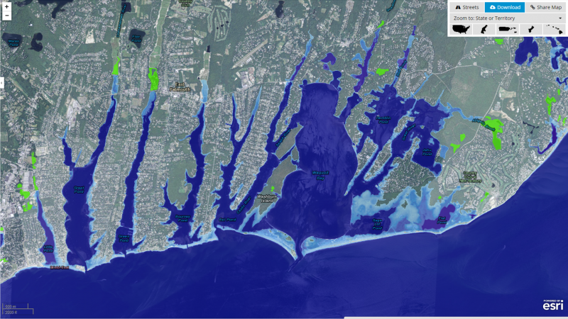
Students use the Sea Level Rise Viewer, a tool developed by NOAA’s Office for Coastal Management on the Digital Coast website, to consider the potential impacts from sea level rise on their community’s coastline. The classroom component is followed with a trip to a beach that has been impacted by flooding and erosion. In the field, students measure and visualize the increased flood zone at predicted levels of sea level rise and estimate the impacts.

In 2015, STEM Academy Middle school adopted the Research Reserve's education unit for their 8th grade curriculum. The unit now reaches over 260 students per year. Students found the unit engaging, as they could investigate their own neighborhoods, evaluate their coastal risks, and consider viable evacuation routes during flood events. With these lessons learned, students will be better prepared when the next big storm hits Cape Cod.


