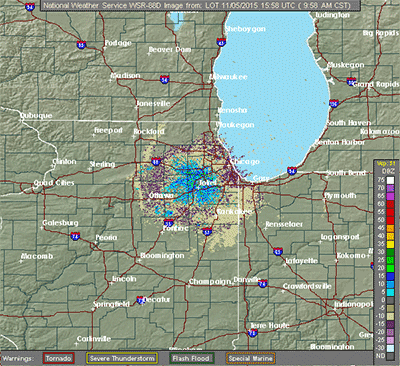
On some occasions, it can be difficult to determine if the radar is showing real echoes. Therefore, always get a second opinion for what is displayed by the radar. That second opinion is gained by looking at adjacent radars to determine if they are "seeing" the same thing.
False echoes are known as anomalous propagation (AP) - an echo that is not precipitation. Radar return from AP is unpredictable, contaminates precipitation measurements, and can cause the generation of erroneous rainfall estimates used in hydrology products. There are two main types of anomalous propagation on radars: Ground Clutter and Superrefraction.
Ground Clutter is the most common and is usually seen in every radar image. When atmospheric conditions are such that there are low-level inversions (air temperature increasing with height instead of the typical decreasing with height), ground clutter can be very pronounced.
This is the easiest false echo to recognize since it does not move, has no structure to it that looks similar to real precipitation, and is usually close to the radar. Ground clutter in clear air mode is often more prevalent than in precipitation mode because the radar is in its most sensitive operation, thereby "seeing" smaller objects such as dirt, dust, and bugs.
Superrefraction is where the radar beam is bent greater than normal back toward the Earth. If the bending is severe, it can actually intersect with the Earth's surface.
With superrefraction, not only can the radar not see the more distant real precipitation, the AP can also appear the most real. Superrefraction is more likely when a strong low-level inversion is in place, especially when the low-level air is moist and the air above the inversion is very dry.


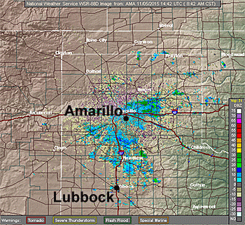
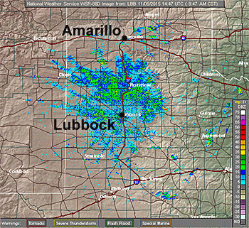
The left image (above), from the NWS Amarillo Doppler radar, shows a large number of echoes near the radar, with none near Lubbock, TX. The right image (above) is from the NWS Lubbock radar at the same time.

We know both radars are showing strong anomalous propagation because neither radar supports what the other is seeing. Therefore, none of the echoes on either radar are precipitation (with the exception of some light precipitation seen on the far right side of the Lubbock radar). This is seeking the second opinion to verify the validity of what the radar is indicating.
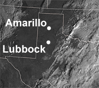
To further verify the anomalous propagation, this visible satellite image (left), taken at the same time as the two radar images, shows clear skies over both locations.


