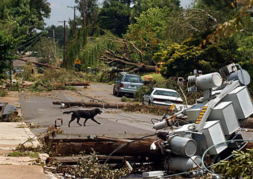
The National Weather Service does not issue "derecho warnings" as, by their definition, derechos are wind events produce by severe thunderstorms. Therefore, the NWS will issue a Severe Thunderstorm Warning if a derecho approaches your location.
Derechos cause more fatalities than EF0 and EF1 tornadoes combined in spite of the fact that EF0 and EF1 tornadoes comprise over 80% of all recorded tornadoes. This is primarily due to the derecho's typical broad path of high winds and subsequent damage.
Nearly half of fatalities attributed to derechos occur either in vehicles or boats. In boats, the vessels overturned due to the high winds and the occupants drowned. In vehicles, some fatalities occur when 18 wheelers are blown onto their sides, trees are blown onto automobiles, and vehicles are driven into trees.
Besides their damaging winds, what makes derechos particularly dangerous is their forward speed - it is not uncommon for a derecho to move at 60 to 70 mph (97 to 113 km/h). At such speeds, you do not have much time to ensure your safety.

This can pose problems for campers and hikers. When threatening clouds approach, people outdoors should seek adequate shelter. However, a derecho's very fast forward speed greatly reduces preparation time and can often catch individuals in exposed locations.
Typically, the National Weather Service will issue a severe weather warning for your county when the storm (or storms) is located in an adjacent county or parish and is expected to move into your area. However, with the fast forward speeds of derechos, the warning may be issued for your county while the storm is still relatively far away. Instead of thinking you have extra time to get prepared, be prepared for the potential for an extremely rapid deterioration of your weather. It is your call for action. Be weather-wise, not otherwise.
Safety rules for derechos are the same for severe thunderstorms in general. Remember Rule #1: at the beginning of your day, check your weather forecast.
While we will never be able to pinpoint exactly when and where severe weather will develop, we can identify broader areas or regions with the potential for the development of severe weather.
You may need to check several times daily, to see if you are, or will be, under a risk of severe weather.
In addition of obtaining your weather forecast from your local National Weather Service Forecast Office, check the NWS Storm Prediction Center (SPC) severe weather outlooks. SPC can provide several hours of advanced notice for a threat of severe weather. Learn how to interpret SPC graphics at Staying Ahead of the Storm.
Also, if outdoors away from a computer, there are numerous weather apps that push NWS warnings to your smartphone, or check AM/FM Radio or a NOAA Weather Radio. In addition, there are apps that display NWS Doppler radar in real time. For your safety, be proactive in monitoring the weather.


