As radiosonde balloons ascend, they record the temperature and relative humidity at certain prescribed pressure levels (called the mandatory levels) and anytime a significant change occurs in the temperature, humidity, or wind.
Typically, a radiosonde observation is complete when the balloon carrying the radiosonde bursts and begins to descend. At that time, the data is compiled into a series of five-digit groupings containing temperature, dew point depression, and wind speed/direction for mandatory and significant levels. This data is plotted onto a Skew-T.
The five-digit coded radiosonde observation is complicated to decode and plot onto a Skew-T diagram. As such, NOAA's Storm Prediction Center (SPC), as well as several private weather vendors and universities, have written programs to decode and plot (or redisplay the info in a tabular format) these observations. A simple internet search for "atmospheric soundings" will provide you with several additional choices.

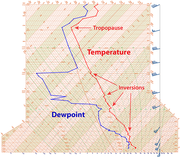
There are two basic lines plotted on a Skew-T from which we can derived much information. These represent the dew point, which is calculated from the relative humidity (in blue, left line), and air temperature (in red, right line).
While air temperature generally decreases with height, this decrease is not uniform nor is it consistent. Sometimes the air temperature remains the same or increases with height. When the normal temperature decrease is "inverted" and the temperature increases with height, this is called a temperature inversion.
The tropopause is the boundary between the troposphere and stratosphere and is also indicated by a large temperature inversion. Therefore, the location of the tropopause can be identified on a radiosonde soundings.
The dew point line will be the most "wiggly" as the radiosonde ascends through intervening pockets of moist and dry air. At each level on the Skew-T, the closer the dew point is to the temperature, the higher the relative humidity is at that level. The dew point will occasionally equal the air temperature, which is indicated by the intersection of both lines.
Wind speed and direction are also plotted on a Skew-T. This information is obtained using GPS tracking as the radiosonde ascends. The wind speed and direction is reported at the mandatory pressure levels with additional required elevations and for any significant changes in speed or direction.
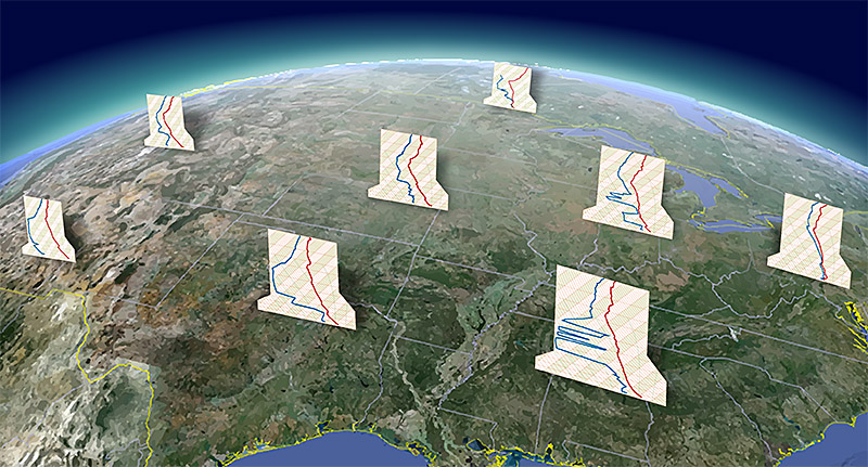
Across the country and around the world, radiosondes sample the atmosphere twice daily, ahead of high-impact weather events, or to aid in research, providing answers concerning the state of the upper air.


