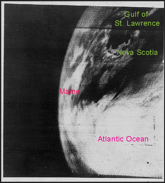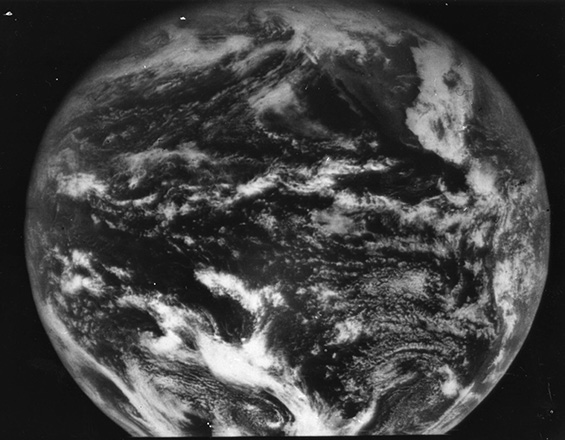
The world's first meteorological satellite was launched from Cape Canaveral on April 1, 1960. Named TIROS for Television Infrared Observation Satellite, it demonstrated the advantage of mapping the Earth's cloud cover from satellite altitudes.
TIROS showed clouds banded and clustered in unexpected ways. Sightings from the surface had not prepared meteorologists for the interpretation of the cloud patterns that the view from an orbiting satellite would show.
TIROS was a polar orbiting satellite, meaning the satellite orbited in a latitudinal motion, which takes it over the North and South Poles. Today, polar orbiting satellite round the Earth 14.1 times daily.
Since the number of orbits per day is not a whole number, the orbital tracks do not repeat on a daily basis. Currently in orbit are morning and afternoon satellites passes that provide global coverage four times daily.
The advantages of polar orbiting satellites:
- Closer to the Earth, with an orbit of about 520 miles (833 km) above the surface, thus providing much more detailed images.
- Excellent views of the polar regions.
The disadvantages of polar orbiting satellites:
- Cannot see the whole Earth's surface at any one time.
- The path of each orbit changes due to the Earth's rotation, so no two images are from the same location.
- Limited to about six or seven images a day since, most of the time, the satellite is below the Earth's horizon and out of range of listening equipment.
Go to the Alaska Aviation Weather Unit page for images from the polar orbiting satellites and the NOAA Satellite and Information Service (NESDIS) for the the tropical regions.
Geostationary Satellites

The first geostationary satellite was launched in 1966. Unlike polar orbiting satellite, geostationary satellites orbit at a much higher altitude of 22,236 miles (35,786 km). Positioned over the equator, the satellite completes one orbit in 24 hours, meaning it orbits in sync with the Earth's rotation. The net result of this timing is that the satellite appears stationary relative to the Earth's surface, allowing them to hover continuously over one position on the surface.
Early geostationary satellites were "spin stabilized", meaning they maintained stability by rotating and, therefore, viewed the Earth only about 10% of the time. Current satellites are now stabilized in a way that allows them to always view the Earth. These current satellites are called Geostationary Operational Environmental Satellites (GOES).
Because they stay above a fixed spot on the surface, they provide a constant vigil for the atmospheric "triggers" for severe weather conditions such as tornadoes, flash floods, hail storms, and hurricanes.
Geostationary satellite are the bread and butter satellites for the meteorologist. Their advantages are:
- They are always located in the same spot of the sky relative to the Earth.
- They view the entire Earth at all times.
- They can record images as frequently as once every minute.
- Since their view is always from same perspective, the motion of clouds over the Earth's surface can be measured.
- They can receive transmissions from free-floating balloons, buoys, and remote automatic data collection stations around the world.
The disadvantages of geostationary satellites are:
- Their high location, at 22,300 miles (35,000 km) above the Earth, provides lower-detailed views.
- Views of the polar regions are limited due to the Earth's curvature.
Moving Geo"stationary" Satellites
Despite the fact that GOES satellites are stationary relative to their position over the Earth, that position can and does get moved. As newer satellites are placed in orbit, older versions are moved into storage positions where they can be called upon again if needed.
As such, these satellites have rocket engines to move them, but not likely in a way you may think.
The farther out from the center of a rotating object, the faster the speed needed to "keep up". GOES satellites orbit at a constant speed that matches the Earth’s rotation at their particular distance from the surface. As a result, if this distance were less, then the satellite's unchanging speed would cause it to orbit faster relative to the Earth's rotation. An orbit at a greater distance would be slower relative to the Earth's rotation.
If the satellite is orbiting faster relative to the Earth, then the point over which it appears would move east. A slower-orbiting satellite would appear to move west over the Earth.

This is the method for moving these "stationary" satellites: the rocket engines do not change the actual speed but move the satellites closer or farther away from the Earth, altering their relative speed. When they are in the desired new position, the rockets are fired again to return them to the distance where they appear "stationary" again.
GOES-R Series
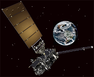
In November 2016, the newest geostationary satellite, GOES-R, was launched. After undergoing a year of testing, it was designated GOES-16 and placed in operation located over 70ºW longitude. Also known as GOES-East, this satellite marks a vast improvement over the previous aging GOES satellites.
The next GOES-R series satellite was launched March 1, 2018. After testing, it was designated GOES-17 (GOES West) and currently operates over 137ºW.
Both GOES-16 and GOES-17 will cover the Weather Hemisphere from the West coast of Africa to as far west as New Zealand. Two additional GOES-R series satellites will eventually be launched to help provide dedicated service through the year 2036.


