Weather around the world falls into three basic categories: precipitation, obscurations, and "other" phenomena.
Weather around the world falls into three basic categories: precipitation, obscurations, and "other" phenomena.
Precipitation
Precipitation is any form of water particle, whether liquid or solid, that falls from the atmosphere and reaches the ground. The different types of precipitation are:
Rain
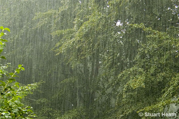
Most commonly observed; water drops larger than drizzle (0.02 inch / 0.5 mm or more) are considered rain. However, smaller drops are also considered raindrops if, in contrast to drizzle, they are widely separated.
Drizzle
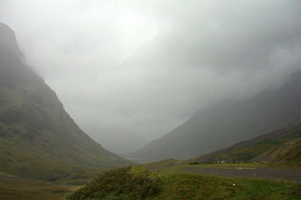
Fairly uniform precipitation composed exclusively of fine drops very close together. Drizzle appears to float while following air currents, but unlike fog droplets, it falls to the ground. Quite often, fog and drizzle occur together.
Ice Pellets (Sleet)
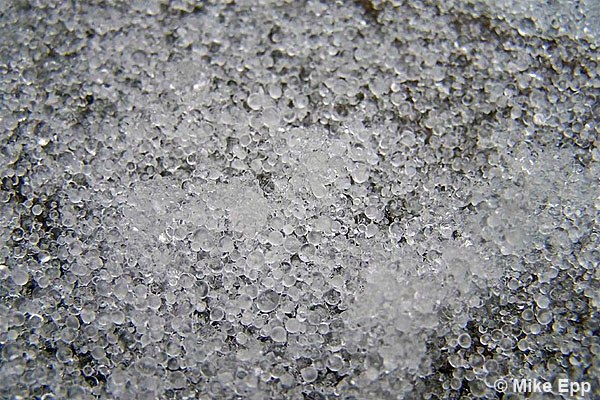
Precipitation of transparent or translucent pellets of ice, which are round or irregular hard grains of ice consisting of frozen raindrops or largely melted then refrozen snowflakes.
Hail
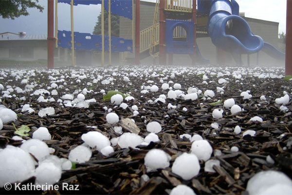
Precipitation in the form of small balls or other pieces of ice falling separately or frozen together in irregular lumps. Associated with thunderstorms, individual hail stones are ¼ inch (5 mm) or greater in diameter. Hail sizes of 1 inch (2.5 cm) or more are indicative of severe thunderstorms.
Graupel (Small Hail, Snow Pellets)
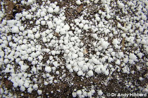
Precipitation of white, opaque grains of ice that are round or sometimes conical. Diameters are less than ¼ inch (5 mm).
Snow
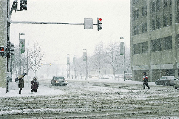
Precipitation of snow crystals that are mostly branched and in the form of six-pointed stars.
Snow Grains
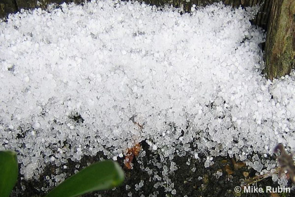
Precipitation of very small, white, and opaque grains of ice. Basically, this is frozen drizzle.
Ice Crystals
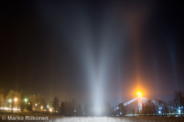
Generally occurring in very cold regions, they are falling crystals of ice in the form of needles, columns, or plates. Also called "diamond dust", ice crystals appear like fog but with individual water particles forming directly as ice. The shape of the individual ice crystals causes the "light pillar" optical effect above a light source.
Obscuration Types
An obscuration is any phenomena in the atmosphere, other than precipitation, that reduces the horizontal visibility. The most common is fog. Obscurations include:
Mist
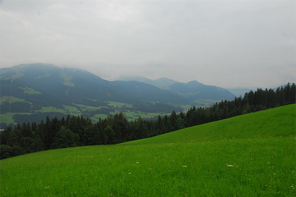
Visible minute water particles suspended in the atmosphere that reduce visibility to fewer than 7 miles (11 km) but more than or equal to 5/8 mile (1 km). There is often not much difference in the appearance of "haze" and "mist", but it is called mist when the difference between the air temperature and dew point is 3°F (1.7°C) or less.
Fog
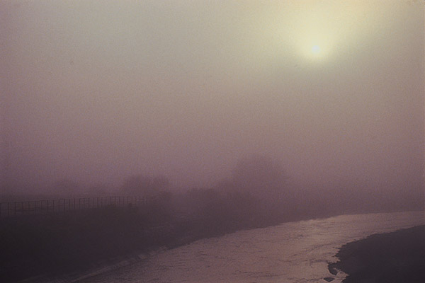
Visible minute water particles (droplets) at the Earth's surface that reduce horizontal visibility to less than 5/8th mile (1 km). Unlike drizzle, fog does not fall to the ground but remains suspended.
Smoke
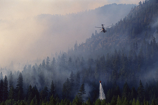
Small particles produced by combustion and suspended in the air. A transition to haze may occur when smoke particles have traveled great distances, 25 to 100 miles (40 to 160 km) or more, and larger particles have settled out, leaving the remaining particles widely scattered through the atmosphere.
Volcanic Ash
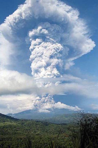
Fine particles of rock powder that originate from a volcano and that may remain suspended in the atmosphere for long periods.
Dust
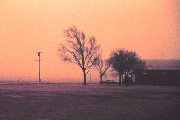
Fine particles of earth or other matter, raised or suspended in the air by the wind, that may restrict horizontal visibility.
Sand
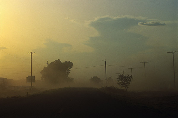
Sand particles raised by the wind to a height sufficient to reduce horizontal visibility.
Haze
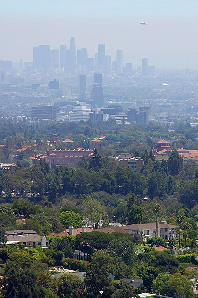
A suspension in the air of extremely small, dry particles that are invisible to the naked eye and sufficiently numerous to give the air an opalescent appearance. That is the scientific way of saying haze is air pollution. There is often not much difference in the appearance of "haze" and "mist". It is called haze when the difference between the air temperature and dew point is greater than 3°F (1.7°C).
Other Weather Types
Significant types of weather are related to wind. These other forms of weather include:
Squall
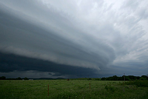
A strong wind characterized by a sudden onset in which the wind speed increases at least 18 mph (16 knots, 30 km/h) and is sustained at 25 mph (22 knots, 41 km/h) or more for at least one minute. These often occur from thunderstorms, where the term "squall line" originates. However, the term "squall" only refers to the wind speed increase, not any other associated weather. In the image, the low arcing clouds are not the squall line but mark the approximate location of the squall.
Tornado
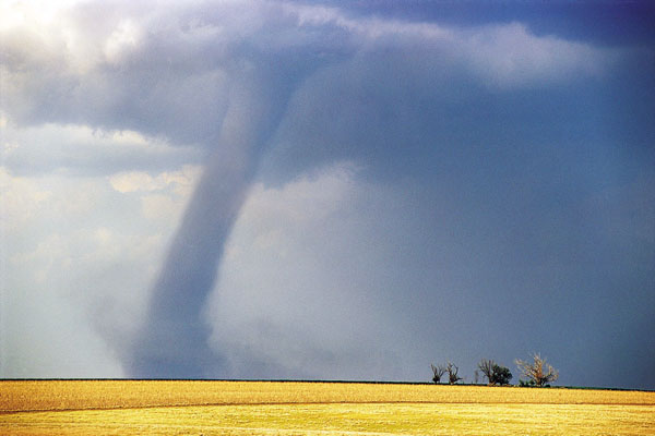
A violent, rotating column of air touching the ground.
Funnel Cloud
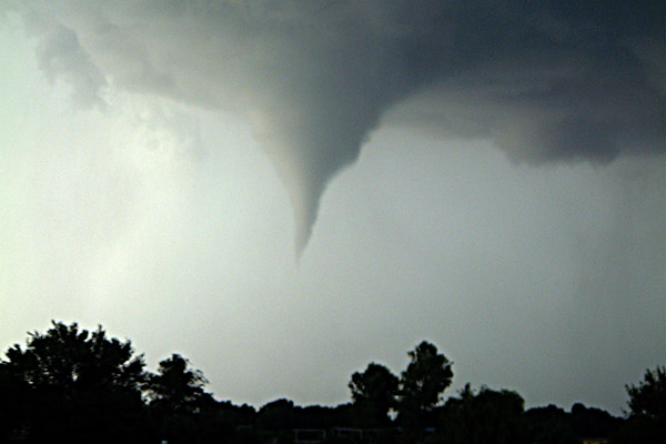
A violent, rotating column of air which does not touch the surface.
Waterspout
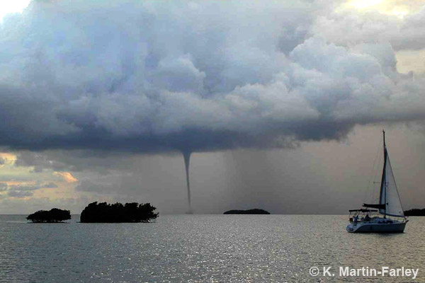
A violent, rotating column of air that forms over a body of water and touches the water surface. If it does not touch the water surface, then it is called a funnel cloud.
Sand Storm
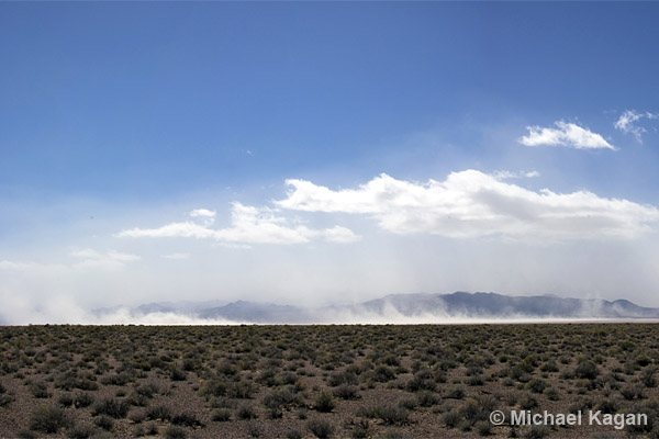
Particles of sand carried aloft by a strong wind. The sand particles are mostly confined to the lowest ten feet and rarely rise more than fifty feet above the ground. These are sometimes called "haboobs".
Dust Storm
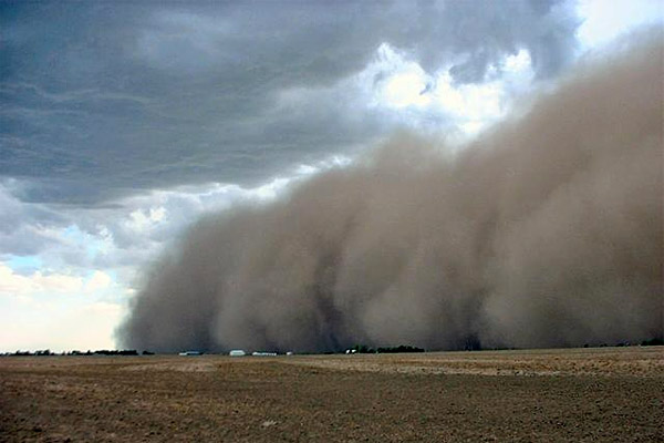
A severe weather condition characterized by strong winds and dust-filled air over an extensive area. Particle size is typically smaller than in sand storms. These are sometimes called "haboobs".
Well-Developed Dust/Sand Whirls
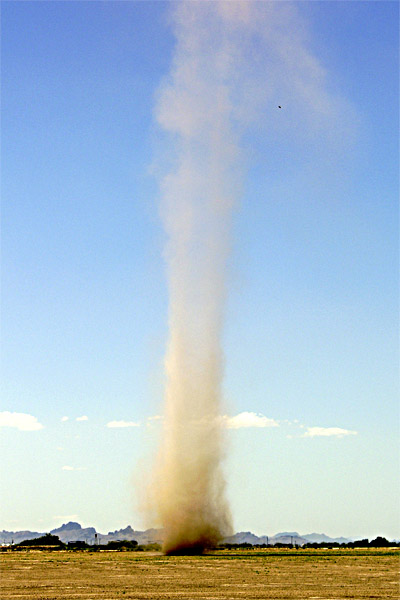
Particles of dust or sand, sometimes accompanied by small litter, raised from the ground in the form of a whirling column of varying height with a small diameter and an approximately vertical axis. Commonly called a "dust devil".


