All thunderstorms require three ingredients for their formation:
- Moisture,
- Instability, and
- a lifting mechanism.
Sources of moisture
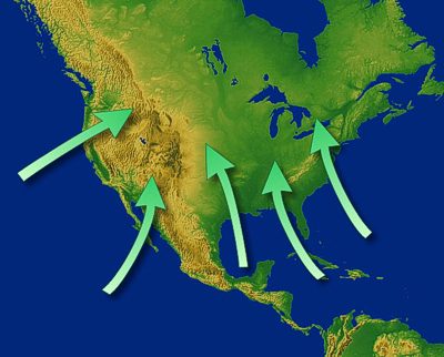
Oceans are the typical source of moisture for thunderstorms, and water temperature plays a large role in just how much moisture gets added to the atmosphere. Warm ocean currents have higher evaporation and therefore produce more moisture than cold ocean currents at the same latitude.
Recall from the Ocean Section that warm ocean currents occur along east coasts of continents, while cool ocean currents occur along west coasts. Therefore, warm water from the Atlantic Ocean and Gulf of Mexico results in much more precipitation in the southeastern U.S. compared to the same latitude in Southern California.
Instability

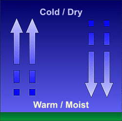
Air is considered unstable if it continues to rise when given a nudge upward or continues to sink if given a nudge downward. An unstable air mass is characterized by warm moist air near the surface and cold dry air aloft.
In these situations, if a bubble or parcel of air is forced upward, it will continue to rise on its own. As this parcel rises, it cools and some of the water vapor will condense, forming the familiar tall cumulonimbus clouds that make up a thunderstorm.
Sources of Lift (upward)
The upward motion doesn’t happen spontaneously; there needs to be a mechanism which initiates it. This upward nudge is a direct result of air density.
As the Sun heats the Earth's surface, some heat is transferred to the air, which creates different air densities. The propensity for air to rise increases with decreasing density. This difference in air density is the main source for lift and is accomplished by several methods.
Differential Heating
The sun does not uniformly heat the Earth's surface. A grassy field, for example, will heat at a slower rate than a paved street; a body of water will heat slower than the nearby landmass. This results in adjacent areas having air of different densities. An example of this is the Sea Breeze. As cooler air sinks, pulled toward the surface by gravity, it forces up the warmer, less dense air, creating thermal circulation.
Fronts, Dry Lines and Outflow Boundaries
Fronts are the boundary between two air masses of different temperatures and, therefore, different air densities. Fronts lift warmer, less dense air overtop colder, more dense air. Cold fronts lift the warmer air most abruptly. If the air is moist and unstable, thunderstorms will often form along the front.
Dry Lines are the boundary between two air masses of different moisture content and divide warm, moist air from hot, dry air. Moist air is less dense than dry air. Dry lines therefore act similarly to fronts in that the moist, less dense air is lifted up and over the drier, more dense air.

The air temperature behind a dry line is often much higher due to the lack of moisture. That alone will make the air less dense, but the moist air ahead of the dryline has an even lower density, making it more buoyant. The end result is air lifted along the dryline, forming thunderstorms. This is common over the plains in the spring and early summer.
Outflow boundaries are a result of a rush of cold air as a thunderstorm moves overhead. The rain-cooled denser air acts as a mini cold front called an outflow boundary. Like fronts, this boundary lifts warm moist air and can cause new thunderstorms to form.
Terrain
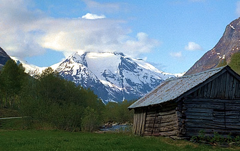
As air encounters a mountain, it is forced up because of the terrain. Upslope thunderstorms are common in the Rocky Mountain west during the summer.


