Severe weather rarely happens without any warning. While we will never be able to pinpoint exactly when and where severe weather will develop, we can identify broad areas with the potential for the development of severe weather. It is your responsibility to check the weather forecast, which may be often several times daily, to see if you are, or will be, under a risk of severe weather.
The weather office charged with monitoring and forecasting the potential for severe weather over the 48 continental United States is the Storm Prediction Center (SPC) located in Norman, OK. Use the information provided by SPC to give you early critical information concerning the threat of severe weather in your locale.
Convective Outlooks
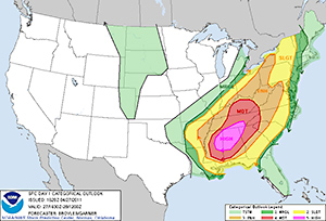
Convective Outlooks consist of a written narrative and a graphic depicting severe thunderstorm threats across the continental United States. The outlook narratives are written in technical language, intended for sophisticated weather users, and provide the meteorological reasoning for the risk areas.
This product also provides explicit information regarding the timing, greatest severe weather threat, and expected severity of the event. The graphics that accompany the narratives provide vital information that increases public awareness and allows for critical users to make decisions with the mission of protecting life and property as much as possible.
The convective outlook graphics display up to six different color categories to reflect the likelihood of occurrences and/or increased severity of a severe weather event(s). The four convective outlooks issued are Day 1, Day 2, Day 3, and Days 4-8:
| Day 1 | Day 1 covers the risk of severe weather today through early tomorrow morning. Day 1 forecasts are issued five times daily: 06z (midnight CST), 13z (around sunrise), 1630z (10:30 a.m. CST), 20z (2 p.m. CST), and 01z (early evening). This is the forecast you will see on SPC's frontpage. (What is Z-time?) |
|---|---|
| Day 2 | Day 2 continues from the ending of Day 1 (tomorrow morning) for the next 24 hours. These are issued twice daily: 07z (around midnight) and 1730z (around noon). |
| Day 3 | This is the forecast for the subsequent 24 hours. Day 3 forecasts are issued daily by 0830z during standard time and 0730z during daylight time. |
| Days 4-8 | A severe weather area is depicted in days four through eight. It is issued at 10z daily (early morning) and indicates a 15% or 30% or higher probability for severe thunderstorms (e.g. a 15% or 30% chance that a severe thunderstorm will occur within 25 miles of any point). |
The following is the meaning of the colors used in convective outlooks:
General Thunderstorms
The light green shading depicts a 10% or higher probability of non-severe or near severe thunderstorms during the valid period. However, remember that while a thunderstorm producing ¾" hail and wind gusts to 55 mph wind is officially a NON-severe storm, it can still produce damage. Therefore, even if you are in an area of "general thunderstorms", you need to keep alert for the possibility of rapidly changing weather conditions.
Severe Category 1 - Marginal Risk
The dark green shading area indicates a marginal (MRGL) risk of severe thunderstorms during the forecast period. This means a...
2% probability or greater tornado probability
OR
probability for severe hail (≥1" / ≥2.4cm) OR severe wind (≥58 mph / ≥93 km/h).
Severe Category 2 - Slight
The yellow shaded area indicates a slight (SLGT) risk of severe thunderstorms during the forecast period. This means a...
5% probability or greater tornado probability
OR
15% probability for severe hail or severe wind probability WITH OR WITHOUT 10% or greater probability of hail 2" (4.8 cm) or greater in diameter
OR
wind gusts 75 mph (120 km/h) or greater.
Severe Category 3 - Enhanced
The orange shaded area indicates an enhanced (ENH) risk of severe thunderstorms during the forecast period. This means a...
10% probability for any tornado WITH OR WITHOUT 10% or greater probability of an EF2+ tornado
OR
15% probability for any tornado
OR
30% severe hail or severe wind probability WITH OR WITHOUT 10% or greater probability of hail 2" (4.8 cm) or greater in diameter, or wind gusts 75 mph or greater
OR
45% probability of severe hail or wind.
Severe Category 4 - Moderate
The red shaded area indicates a moderate (MDT) risk of severe thunderstorms are expected. This means a...
15% tornado probability AND 10% or greater probability of an EF2+ tornado
OR
30% probability for any tornado
OR
45% severe wind probability AND 10% or greater probability of a wind gusts 75 mph (120 km/h) or greater
OR
45% severe hail probability AND 10% or greater probability of hail 2" (4.8 cm) or greater in diameter
OR
60% severe wind probability
OR
60% severe hail probability WITH OR WITHOUT 10% or greater probability of hail 2" (4.8 cm) or greater in diameter.
Severe Category 5 - High
The fuchsia shaded area indicates a high (HIGH) risk of severe thunderstorms are expected. This means a...
30% tornado probability AND 10% or greater probability of an EF2+ tornado
OR
45% or greater probability for any tornado WITH OR WITHOUT 10% or greater probability of an EF2+ tornado
OR
60% severe wind probability AND a 10% or greater probability of a wind gust 75 mph (120 km/h) or greater.
These are the official definitions. The reason for the "AND"s, "OR"s and "WITH OR WITHOUT"s is that the atmosphere is complicated, with many different conditions that can occur. For example, there will be times when the number of severe weather events will be high but the overall intensities will not necessarily be extreme. Conversely, there may only be one or two severe events expected, but the intensity of the event(s) will be extremely high.
Below is a simplified version of the official definitions.
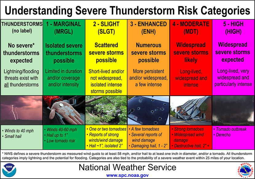
Still Confused? Just know that the greater the threat (from Slight to High), the greater the risk for severe weather, which could mean the number of events, intensity, or both.
The following are current severe weather outlooks from the Storm Prediction Center (click to enlarge – takes you to the SPC website)
Today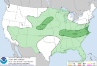
|
Tomorrow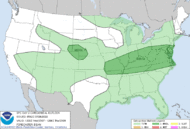
|
Day 3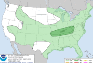
|
Days 4-8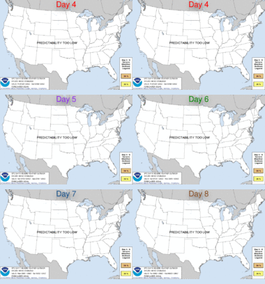
|
Public Severe Weather Outlooks
The Public Severe Weather Outlooks (PWO) are issued when a potentially significant or widespread tornado outbreak is expected. This plain-language forecast is typically issued 12-24 hours prior to the event and is used to alert National Weather Service field offices and other weather customers concerned with public safety of a rare, dangerous situation.
The Public Severe Weather Outlook is reserved for all high risks and for moderate risks with a strong risk for tornadoes and/or widespread damaging winds. The SPC issues about 30 PWOs each year.
Mesoscale Discussions
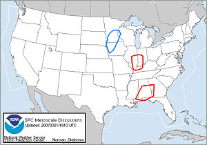
When conditions appear favorable for severe storm development, SPC issues a Mesoscale Discussion (MCD), normally 1-3 hours before issuing a weather watch.
SPC also puts out MCDs for mesoscale aspects of hazardous winter weather events including heavy snow, blizzards, and freezing rain. MCDs are also issued on occasion for heavy rainfall or convective trends.
The MCD describes what is currently happening, what is expected in the next few hours, the meteorological reasoning for the forecast, and when/where SPC plans to issue the watch (if dealing with severe thunderstorm potential). Severe thunderstorm MCDs provide you with extra lead time on the severe weather development.
Severe Weather Watches
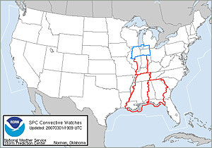
When conditions become favorable for severe thunderstorms and tornadoes to develop, SPC usually issues a severe thunderstorm watch or a tornado watch.
Tornadoes can occur in either type of watch, but tornado watches are issued when conditions are especially favorable for tornadoes. Severe thunderstorm watches are blue and tornado watches are red.
Watches cover large areas, 20,000 to 40,000 square miles, and are issued by county. They are numbered sequentially, with the count reset at the beginning of each year. A typical watch has a duration of about four to six hours, but it may be canceled, replaced, or re-issued as required. A watch is NOT a warning, and should not be interpreted as a guarantee that there will be severe weather!
When a watch is issued, stay alert for changing weather conditions and possible warnings. Any warnings will be issued by your local NWS Weather Forecast Office.
When a severe weather watch is issued close to your location but does not include your county, you should still remain alert.
The atmosphere rarely follows straight lines, and thunderstorms do not always remain within the man-made boundaries we create around them. When SPC feels confident about the possibility of severe weather in a specific area, they try to issue a watch at least one hour prior to the onset of severe weather.
In some instances, the phrase "THIS IS A PARTICULARLY DANGEROUS SITUATION" will headline a watch (called a PDS watch). The "particularly dangerous situation" wording is used in rare situations when long-lived, strong, and violent tornadoes are possible.
PDS watches are issued when, in the opinion of the forecaster, the likelihood of significant events is boosted by very volatile atmospheric conditions. This decision is usually based on a number of atmospheric clues and parameters, so the decision to issue a PDS watch is subjective.
There is no hard threshold or criteria. PDS watches are most often issued in association with "high risk" convective outlooks.


