Overview
Analyzing maps with the current weather conditions is an essential part of the entire forecast process. Without knowing what is occurring in the present, it is nearly impossible to predict what will happen in the future.
Great forecasts – the ones that save lives and property – begin with careful analysis of the current conditions. Weather maps are analyzed using a combination of computers and human interpretation. Analyzing maps by hand helps forecasters study every detail in the weather and enables them to discern the continuity or "flow" of the weather.
Map analysis is not too unlike a "dot-to-dot" image. Just as one would draw a line from one dot to the next, analyzing maps involves drawing lines of equal values between dots representing various elements of the atmosphere.
In this lesson plan, the students will determine the location of cold and warm fronts on a map plotted with weather observations.
| TOTAL TIME | 60 minutes |
|---|---|
| SUPPLIES | Colored pencils |
| PRINTED/AV MATERIAL | Weather maps (see Teacher Preparation) |
| TEACHER PREPARATION |
You will need to provide each student with one of each of the following maps: Surface pressure, Temperature, Dew Point Temperature, Pressure Change, and the Complete Plot maps. Each of the maps can be printed with instructions, or you can print the larger versions of the basic maps and provide the students with the instructions in the classroom. |
| SAFETY FOCUS | NOAA Weather Radio |
Procedure
Instruct the students to complete the following exercises in order.
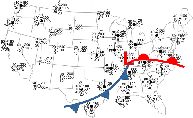
Hand the students the complete surface weather plot map (pdf) for analysis. This map has full weather information for each site in its proper format. For example, the sea level pressure and pressure change are reported in tenths of millibars (Example: '160' means 1016.0 millibars as the surface air pressure map the students analyzed were in whole millibars with the tenths units omitted).
In addition to the same data as seen on the earlier maps, it has some additional information such as sky cover, wind speed and direction, visibility, cloud types, present weather and past weather. Key to decode the plot. (pdf)
With the aid of the four previous analyses...
- Have the students compare and comment on the direction the wind blows around high and low pressure (based upon the arrows they drew) compared to the direction of the staffs on the surface map.
- Have the students compare and comment on the cloud cover under the areas of high and low pressure.
- Ask the students what type of present weather they see plotted on this map. What type of past weather do the students see?
- Have the student place a red "L" on the map in the same location as they placed it on their surface pressure map analysis.
Given the following information, have the students draw on the map a cold front in blue and a warm front in red.
The boundary between two air masses is called a front. Fast moving cold fronts indicate a rapid change in the weather. Warm fronts also can have large changes in weather, but the change is usually not as rapid as with a cold front.
On a weather map, fronts are drawn where there is large changes in temperature, changes in wind direction and speed, and between areas where there are large changes in pressure. On a weather map, fair weather is generally associated with "Highs" while stormy weather is associated with "Lows" and with the portions of fronts that extend from them.
The location of the fronts should be similar to this one.

There is a possibility that a warm front could also be placed between Seattle and the Oregon coast based upon the difference in weather between these two locations.
The above "canned" map is simple. This more difficult map requires a bit more interpolation between data points.
Furthermore, real world weather plots are much more challenging to analyze. View real-time weather observation plots (pdf) from the Storm Prediction Center.
Building a Weather-Ready Nation

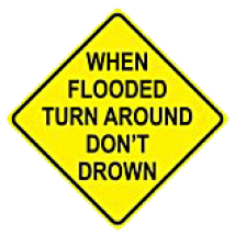
Most flood-related deaths and injuries could be avoided if people who come upon areas covered with water followed this simple advice: Turn Around Don't Drown.
The reason that so many people drown during flooding is because few of them realize the incredible power of water. A mere six inches of fast-moving flood water can knock over an adult. It takes only two feet of rushing water to carry away most vehicles. This includes pickups and SUVs.
If you come to an area that is covered with water, you will not know the depth of the water or the condition of the ground under the water. This is especially true at night, when your vision is more limited. Play it smart, play it safe. Whether driving or walking, any time you come to a flooded road, TURN AROUND DON'T DROWN!


